Bauhinia, Queensland facts for kids
Quick facts for kids BauhiniaQueensland |
|||||||||||||||
|---|---|---|---|---|---|---|---|---|---|---|---|---|---|---|---|

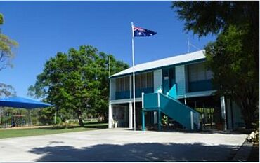
Bauhinia State School, 2022
|
|||||||||||||||
| Population | 28 (2021 census) | ||||||||||||||
| • Density | 0.1242/km2 (0.322/sq mi) | ||||||||||||||
| Postcode(s) | 4718 | ||||||||||||||
| Area | 225.4 km2 (87.0 sq mi) | ||||||||||||||
| Time zone | AEST (UTC+10:00) | ||||||||||||||
| Location |
|
||||||||||||||
| LGA(s) |
|
||||||||||||||
| State electorate(s) | Gregory | ||||||||||||||
| Federal Division(s) | Flynn | ||||||||||||||
|
|||||||||||||||
Bauhinia is a small country town in Queensland, Australia. It's also a rural locality (a type of area) that is split between two different regions: the Central Highlands Region and the Aboriginal Shire of Woorabinda. In 2021, only 28 people lived in the Bauhinia area.
Contents
Where is Bauhinia?
Bauhinia is found where two main roads meet: the Dawson Highway and the Fitzroy Developmental Road. Most of the area is in the Central Highlands Region. However, the south-east part of Bauhinia is in the Aboriginal Shire of Woorabinda.
What is the land used for?
Around Zamia Creek, in the east and south-east, people grow crops. In other parts of Bauhinia, the land is mostly used for grazing, which means animals like cattle eat the natural plants.
A Quick Look at History
Bauhinia State School first opened its doors on March 20, 1967. In 2017, the school celebrated a big milestone: its 50th anniversary!
How Many People Live Here?
In 2016, the Bauhinia area had a population of 47 people. By 2021, the number of people living in Bauhinia was 28.
Learning in Bauhinia
Bauhinia State School is a government primary school for students from Prep (the first year of school) to Year 6. It's located at 11559 Fitzroy Development Road.
In 2013, the school had 15 students and 2 teachers. By 2018, the number of students grew to 22. There were also 3 teachers and 6 other staff members helping out.
What about high school?
There isn't a high school right in Bauhinia. The closest government high school is Moura State High School in Moura. However, Moura is quite far away. Because of this, students often use distance education (learning from home with materials sent to them) or go to a boarding school to continue their studies.
Local Services
The Central Highlands Regional Council runs a library service at Eulan Downs, Moura. You need to make an appointment to visit this library. It's important to know that this library does not offer internet access.
 | Delilah Pierce |
 | Gordon Parks |
 | Augusta Savage |
 | Charles Ethan Porter |


