Bayou des Arc facts for kids
Quick facts for kids Bayou des Arc |
|
|---|---|
 |
|
| Country | United States |
| State | Arkansas |
| City | Des Arc |
| Physical characteristics | |
| Main source | Arkansas Delta White County, Arkansas |
| River mouth | White River Prairie County, Arkansas |
| Basin features | |
| River system | White River watershed |
| Tributaries |
|
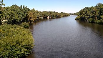
Bayou des Arc is a river in Arkansas, United States. It is about 74 miles (119 kilometers) long. This river is a branch, or tributary, of the White River. It flows into the White River near the city of Des Arc.
Contents
About Bayou des Arc
Bayou des Arc is an important waterway in eastern Arkansas. Rivers like this help carry water across the land. They also provide homes for many plants and animals.
Where Does It Start?
The Bayou des Arc begins in the northwestern part of White County, Arkansas. This area is part of the Arkansas Delta, which is a flat region. The river starts close to a small town called Rose Bud.
Where Does It End?
After flowing for many miles, Bayou des Arc joins the White River. This meeting point is in Prairie County, Arkansas. It is located near the city of Des Arc. The White River then flows into the larger Mississippi River.
Smaller Streams That Join It
Many smaller streams and creeks flow into Bayou des Arc. These are also called tributaries. They add more water to the main river.
Streams from the Left
Some of the streams that join Bayou des Arc from its left side include:
- Bear Creek
- White Creek
- Big Cypress Bayou, which is a wetland area
Streams from the Right
Other streams join Bayou des Arc from its right side. These include:
- Long Branch
- White Oak Creek
- Dogwood Creek
- Hog Thief Creek
These smaller waterways are all part of the larger White River watershed. A watershed is an area of land where all the water drains into a single river or lake.
 | Toni Morrison |
 | Barack Obama |
 | Martin Luther King Jr. |
 | Ralph Bunche |

