Beaufort Island facts for kids

Beaufort Island
|
|
|
Location in Antarctica
|
|
| Geography | |
|---|---|
| Location | Antarctica |
| Coordinates | 76°57′S 166°57′E / 76.950°S 166.950°E |
| Archipelago | Ross Archipelago |
| Area | 18.4 km2 (7.1 sq mi) |
| Highest elevation | 771 m (2,530 ft) |
| Highest point | Paton Peak |
| Administration | |
| Administered under the Antarctic Treaty System | |
| Demographics | |
| Population | Uninhabited |
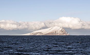
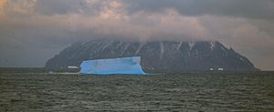
Beaufort Island is a special island located in Antarctica's Ross Sea. It's the northernmost part of the Ross Archipelago. This island is about 21 kilometres (13 miles) north of Cape Bird on Ross Island.
Beaufort Island covers an area of about 18.4 km2 (7 square miles). It was first explored and mapped by James Clark Ross in 1841. He named the island after Sir Francis Beaufort. Sir Francis was a very important mapmaker for the British Royal Navy.
Island Features
Beaufort Island is what's left of an old basaltic stratovolcano. We don't know exactly how old it is. The island has a unique semi-circular shape.
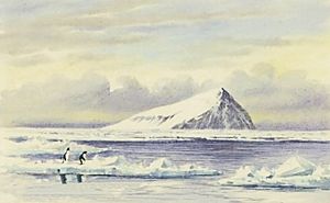
The highest point on the island is called Paton Peak. It stands tall at 771 m (2,530 ft). The island has many different types of land and places for animals to live.
Land and Ice
A large part of the western side of the island is covered by gently sloping ice fields. Along the coast, these ice fields form cliffs about 20 m (66 ft) high.
The eastern and southern parts of the island are mostly free of ice. Here, you'll find very steep cliffs that rise straight out of the sea. The ground that isn't covered in ice slopes gently. In the summer, you can see small ponds and streams from melting ice draining towards the coast.
Wildlife and Nature
Beaufort Island is a very important natural area. It's called an Antarctic Specially Protected Area. This means it's protected to keep its natural environment safe. It also helps protect the many different kinds of birds that live there.
The island is far away and hard to reach. Not many people visit it. This means it hasn't been disturbed much by humans. Because of this, there are fewer chances for new, non-native plants or animals to be brought in. Even though some studies have been done, we still have a lot to learn about Beaufort Island.
Amazing Birds
Beaufort Island is home to several amazing bird colonies.
- A small group of emperor penguins breeds on the sea ice near the northern end of the island.
- A large colony of Adélie penguins lives on a raised beach called Cadwalader Beach. This beach is at the south-western end of the island.
- Several groups of south polar skua also breed here.
Because of all these important bird populations, BirdLife International has named Beaufort Island an Important Bird Area.
Unique Plants
The island has a large area covered in plants. This plant area is on a ridge of rocky material called a moraine bench. It's located about 5–7 m (16.4–23.0 ft) above the beach at the north end of the island. This moraine bench can be up to 50 m (164 ft) wide.
The plants here are mostly a type of moss called Bryum argenteum. This is the biggest and most continuous area of mosses known in the McMurdo Sound region. There are also many different types of algae.
This spot is one of the southernmost places where red snow algae can be found. These include types like Chlamydomonas sp., Chloromonas sp., and Chlamydomonas nivalis. The location is great for plants because of warmer summer temperatures. High ice cliffs protect the area from strong southerly winds. Water for the plants comes from the melting ice cliffs and snow banks.
See also
 In Spanish: Isla Beaufort para niños
 | Jackie Robinson |
 | Jack Johnson |
 | Althea Gibson |
 | Arthur Ashe |
 | Muhammad Ali |


