Beaverdam Creek (Soque River tributary) facts for kids
Beaverdam Creek is a small stream in Georgia, USA. It flows into a larger river called the Soque River. Beaverdam Creek is about 5.79 miles (9.32 kilometers) long.
Where Does Beaverdam Creek Flow?
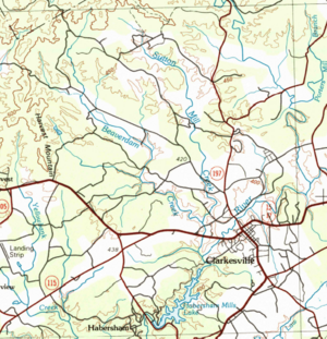
Beaverdam Creek starts in the northwestern part of Habersham County, Georgia. This is northwest of a town called Clarkesville.
The creek flows mostly towards the southeast for about 5 miles. Along the way, it collects water from several smaller streams.
It then meets another creek called Sutton Mill Creek. This happens less than 2 miles east of where two main roads, State Route 17 and State Route 115, cross. Sutton Mill Creek starts near where Beaverdam Creek begins.
After this, Beaverdam Creek crosses State Route 17/115. Finally, it flows into the Soque River. This meeting point is just west of Clarkesville and north of Habersham Mills Lake.
What is a Watershed?
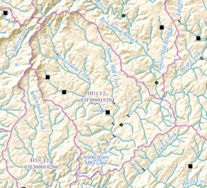
Every stream and river has a special area of land called a watershed. This is the area where all the rain and melting snow drain into that specific stream or river.
The land around Beaverdam Creek is part of a larger watershed. The United States Geological Survey calls this area the Middle Soque River sub-watershed. It covers about 22 square miles. This area is northwest of Clarkesville and also northwest of the Soque River itself.


