Soque River facts for kids
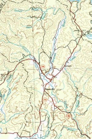
The Soque River (Cherokee: ᏐᏈ) is a river in northeast Georgia. It flows entirely within Habersham County. The Soque River is a branch, also called a tributary, of the larger Chattahoochee River. Parts of the river run alongside State Route 197.
The highest point in the Soque River's watershed is Tray Mountain, which is about 4,430 feet (1,350 meters) high. The Soque River is about 28.5 miles (45.9 kilometers) long. Its watershed covers about 83,983 acres (340 square kilometers). This is about 47% of Habersham County. A part of the river and its watershed is also inside the Chattahoochee National Forest and the Tray Mountain Wilderness.
A group called the Soque River Watershed Association started in 1998. Their goal is to protect and restore the Soque River and all the smaller streams that flow into it. This group holds events, organizes clean-ups, and works on projects to help the environment. For example, they have built greenways, put up fences to keep cattle out of the river, fixed riverbanks, and managed stormwater in new ways.
Contents
What's in a Name?
The Soque River got its name from a Cherokee village called Soque (or Sakwiyi). This village used to be located along the river's banks.
Soque River's Smaller Streams
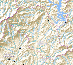
The Soque River watershed is made up of seven smaller areas called sub-basins. These are like smaller watersheds that all drain into the Soque River. They are listed from north to south.
Headwaters of the Soque River
The Headwaters area is where the Soque River begins. It covers about 17.3 square miles (44.8 square kilometers). This area includes the Left Fork and Right Fork of the Soque River, which join together north of Batesville. The Left Fork starts near Tray Mountain. It is joined by South Prong Goshen Creek and Goshen Branch. The Right Fork starts as Goshen Creek and becomes the Right Fork Soque River at Wilson Falls. A large part of this area is U.S. Forest Service land.
Raper Creek
Raper Creek starts east of the Right Fork Soque River. It flows south, following State Route 197. It picks up Chastain Branch and Moates Branch before joining the Soque River. Most of this 9.6 square mile (24.9 square kilometer) area is U.S. Forest Service land. Important spots here include Raper Creek Falls and trails for off-highway vehicles (OHV). Chastain Branch is known for having a small population of brook trout.
Shoal Creek
The Shoal Creek area is on the eastern side of the Soque River. It covers about 9.8 square miles (25.4 square kilometers). The main streams that flow into Shoal Creek are Alley Creek, Nerve Branch, Shoal Branch, and Long Branch. Shoal Creek joins the Soque River near King's Bridge on State Route 197.
Deep Creek
The Deep Creek area is also on the eastern side of the Soque River. It is the second largest sub-basin, covering about 30.2 square miles (78.2 square kilometers). This area includes the community of Hollywood. Main streams flowing into Deep Creek are Liberty Creek, Roberts Branch, Fry Branch, Glade Creek, and Rock Ford Branch. Deep Creek joins the Soque River just before the water intake for the City of Clarkesville.
Beaverdam Creek
The Beaverdam Creek area is on the western side of the Soque River. It covers 14.6 square miles (37.8 square kilometers). Important features in this area are Alec Mountain Road, which runs along Beaverdam Creek, and Stonepile Road, which follows Sutton Mill Creek.
Hazel Creek
The Hazel Creek area is the largest sub-basin, covering about 31.9 square miles (82.6 square kilometers). The city of Demorest is entirely within this area. Parts of Mount Airy and Cornelia also drain into this basin. Camp Creek, which starts in Mount Airy, is the main source of drinking water for Cornelia at the Camp Creek Reservoir. Other important streams here are Law Creek, Little Hazel, and Lick Log Creek.
Yellowbank Creek
The Yellowbank Creek area is on the western side of the Soque River. It is the smallest sub-basin, covering 6.7 square miles (17.4 square kilometers). This is the last sub-basin to join the Soque River before the Soque flows into the Chattahoochee River.
 | Laphonza Butler |
 | Daisy Bates |
 | Elizabeth Piper Ensley |


