Clarkesville, Georgia facts for kids
Quick facts for kids
Clarkesville, Georgia
|
|
|---|---|

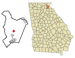
Location in Habersham County and the state of Georgia
|
|
| Country | United States |
| State | Georgia |
| County | Habersham |
| Named for | John C. Clark |
| Area | |
| • Total | 2.49 sq mi (6.44 km2) |
| • Land | 2.46 sq mi (6.37 km2) |
| • Water | 0.03 sq mi (0.07 km2) |
| Elevation | 1,404 ft (428 m) |
| Population
(2020)
|
|
| • Total | 1,911 |
| • Density | 777.46/sq mi (300.18/km2) |
| Time zone | UTC-5 (Eastern (EST)) |
| • Summer (DST) | UTC-4 (EDT) |
| ZIP code |
30523-4712
|
| Area code(s) | 706 |
| FIPS code | 13-16460 |
| GNIS feature ID | 2404056 |
Clarkesville is a city in Georgia, United States. It is the main town, or county seat, of Habersham County. In 2020, about 1,911 people lived there. This was more than the 1,733 people counted in 2010.
Contents
History of Clarkesville
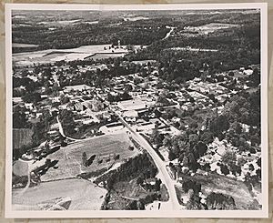
Clarkesville has a long history. It was first a Native American settlement called Sak-yi. Later, this name was used for the Soque River. The city was built along the Unicoi Turnpike. This was a very old Native American trail, used for over 1,000 years. In the early 1700s, people used this trail to move deerskins and furs. They took them from Tennessee to cities like Savannah and Charleston. From there, the furs were shipped to Europe.
Clarkesville was officially started in 1821. It became the main town for Habersham County. The community was named after John Clark, who was a governor of Georgia.
Geography of Clarkesville
Clarkesville is located in the middle of Habersham County. It sits on the south side of the Soquee River. This river flows southwest and joins the Chattahoochee River.
The city covers about 6.45 square kilometers (2.49 square miles) in total. Most of this area is land, about 6.37 square kilometers (2.46 square miles). A small part, about 0.08 square kilometers (0.03 square miles), is water.
Population and People
| Historical population | |||
|---|---|---|---|
| Census | Pop. | %± | |
| 1850 | 502 | — | |
| 1870 | 263 | — | |
| 1880 | 291 | 10.6% | |
| 1890 | 396 | 36.1% | |
| 1900 | 491 | 24.0% | |
| 1910 | 528 | 7.5% | |
| 1920 | 542 | 2.7% | |
| 1930 | 617 | 13.8% | |
| 1940 | 850 | 37.8% | |
| 1950 | 1,106 | 30.1% | |
| 1960 | 1,352 | 22.2% | |
| 1970 | 1,294 | −4.3% | |
| 1980 | 1,348 | 4.2% | |
| 1990 | 1,151 | −14.6% | |
| 2000 | 1,248 | 8.4% | |
| 2010 | 1,733 | 38.9% | |
| 2020 | 1,911 | 10.3% | |
| U.S. Decennial Census | |||
Clarkesville in 2020
In 2020, the 2020 United States Census counted 1,911 people living in Clarkesville. There were 709 households and 402 families.
Here is a look at the different groups of people living in Clarkesville in 2020:
| Race | Number of People | Percentage |
|---|---|---|
| White | 1,544 | 80.8% |
| Black or African American | 103 | 5.39% |
| Native American | 2 | 0.1% |
| Asian | 31 | 1.62% |
| Pacific Islander | 1 | 0.05% |
| Other/Mixed | 100 | 5.23% |
| Hispanic or Latino | 130 | 6.8% |
Education in Clarkesville
The Habersham County School District manages schools in the area. It has schools for all ages, from pre-school to twelfth grade. There are eight elementary schools, three middle schools, and two high schools. The district has many teachers, with over 367 full-time teachers. More than 5,955 students attend these schools. North Georgia Technical College is also located in Clarkesville. This college offers technical training and education.
Notable People from Clarkesville
Many interesting people have connections to Clarkesville:
- Linda Anderson – An artist known for her "memory paintings."
- Red Barron – A talented player in both football and baseball.
- McKenzie Coan – A Paralympic gold medalist from 2016.
- Oliver Clyde Fuller – A banker, financier, and golfer.
- April Masini – An advice columnist and expert on relationships.
- Benjamin Purcell – A U.S. Army officer and state legislator.
See also
 In Spanish: Clarkesville (Georgia) para niños
 | Delilah Pierce |
 | Gordon Parks |
 | Augusta Savage |
 | Charles Ethan Porter |


