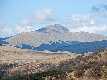
Beinn Bhuidhe (Glen Fyne) facts for kids
Quick facts for kids Beinn Bhuidhe |
|
|---|---|

Beinn Bhuidhe
|
|
| Highest point | |
| Elevation | 948 m (3,110 ft) |
| Prominence | 592 m (1,942 ft) |
| Parent peak | Ben Lui |
| Listing | Munro |
| Naming | |
| English translation | Yellow hill |
| Language of name | Gaelic |
| Pronunciation | Gaelic |
| Geography | |
|
Lua error in Module:Location_map at line 420: attempt to index field 'wikibase' (a nil value).
|
|
| Parent range | Grampian Mountains |
| OS grid | NN20361871 |
| Topo map | OS Landranger 50, 56. |
| Climbing | |
| Easiest route | Hike |
Beinn Bhuidhe is a cool Scottish mountain. Its name means 'Yellow Hill' in Gaelic. You can find it at the top of Loch Fyne in Argyll and Bute, Scotland.
Exploring Beinn Bhuidhe
Beinn Bhuidhe is a tall mountain, standing at 948 meters (about 3,110 feet) high. It's known as a Munro, which is a Scottish mountain over 3,000 feet. This mountain is a bit separate from the main group of mountains called the Arrochar Alps.
It's a quiet and remote place. Climbing it, especially in winter, can feel like a real adventure! Beinn Bhuidhe is located north of Loch Fyne. It sits between two valleys: Glen Fyne and Glen Shira. It's the only very tall hill in a large area of open land. This land is found between Loch Lomond and Loch Awe.
The top of Beinn Bhuidhe has a long ridge. This ridge has three high points. The very highest point is the one towards the southwest. Beinn Bhuidhe is much less busy than the Arrochar Alps. This is partly because you have to walk about 7.3 kilometers (4.5 miles) along a private road before you even start climbing.
Mountain Shape and Features
Beinn Bhuidhe is a big mountain. It has three ridges that spread out like the prongs of a trident. The longest ridge is the one furthest south. It stretches towards Clachan Hill, which is 658 meters (about 2,159 feet) high.
The shortest ridge is the most northern one. It goes towards Beinn an t-Sidhein, which is 694 meters (about 2,277 feet) high. In the middle of these two is the main ridge. This is where the summit, or highest point, is located.
This main ridge is about 6 kilometers (3.7 miles) long. It runs from Tom a’ Phiobaire in the southwest to Ceann Garbh in the northeast. Ceann Garbh is 803 meters (about 2,635 feet) high. The very top of Beinn Bhuidhe, at 948 meters, is found about halfway along this main ridge.
How to Climb Beinn Bhuidhe
There are roads in both Glen Fyne and Glen Shira. But most people start their climb from Glen Fyne. There are good paths that lead up the long ridges on the southwest side.
However, the most popular way to climb is a shorter, steeper path. This path goes west-northwest from a place called Inverchorachan House.
 | Victor J. Glover |
 | Yvonne Cagle |
 | Jeanette Epps |
 | Bernard A. Harris Jr. |

