Beitbridge facts for kids
Quick facts for kids
Beitbridge
|
|
|---|---|
| Beitbridge | |

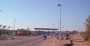
Beitbridge Borderpost, Zimbabwe
|
|
| Country | |
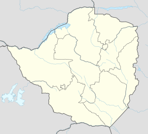
| Province | Matabeleland South |
| District | Beitbridge |
| Established | 1929 |
| Elevation | 457 m (1,499 ft) |
| Population
(2022 census)
|
|
| • Total | 58,100 |
| Time zone | UTC+2 (CAT) |
| Climate | BSh |
Beitbridge is a busy border town in Zimbabwe. It is located in the Matabeleland South province. The town is famous for its important border crossing. This crossing connects Zimbabwe with South Africa.
The name Beitbridge also refers to the bridge itself. This bridge crosses the Limpopo River. The Limpopo River forms the natural border between the two countries. There is also a town called Beitbridge on the South African side.
Contents
About Beitbridge Town
Beitbridge is found just north of the Limpopo River. It is about 1 kilometer (0.6 miles) from the Alfred Beit Road Bridge. This bridge links South Africa and Zimbabwe. The town is a key point for travel. Major roads lead from Beitbridge to other big cities in Zimbabwe. These include Bulawayo (321 km away) and Harare (758 km away).
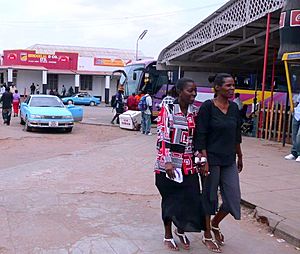
In 2012, the town had about 41,767 people. Most residents are from the Venda and Ndebele groups. Many Shona people from other parts of Zimbabwe also live here. This makes Beitbridge a very active place. It is one of the busiest road border posts in Southern Africa.
What is the Climate Like in Beitbridge?
Beitbridge has a hot, semi-arid climate. This means it is generally warm and dry. The town gets most of its rain during the summer months. Winters are usually dry and mild. Temperatures can get very hot, especially in summer.
| Climate data for Beitbridge (1961–1990) | |||||||||||||
|---|---|---|---|---|---|---|---|---|---|---|---|---|---|
| Month | Jan | Feb | Mar | Apr | May | Jun | Jul | Aug | Sep | Oct | Nov | Dec | Year |
| Record high °C (°F) | 43.3 (109.9) |
42.3 (108.1) |
43.3 (109.9) |
39.4 (102.9) |
36.7 (98.1) |
36.6 (97.9) |
33.9 (93.0) |
40.2 (104.4) |
40.0 (104.0) |
43.3 (109.9) |
44.4 (111.9) |
42.8 (109.0) |
44.4 (111.9) |
| Mean daily maximum °C (°F) | 33.5 (92.3) |
32.8 (91.0) |
32.0 (89.6) |
30.4 (86.7) |
28.2 (82.8) |
25.4 (77.7) |
25.4 (77.7) |
27.6 (81.7) |
30.2 (86.4) |
31.8 (89.2) |
31.8 (89.2) |
33.1 (91.6) |
30.2 (86.4) |
| Mean daily minimum °C (°F) | 21.9 (71.4) |
21.5 (70.7) |
20.1 (68.2) |
17.0 (62.6) |
11.9 (53.4) |
8.2 (46.8) |
7.9 (46.2) |
10.7 (51.3) |
15.2 (59.4) |
18.6 (65.5) |
20.3 (68.5) |
21.2 (70.2) |
16.2 (61.2) |
| Record low °C (°F) | 12.8 (55.0) |
14.4 (57.9) |
11.7 (53.1) |
3.9 (39.0) |
2.8 (37.0) |
−1.1 (30.0) |
−0.6 (30.9) |
0.0 (32.0) |
4.4 (39.9) |
8.9 (48.0) |
11.1 (52.0) |
13.3 (55.9) |
−1.1 (30.0) |
| Average rainfall mm (inches) | 56.8 (2.24) |
54.8 (2.16) |
34.1 (1.34) |
25.6 (1.01) |
10.0 (0.39) |
3.1 (0.12) |
0.4 (0.02) |
1.5 (0.06) |
14.9 (0.59) |
28.4 (1.12) |
48.7 (1.92) |
53.7 (2.11) |
332.0 (13.07) |
| Average rainy days | 5 | 4 | 3 | 2 | 1 | 1 | 0 | 0 | 1 | 2 | 5 | 5 | 29 |
| Average relative humidity (%) | 62 | 64 | 60 | 58 | 52 | 56 | 51 | 46 | 46 | 48 | 53 | 57 | 54 |
| Mean monthly sunshine hours | 244.9 | 217.5 | 241.8 | 240.0 | 275.9 | 252.0 | 263.5 | 272.8 | 252.0 | 248.0 | 225.0 | 226.3 | 2,959.7 |
| Mean daily sunshine hours | 7.9 | 7.7 | 7.8 | 8.0 | 8.9 | 8.4 | 8.5 | 8.8 | 8.4 | 8.0 | 7.5 | 7.3 | 8.1 |
| Source 1: World Meteorological Organization | |||||||||||||
| Source 2: Deutscher Wetterdienst (extremes, humidity, and sun) | |||||||||||||
Life in Beitbridge
Beitbridge has many houses. Some are formal homes for government workers and others. There were also informal settlements, but these mud houses have been removed. Most formal homes have two or three rooms. Many people who work in Beitbridge do not bring their families. So, several people often share a house. There are not many places for fun in the low-income areas. People mostly enjoy bars and soccer fields.
Jobs and Work
Many people in Beitbridge work in different areas. These include:
- Moving goods (freight)
- Shops and sales (retail)
- Building things (construction)
- Customs (at the border)
- Police work
About 1,200 people have these formal jobs. Even more people work in the informal sector. This means they sell goods or trade on their own. Outside the town, farming is a big job. A diamond mine used to be open, but it closed. This caused more people to lose their jobs. Many women earn money by selling items or trading across the border. Truck drivers also find work here because of the busy border.
The Famous Bridge
The Alfred Beit Road Bridge is a very important landmark. It is named after Alfred Beit. He was a famous businessman who helped start the De Beers diamond company. He also worked with Cecil Rhodes. Beit was involved in many companies, including railways.
The first bridge was built in 1929. It cost $600,000. The Beit Railways Trust and the South African Railways paid for it together. A newer, stronger bridge was finished in 1995. The Zimbabwean Government built this new bridge. Now, the government collects a fee (a toll) from vehicles that cross it. The new bridge can handle much more traffic. The old bridge is now only used for trains.
Connecting Beitbridge to Other Places
Beitbridge is a key transport hub. On the South African side, the N1 Highway connects to major cities. These include Pretoria (463 km away) and Johannesburg (521 km away). The closest town in South Africa is Musina, which is 16 km away.
On the Zimbabwean side, the road splits. The A6 goes to Bulawayo. The R1 goes to Masvingo. There are also railway lines that pass through Beitbridge. These lines connect to Bulawayo and Gweru.
Learning in Beitbridge
Beitbridge has several schools for children. There are four primary schools:
- Beitbridge Mission
- Beitbridge Government
- Dulivhadzimo Primary
- St Mary's Primary School
There is also a private school called Oakleigh House Trust School. For older students, there are two secondary schools:
- Vhembe High School
- St Joseph's Secondary School
After high school, students usually travel outside Beitbridge for college or university.
Local Events
Dulivhadzimu Stadium is a small sports area in Beitbridge. It has hosted important events. For example, in 2008, a national celebration was held there. This event honored the birthday of Robert Mugabe, who was the leader at the time. Workers even fixed potholes on the main roads for the event.


