Bel Aire, Kansas facts for kids
Quick facts for kids
Bel Aire, Kansas
|
|
|---|---|

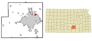
Location within Sedgwick County and Kansas
|
|

|
|
| Country | United States |
| State | Kansas |
| County | Sedgwick |
| Founded | 1955 |
| Incorporated | 1980 |
| Area | |
| • Total | 6.79 sq mi (17.60 km2) |
| • Land | 6.76 sq mi (17.52 km2) |
| • Water | 0.03 sq mi (0.08 km2) |
| Elevation | 1,394 ft (425 m) |
| Population
(2020)
|
|
| • Total | 8,262 |
| • Density | 1,216.8/sq mi (469.43/km2) |
| Time zone | UTC-6 (CST) |
| • Summer (DST) | UTC-5 (CDT) |
| ZIP codes |
67220, 67226
|
| Area code | 316 |
| FIPS code | 20-05400 |
| GNIS ID | 473837 |
Bel Aire is a city located in Sedgwick County, Kansas, in the United States. It's like a smaller town right next to the bigger city of Wichita. In 2020, about 8,262 people lived there.
Contents
History of Bel Aire
Bel Aire started in January 1955. At that time, local people asked the county government to create a special area. This area was set up to help improve the water system.
Later, on November 26, 1980, Bel Aire officially became a city. This happened after a two-year legal fight. The bigger city of Wichita didn't think Bel Aire had the right to become its own city. But the case went all the way to the Kansas Supreme Court. The court decided that Bel Aire could indeed become a city.
Where is Bel Aire Located?
Bel Aire is in south-central Kansas. It sits about 1,394 feet (425 meters) above sea level. The city is on the north side of the East Fork of Chisholm Creek. This creek is about 6 miles (10 km) northeast of the Arkansas River.
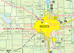
Bel Aire is part of the Wichita metropolitan area. This means it's one of the towns close to Wichita. Wichita borders Bel Aire to the south and west. The town of Kechi is to the north.
The city covers about 6.86 square miles (17.77 square kilometers). Most of this area is land. Only a tiny part, about 0.03 square miles (0.08 square kilometers), is water.
People in Bel Aire
Bel Aire is part of the larger Wichita, KS Metropolitan Statistical Area. This area includes Wichita and nearby cities like Bel Aire.
Population in 2020
The 2020 United States census counted 8,262 people living in Bel Aire. There were 3,080 households, which are groups of people living together. About 2,234 of these were families.
Most people in Bel Aire, about 74.27%, were White or European American. About 9.92% were Black or African American. Around 4.56% were Asian. Other groups included Native American and Pacific Islander people. About 7.6% of the population was Hispanic or Latino.
In Bel Aire, 23.7% of the people were under 18 years old. About 19.1% were 65 years or older. The average age in the city was 38.3 years.
Population in 2010
In the census of 2010, Bel Aire had 6,769 people. There were 2,465 households. The city had about 991 people per square mile.
The racial makeup was mostly White (81.1%). There were also African American (8.6%), Asian (4.5%), and Native American (0.9%) residents. About 4.8% of the people were Hispanic or Latino.
About 38.7% of households had children under 18. Many households (65.3%) were married couples. The average household had 2.75 people. The average family had 3.21 people.
The median age in 2010 was 36 years. About 28.3% of residents were under 18.
Schools in Bel Aire
Bel Aire has public schools managed by two different districts. These are Wichita USD 259 and Circle USD 375.
The city also has two private schools:
- Sunrise Christian Academy, which teaches students from pre-kindergarten to 12th grade.
- Resurrection Catholic School, for students from pre-kindergarten to 5th grade.
Northeast Magnet High School is a public high school. It is run by the Wichita USD 259 district and is located in Bel Aire.
See also
 In Spanish: Bel Aire (Kansas) para niños
 | James Van Der Zee |
 | Alma Thomas |
 | Ellis Wilson |
 | Margaret Taylor-Burroughs |

