Bellwood, Illinois facts for kids
Quick facts for kids
Bellwood, Illinois
|
|||
|---|---|---|---|

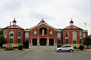
Mar Thoma Sleeha Cathedral
|
|||
|
|||
| Motto(s):
"Your Family Is Our Future"
|
|||

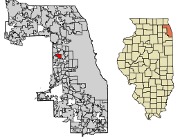
Location of Bellwood in Cook County, Illinois.
|
|||
| Country | United States | ||
| State | Illinois | ||
| County | Cook | ||
| Township | Proviso | ||
| Incorporated | 1900 | ||
| Area | |||
| • Total | 2.40 sq mi (6.21 km2) | ||
| • Land | 2.40 sq mi (6.21 km2) | ||
| • Water | 0.00 sq mi (0.00 km2) | ||
| Population
(2020)
|
|||
| • Total | 18,789 | ||
| • Density | 7,835.28/sq mi (3,025.05/km2) | ||
| Time zone | UTC-6 (CST) | ||
| • Summer (DST) | UTC-5 (CDT) | ||
| ZIP Code(s) |
60104
|
||
| Area codes | 708/464 | ||
| FIPS code | 17-04975 | ||
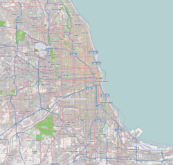
Bellwood is a village in Proviso Township, Cook County, Illinois, United States. It's about 13 miles (21 km) west of Chicago's downtown area. Bellwood is surrounded by other towns and important roads. In 2020, about 18,789 people lived there.
Contents
History of Bellwood
Bellwood became an official village on May 21, 1900. Its name came from an early neighborhood called "Bellewood." Later, the last "e" was removed.
At first, Bellwood was mostly flat farmland. Some businesses, like taverns, started to appear. These businesses asked for the area to become a village. This happened because a nearby town, Maywood, was trying to take over the area.
Between 1900 and 1930, Bellwood's population grew a lot. By 1920, the number of people living there had more than doubled to 1,881. Many new residents were immigrants from Germany and Russia. The population grew even more to 4,991 by 1930. This was partly because Bellwood added more land to its west in 1926.
Train services helped the village grow even more. In the 1970s, Bellwood became part of an important case that went all the way to the Supreme Court. In 1975, Bellwood sued a real estate company. The village said the company was treating people unfairly because of their race. Four years later, the Supreme Court made a big decision. It said that local governments could use "testers" (people who pretend to be homebuyers) to find out if discrimination was happening. They could also sue if they found unfair treatment. This decision was a big step in fighting discrimination.
Today, Bellwood has some large companies. Even though some big industries have left, new smaller businesses have helped the community grow.
Bellwood's Geography
Bellwood covers about 2.40 square miles (6.21 square kilometers) of land. It does not have any large bodies of water within its borders.
People of Bellwood (Demographics)
As of the 2020 census, Bellwood had 18,789 people. There were 6,059 households, and 4,310 families living in the village.
Most of the people in Bellwood are African American (about 68%). About 27% of the population is Hispanic or Latino. The village is a mix of many different backgrounds.
About 23.7% of the people in Bellwood are under 18 years old. The average age in the village is about 36.1 years. The average income for a family in Bellwood was around $69,730 in 2020.
Education in Bellwood
Bellwood has its own school district, Bellwood School District 88. It includes seven schools:
- Grant Primary School
- Grant Elementary School
- Lincoln Primary–Early Childhood Center
- Lincoln Elementary School
- McKinley Elementary School
- Thurgood Marshall Elementary School
- Roosevelt Middle School
Some parts of Bellwood are also served by Berkeley School District 87. There is also a private school called MECA Christian Academy.
Transportation in Bellwood
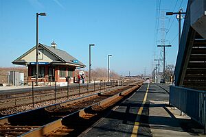
Bellwood has a Metra train station. This allows people to travel to Chicago and other towns. Trains from Bellwood station go east to the Ogilvie Transportation Center in Chicago. They also go west to Elburn station.
Bus service in Bellwood is provided by Pace. The Chicago Transit Authority used to offer bus services, but they stopped their #17 route in 2012.
In 2011, the Union Pacific Railroad announced plans to improve Bellwood's Metra station. They also planned to add a third train track. This project cost about $4 million and was finished by the fall of 2012. It was done at no cost to the people living in Bellwood.
Notable People from Bellwood
Bellwood has been home to some famous people:
- Lee J. Archambault – A NASA astronaut who flew on two space shuttle missions.
- Eugene Cernan – Another NASA astronaut. He was the commander of the Apollo 17 mission and was the "last man on the Moon." He lived in Bellwood when he was a child.
- Robert Covington – A professional basketball player who played for the Philadelphia 76ers. He was born in Bellwood.
See also
 In Spanish: Bellwood (Illinois) para niños
 | Aurelia Browder |
 | Nannie Helen Burroughs |
 | Michelle Alexander |


