Benbradagh facts for kids
Quick facts for kids Benbradagh |
|
|---|---|
| Binn Bhradach | |

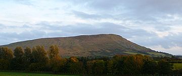
Benbradagh Mountain as seen from Derryork, in October 2008
|
|
| Highest point | |
| Elevation | 465 m (1,526 ft) |
| Prominence | 171 m (561 ft) |
| Geography | |
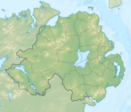
| Location | County Londonderry, Northern Ireland |
| Parent range | Sperrin Mountains |
| OSI/OSNI grid | C7219411337 |
| Topo map | OSNI Discoverer Series 13 The Sperrins (1:50000), OSNI Activity Map Sperrins (1:25000) |
Benbradagh (which means thief's peak in Irish) is a mountain located in County Londonderry, Northern Ireland. It stands near the town of Dungiven. This mountain is quite tall, reaching about 465 meters (1,526 feet) high. It is the second most northern peak in the Sperrin Mountains area. It is also the 564th highest mountain in all of Ireland.
Contents
Exploring Benbradagh
Benbradagh is a popular spot for outdoor activities. Its steep slopes make it a great place for paragliding. Paragliders love to launch from here because of the good winds and amazing views.
Getting to the Summit
You can reach Benbradagh by following the Curragh Road. This road goes quite close to the top of the mountain. This makes it easier for people to access the summit for hiking or other activities.
A Look Back in Time
From the 1940s to the early 1970s, Benbradagh had a special role. It was used as a base by the United States Military. This shows how important its location was during those years.
Benbradagh as a Local Area
The name Benbradagh is also used for a local area. This area is a district electoral area. It is centered around the town of Dungiven. This area is part of the Causeway Coast and Glens Borough Council. This council helps manage local services and decisions for the community.
See also
 In Spanish: Benbradagh para niños
 | Shirley Ann Jackson |
 | Garett Morgan |
 | J. Ernest Wilkins Jr. |
 | Elijah McCoy |


