County Londonderry facts for kids
Quick facts for kids
County Londonderry
|
||
|---|---|---|
|
||
| Nickname(s):
The Oak Leaf County
|
||
| Motto(s): | ||
 |
||
| Country | United Kingdom | |
| Region | Northern Ireland | |
| Province | Ulster | |
| Established | Date | |
| County Coleraine | 1585 | |
| County Londonderry | 1613 | |
| County town | Coleraine | |
| Area | ||
| • Total | 818 sq mi (2,118 km2) | |
| Area rank | 15th | |
| Highest elevation | 2,224 ft (678 m) | |
| Population
(2021)
|
252,231 | |
| • Rank | 6th | |
| Time zone | UTC±0 (GMT) | |
| • Summer (DST) | UTC+1 (BST) | |
| Postcode area | ||
| Contae Dhoire is the Irish name; Coontie Lunnonderrie is its name in Ulster Scots. | ||
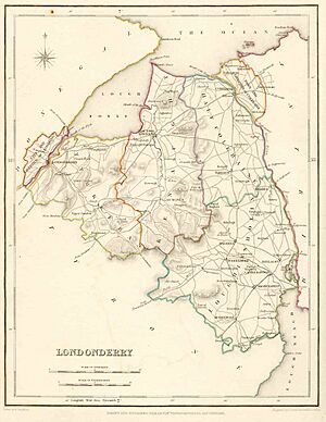
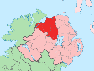
County Londonderry (also known as County Derry) is one of the six counties in Northern Ireland. It is also one of the 32 counties that make up the whole island of Ireland. This county is part of Ulster, one of Ireland's four historic provinces.
Before Ireland was divided, County Londonderry was part of the Kingdom of Ireland from 1613. Later, it became part of the United Kingdom. It is located next to the north-west shore of Lough Neagh, which is a large lake. The county covers an area of about 2,118 square kilometers (818 sq mi). Today, around 252,231 people live here.
Since 1972, the counties in Northern Ireland are no longer used for local government. After more changes in 2015, the area is now managed by three different districts. These are Derry and Strabane, Causeway Coast and Glens, and Mid-Ulster. Even though counties are not used for daily government, they are still important for sports and cultural events. For example, the Derry GAA (Gaelic Athletic Association) uses the county name.
Since 1981, County Londonderry has been one of four counties in Northern Ireland where most people are Catholic. The county's special flower is the purple saxifrage.
Contents
What's in a Name?
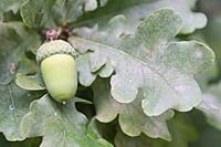
The name Derry comes from an old Irish word, Daire. This word means "oak-grove" or "oak-wood."
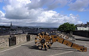
There is a disagreement about whether to call it "Derry" or "Londonderry." This is similar to the debate over the city's name. People who support staying part of the UK (called unionists) usually prefer "Londonderry." People who want a united Ireland (called nationalists) prefer "Derry."
However, there has never been a "County Derry" in official records. County Londonderry was mostly created from an older area called County Coleraine. British authorities use "Londonderry," while the Republic of Ireland uses "Derry."
A Look Back in Time
Ancient Times
County Londonderry has many ancient stone structures from prehistoric times. These include the Ballygroll Prehistoric Landscape. The most important ancient site is Mountsandel. It is near Coleraine and is thought to be the oldest known settlement in Ireland.
How County Londonderry Was Formed
Long ago, the area that became County Coleraine was home to the O'Cahan family. They were connected to the powerful O'Neill family. During the time of Queen Elizabeth I, England took control of this land. They wanted to limit the O'Neills' power. This area was then named County Coleraine, after its main town.
On March 2, 1613, King James I gave a special permission to a group called The Honourable The Irish Society. This group was tasked with setting up a new county. This new county was named Londonderry. The name combined "London" (referring to the London companies in the Irish Society) and "Derry."
The King's permission said that the "City of Londonderry" and the new county would be one area. It would be separate from all other counties in Ireland. From then on, it would be called the County of Londonderry.
This new county included the old County Coleraine. It also added parts of other counties. For example, it took land from County Tyrone for its wood. It also took parts of County Antrim and County Donegal. This was so the Irish Society could control both sides of the River Foyle and River Bann.
The Irish Society was made up of twelve main companies from London. These companies were given land throughout the county. Some of these companies and their main locations were:
- Clothworkers, based near Articlave.
- Drapers, based near Moneymore.
- Fishmongers, based near Ballykelly.
- Goldsmiths, based near Newbuildings.
- Grocers, based near Eglinton.
- Haberdashers, based near Ballycastle.
- Ironmongers, based in Agivey.
- Mercers, based in Movanagher.
- Merchant Taylors, based near Macosquin.
- Salters, based near Magherafelt and Salters Town.
- Skinners, based near Dungiven.
- Vintners, based near Bellaghy.
Changes in the 1800s
In 1898, the city of Derry became separate from the county for government reasons. It became its own "county borough." Because of this, the main town of County Londonderry became Coleraine. Coleraine was the seat of the Londonderry County Council until it was closed in 1973.
| Historical population | ||
|---|---|---|
| Year | Pop. | ±% |
| 1653 | 6,102 | — |
| 1659 | 7,102 | +16.4% |
| 1821 | 193,869 | +2629.8% |
| 1831 | 222,012 | +14.5% |
| 1841 | 222,174 | +0.1% |
| 1851 | 192,022 | −13.6% |
| 1861 | 184,209 | −4.1% |
| 1871 | 173,906 | −5.6% |
| 1881 | 164,991 | −5.1% |
| 1891 | 152,009 | −7.9% |
| 1901 | 144,404 | −5.0% |
| 1911 | 140,625 | −2.6% |
| 1926 | 139,693 | −0.7% |
| 1937 | 142,736 | +2.2% |
| 1951 | 155,540 | +9.0% |
| 1961 | 165,298 | +6.3% |
| 1966 | 174,658 | +5.7% |
| 1971 | 183,094 | +4.8% |
| 1981 | 197,278 | +7.7% |
| 1991 | 213,035 | +8.0% |
| 2001 | 235,864 | +10.7% |
| 2011 | 247,132 | +4.8% |
| 2021 | 252,231 | +2.1% |
Exploring the County's Geography
The highest point in County Londonderry is Sawel Mountain. It is 678 meters (2,224 ft) tall and sits on the border with County Tyrone. Sawel Mountain is part of the Sperrin Mountains, which cover the southern part of the county.
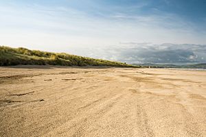
To the east and west, the land slopes down into the valleys of the River Bann and River Foyle. In the south-east, the county touches Lough Neagh, Ireland's largest lake. The northern part of the county has steep cliffs, sand dunes, and beautiful beaches along the Atlantic coast.
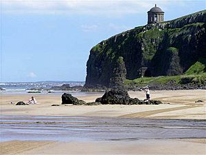
The county has many important places to visit. These include the old city walls of Derry, built in the 17th century. There is also Springhill House, a historic estate. Mussenden Temple stands on the Atlantic coast. You can also find bird sanctuaries along Lough Foyle.
In the middle of the county are old forests like Banagher and Ness Wood. Here, the Burntollet River flows over the highest waterfalls in Northern Ireland.
County Divisions
The county is divided into smaller areas for different purposes.
- Baronies
- Coleraine
- Keenaght
- North East Liberties of Coleraine
- North West Liberties of Londonderry
- Loughinsholin
- Tirkeeran
- Parishes
- Townlands
Towns and Villages
Here are some of the main settlements in County Londonderry:
- Cities
- Derry (population over 75,000)
- Large towns
- Coleraine (population 18,000 to 75,000)
- Medium towns
- Limavady (population 10,000 to 18,000)
- Small towns
- Intermediate settlements
- Culmore (part of Derry Urban Area)
- Dungiven
- Eglinton
- Maghera
- Newbuildings (part of Derry Urban Area)
- Villages
- Ballykelly
- Bellaghy
- Castledawson
- Castlerock
- Claudy
- Draperstown
- Garvagh
- Greysteel
- Kilrea
- Moneymore
- Strathfoyle (part of Derry Urban Area)
- Small villages or hamlets
People and Their Backgrounds
| Religious Background in Londonderry (2021) | ||||
|---|---|---|---|---|
| Religion | Per cent | |||
| Catholic | 61.3% | |||
| Protestant and Other Christian | 32.5% | |||
| None | 5.3% | |||
| Other faiths | 0.9% | |||
County Londonderry is one of four counties in Northern Ireland where most people identify as Catholic. This is based on the 2021 census. At that time, there were 252,231 residents in the county.
Of these, 61.3% were from a Catholic background. 32.5% were from a Protestant or other Christian background. 0.9% belonged to other religions, and 5.3% had no religious background.
| Religion or religion brought up in | Number | % |
|---|---|---|
| Catholic | 154,621 | 61.3% |
| Protestant and Other Christian | 81,995 | 32.5% |
| Other religions | 2,368 | 0.9% |
| None (no religion) | 13,247 | 5.3% |
| Total | 252,231 | 100.00% |
People in County Londonderry have different national identities. The 2021 census showed these results:
| National identity | Number | (%) |
|---|---|---|
| Irish only | 106,343 | 42.2% |
| British only | 62,562 | 24.8% |
| Northern Irish only | 49,764 | 19.7% |
| British and Northern Irish only | 13,148 | 5.2% |
| Irish and Northern Irish only | 5,072 | 2.0% |
| British, Irish and Northern Irish only | 2,475 | 1.0% |
| British and Irish only | 1,388 | 0.6% |
| Other identity | 11,477 | 4.6% |
| Total | 252,231 | 100.0% |
| All Irish identities | 116,032 | 46.0% |
| All British identities | 81,097 | 32.2% |
| All Northern Irish identities | 21,248 | 10.9% |
How the County is Run
From 1899 to 1973, the Londonderry County Council managed the county. In 1973, county councils in Northern Ireland were abolished. They were replaced by smaller local councils called "district councils."
These new councils included Derry City Council, Limavady Borough Council, and Magherafelt District Council. Parts of Coleraine Borough Council and Cookstown District Council were also included. After 2011, the number of councils in Northern Ireland was reduced. Now, County Londonderry is divided into three larger councils. These are Causeway Coast and Glens, Derry and Strabane, and Mid-Ulster District.
Getting Around
Translink runs a train service in the county. You can travel from Derry~Londonderry to Coleraine railway station. From Coleraine, you can go to Portrush or continue to Belfast Lanyon Place and Belfast Grand Central.
There is also the Foyle Valley Railway, which is a museum in Derry. It has old trains from past railway companies. Bus services in the county are now provided by Ulsterbus.
Learning and Education
The Education Authority (EA) manages government-funded education up to secondary school. The EA has different regions. These include the Western region (Derry, Limavady) and the North Eastern region (Coleraine, Magherafelt).
For Catholic schools that receive government funding, the Derry Diocesan Education Office helps with their management.
County Londonderry is home to two major campuses of the University of Ulster. The main headquarters is in Coleraine. There is also the Magee Campus in Derry.
Sports in the County
In Gaelic games, the Derry county team is very important. It covers roughly the same area as County Londonderry. The Derry teams wear red and white colors. The county football team won the All-Ireland Senior Football Championship in 1993. They have also won five National League titles. Hurling is also played, and the county team is one of the best in Ulster.
In soccer, two teams from the county play in the top league, the NIFL Premiership. These are Coleraine F.C. and Institute F.C.. Other teams like Limavady United F.C. play in lower leagues. Derry City F.C. plays in the Premier Division of the League of Ireland.
The Northern Ireland Milk Cup is a famous youth soccer tournament. It started in 1983 and is held in Coleraine and nearby towns. Teams from all over the world, including famous clubs like Manchester United and Barcelona, have played in this event.
In rugby union, Rainey Old Boys Rugby Club, Magherafelt is a senior team from the county. Other rugby clubs include Limavady R.F.C and City of Derry Rugby Club.
Cricket is popular in the north-west of Ireland. Many senior cricket clubs in the region are located in County Londonderry.
In rowing, Richard Archibald from Coleraine competed in the Beijing 2008 Olympics. Another rower from Coleraine, Alan Campbell, won a World Cup gold medal in 2006.
Media and Radio
The county has four main radio stations:
- BBC Radio Foyle
- Q102.9
- Q97.2
- Six FM (in the south of the county)
See also
 In Spanish: Condado de Derry para niños
 | Jewel Prestage |
 | Ella Baker |
 | Fannie Lou Hamer |


