
Maghera facts for kids
Quick facts for kids Maghera
|
|
|---|---|
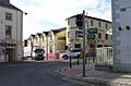
 Maghera Town Centre |
|

Maghera
|
|
| Population | 4,235 (2021 census) |
| District |
|
| Country | Northern Ireland |
| Sovereign state | United Kingdom |
| Post town | MAGHERA |
| Postcode district | BT46 |
| Dialling code | 028 |
| Police | Northern Ireland |
| Fire | Northern Ireland |
| Ambulance | Northern Ireland |
| EU Parliament | Northern Ireland |
| UK Parliament |
|
| NI Assembly |
|

Maghera is a small town located in Northern Ireland. It sits at the bottom of the Glenshane Pass. The name Maghera comes from the Irish words Machaire Rátha, which means "plain of the ringfort". A ringfort was a type of ancient circular fort.
In 2021, about 4,235 people lived in Maghera. The town is now part of the Mid-Ulster District local government area.
Contents
A Look at Maghera's Past
Maghera has a very long history, going back to at least the 6th century. A monastery was started here by Saint Lurach. His family might have learned about Christianity from Saint Patrick.
The old records, called the Annals of Ulster, say that a powerful group called the Cenél nEógain had their main place at Ráth Luraig in Maghera. Today, you can still see the ruins of St. Lurach's Church. This church stands where the old monastery was. It dates back to the 10th century.
One special part of the old church is a carving above a doorway. It shows the crucifixion and might be the oldest one in Ireland. A copy of this carving is also in the modern Catholic church, St Mary's.
The old church and town were burned down in the 12th century. After this, Maghera became an important religious center. It was the main seat for the Bishopric of Cinél nEógain. But in 1246, the bishop, Germanus O'Carolan, asked Pope Innocent IV to move the main church to Derry. He said Maghera was too far away.
Settlers and Changes
Later, during the Plantation of Ulster, many Scottish settlers came to Maghera. This happened after the Irish Rebellion of 1641. These new settlers often had disagreements with the Irish people who had lost their land. They also had conflicts with the powerful Church of Ireland landowners.
Because of these problems, many people from Maghera moved to the American colonies. For example, Charles Thomson, who signed the United States Declaration of Independence, said he was from Maghera. In the 1790s, a group called the Society of United Irishmen was formed. They wanted to make changes and work with their Catholic neighbors.
On June 7, 1798, over 5,000 United Irishmen gathered in Maghera. However, they were not well-armed. The next morning, they heard that the rebels had lost a battle at Antrim. Government troops were also coming. So, the group broke up. A Presbyterian church leader named Watty Graham was executed for his part. His head was even paraded through the town. His minister, John Glendy, had to leave for America.
Later Conflicts and Growth
On July 12, 1830, two groups, the Orange Order and the Ribbonmen, clashed in Maghera. This was because of demonstrations held by the Orange Order. After this, some Catholic homes were burned by Protestants.
Later, a movement for tenant rights helped improve relations between groups. But by the end of the century, the question of Irish independence became more important. Today, the town is still divided politically. Most people support Irish nationalism, while others support unionism.
The Great Famine in the 1840s caused a huge loss of people in the countryside around Maghera. In 2003, a group called the Ancient Order of Hibernians put up a headstone. It marks the "Famine Plot" where local victims were buried.
In the early 1900s, Maghera was doing quite well. It had its own railway station and an embroidery factory. There was also a busy weekly market. It was close to a large linen mill in Upperlands. Maghera was one of the two main towns in the area.
After World War II, the town improved even more. New schools were built for both Catholic and Protestant children in the 1960s. New homes were also built. Roads were made wider because more people had cars.
The Troubles
Maghera experienced violence during a period known as the Troubles. This was a time of conflict in Northern Ireland. Over about 30 years, 14 people died in or near Maghera. Some were members of the security forces. Others were killed because their family members were in the Ulster Defence Regiment. Most of these deaths were caused by the Provisional Irish Republican Army. Two people, including a local politician, were killed by loyalist groups.
Maghera's population has grown a lot over the last century. In 1910, there were only 879 people. By 2011, it was 4,220. In 2011, about 213 people living in Maghera did not speak English as their first language. This shows how diverse the town has become.
How Maghera is Governed
From 1899 to 1973, Londonderry County Council managed the town. Since 2011, Maghera has been part of the Mid-Ulster District Council. It is in an area called Carntogher. In the 2015 local elections, Carntogher elected three representatives from Sinn Féin, one from the SDLP, and one from the DUP.
Places of Worship
Maghera has several churches:
- Old St Lurach's Church: This church dates back to the 10th century. It has one of the oldest carvings of the crucifixion in Ireland.
- St Lurach's Church: This is where the local Church of Ireland congregation meets.
- St Mary's Catholic Church: One of two Catholic churches in the town.
- Maghera Presbyterian Church: This building has been here since at least 1843.
- St Patrick's Church, Glen: An older Catholic church just outside the town.
- Maghera Elim Church


Who Lives in Maghera? (Demographics)
2021 Census Information
On March 21, 2021, the population of Maghera was 4,235 people.
- About 22.57% were under 16 years old.
- About 61.94% were between 16 and 65 years old.
- About 15.49% were 66 years old or older.
- About 51.17% of the people were female, and 48.83% were male.
- About 78.04% were Catholic or grew up Catholic.
- About 18.14% were Protestant or grew up Protestant.
- About 3.66% did not have a religion.
- People could choose more than one national identity:
- 19.24% chose British.
- 55.84% chose Irish.
- 24.16% chose Northern Irish.
- About 24.27% knew some Irish.
- About 6.49% knew some Ulster-Scots.
2011 Census Information
On March 27, 2011, the population of Maghera was 4,220. This was an increase from 3,711 people in 2001.
- Almost all residents (99.55%) were from the white ethnic group.
- About 74.86% were Catholic or grew up Catholic.
- About 22.61% were Protestant or grew up Protestant.
- About 22.56% chose British national identity.
- About 48.82% chose Irish national identity.
- About 27.44% chose Northern Irish national identity.
- About 21.23% knew some Irish.
- About 6.46% knew some Ulster-Scots.
- About 5.06% did not have English as their first language.
Getting Around Maghera (Transport)
Maghera once had its own railway station. It opened in 1880. Passenger trains stopped running in 1950, and the station closed completely in 1959. The old station building is now part of a garden center.

Today, Ulsterbus runs bus routes through Maghera. These buses connect Maghera to places like Kilrea, Coleraine, Magherafelt, Belfast, Derry, Limavady, Eglinton, Monaghan, and Portrush.
Famous People from Maghera
Many notable people have connections to Maghera:
- Charles Thomson (1729–1824): He signed the U.S. Declaration of Independence.
- John Glendy (1755–1832): A republican Presbyterian minister who served in the U.S. Congress.
- Adam Clarke (1762–1832): A Methodist religious scholar.
- Watty Graham (1768–1798): A leader of the Society of United Irishmen, executed in 1798.
- Henry Cooke (1788–1868): A famous Presbyterian minister.
- Robert Hawthorne (1822–1879): Received the Victoria Cross for bravery during the Indian Rebellion of 1857.
- William Shiels (1848–1904): An Australian politician who became the Premier of Victoria.
- Helena Concannon (1878–1952): An Irish historian, writer, and Senator.
- Louis Joseph Walsh (1880–1942): A lawyer, writer, and politician.
- Eve Bunting (1928–2023): A well-known children's author.
- Erwin Gabathuler (1933–2016): A particle physicist.
- Mickey Moran (1951– ): A Gaelic football player and coach.
- Kenny Shiels (1956– ): A footballer and Northern Ireland team manager.
Schools in Maghera
Maghera has three primary schools and one secondary school:
Primary Schools
- St Mary's Primary School, Glenview
- Maghera Controlled Primary School
- St Patrick's Primary School, Glen
Secondary School
- St. Patrick's College: A school for both boys and girls.
Sports in Maghera
- The local Gaelic football club is Watty Graham's Gaelic Athletic Club.
Images for kids
-
Maghera Town Centre
See also
 In Spanish: Maghera para niños
