Coleraine facts for kids
Quick facts for kids Coleraine
|
|
|---|---|
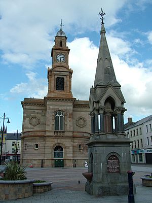 Coleraine Town Hall |
|
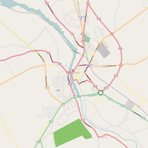 OpenStreetMap of Coleraine |
|
| Population | 24,483 (2021 census) |
| Irish grid reference | C844328 |
| District |
|
| County | |
| Country | Northern Ireland |
| Sovereign state | United Kingdom |
| Post town | COLERAINE |
| Postcode district | BT51, BT52 |
| Dialling code | 028 |
| Police | Northern Ireland |
| Fire | Northern Ireland |
| Ambulance | Northern Ireland |
| EU Parliament | Northern Ireland |
| UK Parliament |
|
| NI Assembly |
|
Coleraine (/koʊlˈreɪn/ KOHL-rayn) is a town in Northern Ireland. It is located near where the River Bann meets the sea, in County Londonderry. The town's name comes from the Irish words Cúil Raithin, which mean 'nook of the ferns'.
Coleraine is about 55 miles (88 km) north-west of Belfast. It is also 30 miles (48 km) east of Derry. Both cities are connected to Coleraine by major roads and railway lines. The town is part of the Causeway Coast and Glens district.
Contents
- About Coleraine
- Coleraine's Past
- Coleraine in Books
- How Coleraine is Governed
- Visiting Coleraine
- Weather in Coleraine
- Interesting Places
- Famous People from Coleraine
- Education in Coleraine
- Getting Around Coleraine
- Sports in Coleraine
- Coleraine's Population
- Other Places Named Coleraine
- International Connections
- See also
About Coleraine
Coleraine is home to about 24,483 people, according to the 2021 census. During the day, the town is quite busy. At night, it becomes quieter. Many people go to the nearby seaside towns of Portrush and Portstewart for evening activities. These three towns are often called “The Triangle” because they are close together and popular with visitors.
Coleraine is also known for having one of the largest Polish communities in Northern Ireland.
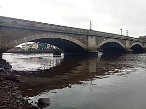
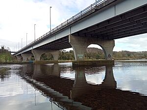
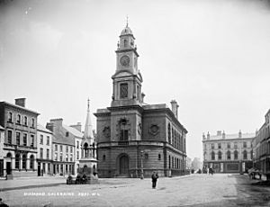
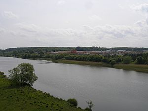
The town is built at the lowest point where the River Bann can be crossed by a bridge. Here, the river is about 90 meters (295 feet) wide. The main town square is called 'The Diamond'. This is where the historic Coleraine Town Hall stands. Coleraine has three bridges: the Sandelford Bridge, Coleraine Bridge, and the Bann Bridge.
You can find St Patrick's Church of Ireland in the town centre. Other churches for different Christian groups are also nearby.
The University of Ulster campus was built in the 1960s. It brought a special place for plays and shows to the town, called the Riverside Theatre. Coleraine is an important town for the surrounding area. It is seen as a "major growth area" in Northern Ireland's plans for development.
Coleraine's Past
Coleraine has a very long history of people living there. The Mount Sandel area shows some of the earliest signs of human life in Ireland. These date back to about 5935 BC.
A very old book from the ninth century, called Tripartite Life of Saint Patrick, tells us how Coleraine got its name. When Patrick visited the area, a local leader named Nadslua welcomed him. Nadslua offered Patrick land by the River Bann to build a church. This spot was covered in ferns. Some boys were burning these ferns for fun. Because of this, the area was called Cúil Raithin ('nook of ferns'). This name later became Coleraine.
In the early 1600s, Coleraine was one of two towns developed by London companies. This was part of the Plantation of Ulster, a plan to settle people in the area. The slightly unusual layout of Coleraine's town centre today comes from this early town planning. You can still see parts of the old walls that protected the town back then.
During a conflict known as the War of the Two Kings (1689–1691), Coleraine was a place where Protestants resisted the rule of King James II. Forces loyal to King James tried to take the town but were pushed back. However, the Protestants had to leave the town soon after and went to Derry. Later, after a siege in Derry failed, the forces loyal to King James also left Coleraine. The town then came under the control of those supporting William III for the rest of the war.
In the 1800s and early 1900s, Coleraine grew a lot. This was due to new industries, a growing river port, and the development of the railway. After the Second World War, the town's population doubled. This happened because of new industries, the building of the New University of Ulster (now Ulster University) in the town, more shops, and new sports facilities. The town area expanded from about 2.25 square miles (5.8 km²) to about 7 square miles (18 km²).
Since 1980, Coleraine has continued to grow, but at a slower pace.
A Time of Change
During a period known as the Troubles in Northern Ireland, Coleraine experienced some difficult events. In total, 13 people lost their lives in or near the town. Ten of these people were killed in two separate car bomb explosions. On 12 June 1973, a car bomb exploded on Railway Road. Six older civilians were killed. Another tragic event happened on 2 October 1975, when four people were killed when their own bomb exploded.
A third large bomb exploded in the town centre on 13 November 1992. This caused a lot of damage to buildings, and some had to be pulled down. Luckily, no one was killed in this incident. Coleraine Town Hall needed a lot of repair work and reopened in August 1995. The other three people killed in Coleraine during this time were shot by loyalist groups.
Coleraine in Books
The poet Letitia Elizabeth Landon wrote a poem called The Coleraine Salmon Leap in 1836. It talks about how many salmon there were in the river back then. It also describes the fun people had fishing for them.
How Coleraine is Governed
Coleraine used to be the main office for the Coleraine Borough Council. In 2015, this council joined with others to form the Causeway Coast and Glens District Council. The new council's main office is still in the former Coleraine Borough Council building.
The area around Coleraine, along with Limavady, forms the East Londonderry area. This area elects representatives to the Westminster Parliament and the Northern Ireland Assembly.
Visiting Coleraine
Coleraine is close to the Causeway Coast tourist route, which attracts over 2 million visitors each year. The Giant's Causeway, a famous UNESCO World Heritage Site, is only a 25-minute bus ride away. You can also take a bus from Coleraine to the village of Bushmills, which has a famous distillery. In summer, a small steam train runs from Bushmills to the Giant's Causeway.
North of Coleraine, you'll find the beautiful coastal town of Portstewart. It has a sandy beach and lovely walks along the coast. Portrush is another popular town nearby.
To the north-west of Coleraine is the small village of Castlerock. It has a beach that connects to Portstewart beach, separated by the mouth of the River Bann. Also close by are the beach at Benone Strand and Mussenden Temple. This temple was built by an 18th-century bishop on top of a cliff. It offers amazing views of County Donegal and Scotland. The bishop's home, Downhill House, is now looked after by the National Trust.
Weather in Coleraine
Coleraine has a maritime climate. This means it has cool summers and mild winters. The nearest official weather station used to be at Coleraine University, about 1 mile (2 km) north of the town. However, observations there stopped a few years ago. The closest current weather station is now at Movanagher, about 12 miles (19 km) south.
Coleraine usually gets the most rain in October, with over 100 mm (3.9 inches). May is the driest month, with less than 60 mm (2.4 inches) of rain. On average, it rains at least 1 mm (0.04 inches) on 173 days a year. January has the most rainy days (18), while June has the fewest (11).
| Climate data for Ulster University, at 23 m.a.s.l. (Weather station 1 mile (2 km) to the North of Coleraine town centre) |
|||||||||||||
|---|---|---|---|---|---|---|---|---|---|---|---|---|---|
| Month | Jan | Feb | Mar | Apr | May | Jun | Jul | Aug | Sep | Oct | Nov | Dec | Year |
| Mean daily maximum °C (°F) | 7.3 (45.1) |
7.6 (45.7) |
9.2 (48.6) |
11.1 (52.0) |
13.9 (57.0) |
15.9 (60.6) |
17.8 (64.0) |
17.8 (64.0) |
15.8 (60.4) |
12.9 (55.2) |
9.8 (49.6) |
8.0 (46.4) |
12.3 (54.1) |
| Mean daily minimum °C (°F) | 1.6 (34.9) |
1.6 (34.9) |
2.8 (37.0) |
3.9 (39.0) |
6.0 (42.8) |
8.7 (47.7) |
11.0 (51.8) |
10.7 (51.3) |
8.8 (47.8) |
6.7 (44.1) |
3.7 (38.7) |
2.4 (36.3) |
5.7 (42.2) |
| Source: yr.no | |||||||||||||
Interesting Places
On the east side of Coleraine, you'll find Mountsandel Forest. This forest is home to the Mount Sandel fort. This ancient site is believed to be the oldest place where humans lived in Ireland. Wooden houses dating back to about 7000 BC were found here. You can get to the fort through Mountsandel Forest. There is another fort about two miles south of Mountsandel, near the small village of Loughan.
Famous People from Coleraine
Many notable people have come from Coleraine.
Living People
- Richard Archibald – rower
- Alan Campbell – rower
- Joel Cassells – rower
- Peter Chambers – rower
- Richard Chambers – rower
- Jack Doherty – potter
- Michelle Fairley – actress
- Maureen Madill – golfer, coach and broadcaster
- Jenna McCorkell – British ladies' figure skating champion
- Gerry McKenna – biologist and university vice chancellor
- James Nesbitt – actor
- Maggie O'Farrell – novelist
- Damien O'Kane – folk singer
- Tommy Sheppard – Scottish politician
- Claire Sugden – politician
- Andrew Trimble – rugby union player
- Bronagh Waugh – actress
- Jayne Wisener – actress
Historical Figures
- Hugh Thompson – artist and illustrator
- Alexander Anderson – physicist
- Peter Dermot Doherty – footballer and manager
- Harry Gregg MBE – goalkeeper
- Sam Henry – civil servant, antiquarian, lecturer, writer, photographer, folklorist, and folk-song collector
- A. M. Irvine – author
- Sir Thomas Ranken Lyle – mathematical physicist
- Hercules Mulligan – tailor and spy during the American Revolutionary War
- Edward Nicolls – Royal Marines officer
- Bertie Peacock – footballer
- Hilary Stevenson – scientist, educator, and expert on food irradiation
- Isaac Todd – fur trader and merchant
- Charles Frederick Williams – journalist and war correspondent
Education in Coleraine
Coleraine has many schools and colleges for all ages.
Schools
Some of the local schools include:
- Saint John's Primary School
- Irish Society's Primary School
- Coleraine Grammar School
- Coleraine College
- St Joseph's College, Coleraine
- D.H Christie Memorial Primary School
- Killowen Primary School
- Loreto College, Coleraine (a co-educational Roman Catholic grammar school)
- Harpurs Hill Primary School
- Millburn Primary School
- Saint Malachy's Primary School
- North Coast Integrated College
- Macosquin Primary School
- Sandelford Special School
- Ballysally Primary School
Higher Education
Coleraine is home to a University of Ulster campus. This campus was originally the New University of Ulster, founded in 1968. It later joined with another college in 1984 to form the current Ulster University. The university is highly rated for its law, biomedical, and humanities programs. The Causeway Institute is also in Coleraine. It is a college for further and higher education, with another campus in Ballymoney.
Getting Around Coleraine
Coleraine railway station opened on 4 December 1855. It shares its facilities with the town's Ulsterbus bus station. You can travel by train on the Belfast-Derry railway line, which goes along the beautiful shore of Lough Foyle. There is also a local line, the Coleraine–Portrush branch line. Plans are in place to improve the Belfast–Derry railway line. This will allow for more frequent and faster trains.
Sports in Coleraine
Coleraine has several sports clubs. These include Coleraine Rugby Club, founded in 1921. Coleraine F.C., a football club, was started in 1927 and plays in the IFA Premiership. CLG Eoghan Rua is a Gaelic games club established in 1957. Coleraine is also one of the towns that hosts the Milk Cup, a famous youth football tournament.
The town is part of the route for the North West 200. This is a series of exciting motorcycle road races organized by the Coleraine and District Motor Club.
Coleraine Bowling Club, a lawn bowls club, was founded in 1903. It is one of the most successful teams in Irish bowling. They have won many titles, including two Irish Bowling Association Senior Challenge Cups. Many international players and Commonwealth Games representatives have come from this club.
Coleraine Cricket Club plays in the North West Senior League.
In the wider area, there are several well-known golf courses. These include Castlerock Golf Club, Royal Portrush Golf Club, and Portstewart Golf Club.
The Coleraine area also has a strong interest in horse riding. The RDA Coleraine (Riding for the Disabled Association) helps people with physical or learning disabilities enjoy horse riding. They have a modern arena at Castleroe. This arena also supports The OWLS Sports Club. OWLS stands for Opportunities Without Limits. It helps create different sports opportunities for people with disabilities and their families.
Coleraine's Population
Coleraine is considered a large town. This means it has a population between 18,000 and 75,000 people.
2021 Census Information
On Census day in 2021, there were 24,483 people living in Coleraine.
- About 18.78% were under 16 years old.
- About 63.25% were between 16 and 65 years old.
- About 17.97% were 66 years old or older.
- About 51.88% of the residents were female, and 48.11% were male.
- About 61.72% were brought up Protestant or other Christian faiths.
- About 24.38% were brought up Catholic.
- About 12.57% did not follow any religion.
- About 61.91% said they had a British national identity.
- About 36.74% said they had a Northern Irish national identity.
- About 11.17% said they had an Irish national identity. (People could choose more than one identity.)
- About 15.65% knew some Ulster-Scots.
- About 4.44% knew some Irish (Gaeilge).
Other Places Named Coleraine
The name Coleraine is used in other parts of the world too!
- In Quebec, Canada, there is a place called Saint-Joseph-de-Coleraine. It was named by Irish settlers who arrived there in 1864.
- In the United States, several places are named after Coleraine. These include two townships in Ohio: Colerain Township, Belmont County and Colerain Township, Hamilton County.
- In 1853, a surveyor named Lindsay Clarke renamed a town in Victoria, Australia, to Coleraine.
International Connections
Coleraine has international projects, like the Zomba Action Project. This charity started in 2003 to help the town of Zomba in southern Malawi. This connection was made because of historical links between churches in Coleraine and Malawi. Donations have helped fund computers, education, and medical projects in Zomba.
Coleraine is also twinned with the French town of La Roche-sur-Yon.
See also
 In Spanish: Coleraine para niños
 | Calvin Brent |
 | Walter T. Bailey |
 | Martha Cassell Thompson |
 | Alberta Jeannette Cassell |


