Benkelman, Nebraska facts for kids
Quick facts for kids
Benkelman, Nebraska
|
|
|---|---|

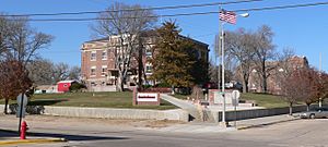
Courthouse square (2011)
|
|

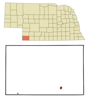
Location within Dundy County and Nebraska
|
|
| Country | United States |
| State | Nebraska |
| County | Dundy |
| Area | |
| • Total | 1.20 sq mi (3.11 km2) |
| • Land | 1.20 sq mi (3.11 km2) |
| • Water | 0.00 sq mi (0.00 km2) |
| Elevation | 3,041 ft (927 m) |
| Population
(2020)
|
|
| • Total | 821 |
| • Density | 684.74/sq mi (264.32/km2) |
| Time zone | UTC-7 (Mountain (MST)) |
| • Summer (DST) | UTC-6 (MDT) |
| ZIP code |
69021
|
| Area code | 308 |
| FIPS code | 31-04230 |
| GNIS ID | 2394133 |
Benkelman is a small city in Nebraska, United States. It is the main town, also called the county seat, of Dundy County. In 2020, about 821 people lived here.
Contents
History of Benkelman
Benkelman started around 1880. It was first named Collinsville after Moses Collins. In 1882, the railroad changed its name to Benkelman. This new name honored J. G. Benkelman, who raised livestock.
Geography and Climate
Benkelman covers about 0.80 square miles (2.07 square kilometers) of land. There is no water area within the city limits.
What is the climate like in Benkelman?
Benkelman has a climate with warm summers and cold winters. Here is a quick look at the average weather:
| Climate data for Benkelman, Nebraska (1991–2020) | |||||||||||||
|---|---|---|---|---|---|---|---|---|---|---|---|---|---|
| Month | Jan | Feb | Mar | Apr | May | Jun | Jul | Aug | Sep | Oct | Nov | Dec | Year |
| Mean daily maximum °F (°C) | 42.5 (5.8) |
45.8 (7.7) |
56.5 (13.6) |
64.6 (18.1) |
74.0 (23.3) |
85.8 (29.9) |
91.4 (33.0) |
89.0 (31.7) |
81.4 (27.4) |
67.7 (19.8) |
54.0 (12.2) |
43.5 (6.4) |
66.4 (19.1) |
| Mean daily minimum °F (°C) | 15.9 (−8.9) |
18.6 (−7.4) |
27.2 (−2.7) |
36.1 (2.3) |
47.4 (8.6) |
58.4 (14.7) |
64.0 (17.8) |
61.5 (16.4) |
51.4 (10.8) |
37.0 (2.8) |
25.4 (−3.7) |
16.9 (−8.4) |
38.3 (3.5) |
| Average precipitation inches (mm) | 0.51 (13) |
0.60 (15) |
0.97 (25) |
1.96 (50) |
3.11 (79) |
2.90 (74) |
3.13 (80) |
2.39 (61) |
1.44 (37) |
1.50 (38) |
0.60 (15) |
0.55 (14) |
19.66 (499) |
| Average snowfall inches (cm) | 5.6 (14) |
5.9 (15) |
4.0 (10) |
2.5 (6.4) |
0.1 (0.25) |
0.0 (0.0) |
0.0 (0.0) |
0.0 (0.0) |
0.2 (0.51) |
1.9 (4.8) |
2.6 (6.6) |
4.8 (12) |
27.6 (70) |
| Average precipitation days (≥ 0.01 in) | 4.3 | 5.5 | 5.5 | 8.7 | 10.0 | 9.4 | 9.4 | 8.6 | 5.6 | 6.0 | 4.1 | 4.0 | 81.1 |
| Average snowy days (≥ 0.01 in) | 3.7 | 4.4 | 2.7 | 1.7 | 0.1 | 0 | 0 | 0 | 0.1 | 0.9 | 2.2 | 3.6 | 19.4 |
| Source: NOAA | |||||||||||||
Population Changes Over Time
The number of people living in Benkelman has changed over the years. Here is how the population has grown and shrunk since 1890:
| Historical population | |||
|---|---|---|---|
| Census | Pop. | %± | |
| 1890 | 357 | — | |
| 1900 | 296 | −17.1% | |
| 1910 | 538 | 81.8% | |
| 1920 | 1,009 | 87.5% | |
| 1930 | 1,154 | 14.4% | |
| 1940 | 1,448 | 25.5% | |
| 1950 | 1,512 | 4.4% | |
| 1960 | 1,400 | −7.4% | |
| 1970 | 1,349 | −3.6% | |
| 1980 | 1,235 | −8.5% | |
| 1990 | 1,193 | −3.4% | |
| 2000 | 1,006 | −15.7% | |
| 2010 | 953 | −5.3% | |
| 2020 | 821 | −13.9% | |
| U.S. Decennial Census | |||
In 2010, there were 953 people living in Benkelman. The city had 445 households. Many people lived alone or in families.
Getting Around Benkelman
Main Roads
Two important roads pass through Benkelman:
- U.S. Route 34 (US 34) goes from east to west.
- Nebraska Highway 61 (NE 61) goes from north to south.
Train Travel
The BNSF Railroad tracks run through Benkelman. They generally follow the Republican River. While Amtrak trains pass by, there is no train station in Benkelman. The closest station is in McCook, about an hour away to the east.
Famous People From Benkelman
Some well-known people have connections to Benkelman:
- Ward Bond, an actor
- Dave Heineman, who was the 39th Governor of Nebraska
- Edward Snedeker, a Lieutenant General in the Marine Corps
- Phaelan Sanford, a free safety for the Las Vegas Raiders American Football team
See also
 In Spanish: Benkelman (Nebraska) para niños
 | Sharif Bey |
 | Hale Woodruff |
 | Richmond Barthé |
 | Purvis Young |

