Bennington, Kansas facts for kids
Quick facts for kids
Bennington, Kansas
|
|
|---|---|

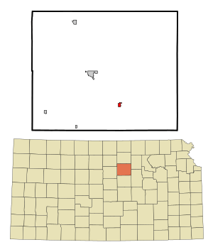
Location within Ottawa County and Kansas
|
|

|
|
| Country | United States |
| State | Kansas |
| County | Ottawa |
| Founded | 1870s |
| Platted | 1878 |
| Incorporated | 1885 |
| Named for | Bennington, Vermont |
| Government | |
| • Type | Mayor–Council |
| Area | |
| • Total | 0.42 sq mi (1.09 km2) |
| • Land | 0.42 sq mi (1.09 km2) |
| • Water | 0.00 sq mi (0.00 km2) |
| Elevation | 1,230 ft (370 m) |
| Population
(2020)
|
|
| • Total | 622 |
| • Density | 1,481/sq mi (570.6/km2) |
| Time zone | UTC-6 (CST) |
| • Summer (DST) | UTC-5 (CDT) |
| ZIP code |
67422
|
| Area code | 785, exchange 488 |
| FIPS code | 20-06075 |
| GNIS ID | 2394136 |
Bennington is a small city located in Ottawa County, Kansas, in the United States. In 2020, about 622 people lived there. It's a quiet place with a rich history and a strong community feel.
Contents
History of Bennington
Bennington was officially planned out, or platted, in 1878. It quickly grew, reaching over 200 residents within just three years. The city's name has an interesting story. Some believe it comes from an old Native American word meaning "place of fine trees." Others say that George R. Parker, one of the city's founders, named it after Bennington, Vermont.
Early Transportation and Growth
In 1878, the Solomon Valley Railroad, which was part of the Kansas Pacific Railroad, reached Bennington. This was a big deal because it helped the town grow by making it easier to transport goods and people.
School Development
The first school in Bennington opened in 1879, a short distance south of the town. Over the years, the school system expanded to meet the needs of the growing community:
- A new school building was constructed in 1918.
- An auditorium was added in 1938, providing a space for performances and events.
- A shop area was built in 1955, likely for vocational training.
- A new grade school building was added in 1961, showing the continued growth of the town's younger population.
Geography and Climate
Bennington covers a total area of about 0.42 square miles (1.09 square kilometers). All of this area is land, meaning there are no large lakes or rivers within the city limits.
Bennington's Climate
The weather in Bennington is known for its hot and humid summers. Winters are generally mild to cool. This type of weather is called a humid subtropical climate. On climate maps, you might see this marked as "Cfa" according to the Köppen Climate Classification system. This means the area gets plenty of rain throughout the year, and it doesn't usually have very cold winters.
Population Information
| Historical population | |||
|---|---|---|---|
| Census | Pop. | %± | |
| 1890 | 390 | — | |
| 1900 | 389 | −0.3% | |
| 1910 | 386 | −0.8% | |
| 1920 | 371 | −3.9% | |
| 1930 | 374 | 0.8% | |
| 1940 | 369 | −1.3% | |
| 1950 | 325 | −11.9% | |
| 1960 | 535 | 64.6% | |
| 1970 | 561 | 4.9% | |
| 1980 | 579 | 3.2% | |
| 1990 | 568 | −1.9% | |
| 2000 | 623 | 9.7% | |
| 2010 | 672 | 7.9% | |
| 2020 | 622 | −7.4% | |
| U.S. Decennial Census | |||
Bennington is part of the Salina area, which is a larger group of towns and cities connected by their economy.
2020 Census Snapshot
The 2020 United States census counted 622 people living in Bennington. There were 254 households and 163 families. Most of the people living in Bennington were white or European American. A small number of people were from other racial backgrounds or identified with two or more races. About 2.25% of the population identified as Hispanic or Latino.
- About 29.9% of households had children under 18.
- Nearly half (49.6%) of households were married couples living together.
- The average household had 2.2 people, and families averaged 2.5 people.
- The median age in Bennington was 40.1 years. This means half the people were older than 40.1 and half were younger.
- About 24.8% of the population was under 18 years old.
2010 Census Snapshot
In 2010, Bennington had 672 residents. The population density was about 1600 people per square mile. Most residents were White, with smaller numbers of African American, Native American, and people of two or more races. About 1.9% of the population was Hispanic or Latino.
- About 37.2% of households had children under 18.
- The average household size was 2.57 people.
- The median age was 37.4 years.
- About 28.4% of residents were under 18 years old.
Education in Bennington
Students in Bennington attend schools within the Twin Valley USD 240 public school district. The district provides education from elementary through high school.
- Bennington High School, located at 301 North Putnam Street.
- Bennington Junior High School, also at 301 North Putnam Street.
- Bennington Grade School, located at 223 North Putnam Street.
See also
 In Spanish: Bennington (Kansas) para niños

