Bentee facts for kids
Quick facts for kids Bentee |
|
|---|---|
| Binn an Tí | |
 |
|
| Highest point | |
| Elevation | 376 m (1,234 ft) |
| Prominence | 270 m (890 ft) |
| Listing | Marilyn |
| Naming | |
| English translation | peak of the house |
| Geography | |
| OSI/OSNI grid | V476780 |
| Climbing | |
| Easiest route | Hike |
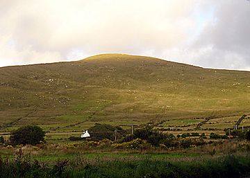
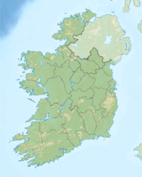
Bentee or Benatee is a cool hill in County Kerry, Ireland. Its name, Binn an Tí, means "peak of the house" in Irish. This hill stands tall over the town of Cahersiveen, offering amazing views of the area.
Contents
Exploring Bentee Hill
Bentee Hill is a popular spot for hikers and nature lovers. It's a great place to explore the beautiful Irish countryside.
How Tall is Bentee?
Bentee Hill reaches a height of 376 meters (about 1,234 feet). While it might not be the tallest mountain, it still offers fantastic views from its top.
What Can You See from the Top?
From the summit of Bentee, you can see many amazing sights. You'll get clear views of Valentia Island and the famous Skellig Islands. You can also spot the long Dingle Peninsula and the impressive MacGillycuddy's Reeks mountain range. It's like a giant map spread out below you!
Walking the Bentee Loop Trail
Getting to the top of Bentee is an exciting adventure. A special path called the Bentee Loop walking trail has been created. This trail makes it easier for people to hike up the hill.
Hiking Through Farmland
Most of the paths on the Bentee Loop Trail go across farmland. Hikers are allowed to use these paths thanks to the kind permission of the local farmers. Always remember to respect the land and follow any signs you see.
 | Bayard Rustin |
 | Jeannette Carter |
 | Jeremiah A. Brown |


