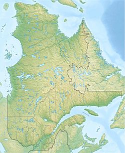
Berthiaume Lake facts for kids
Quick facts for kids Berthiaume Lake |
|
|---|---|
| Location | Lac-Jacques-Cartier (TNO), La Côte-de-Beaupré Regional County Municipality, Capitale-Nationale |
| Coordinates | 47°48′43″N 71°52′31″W / 47.81194°N 71.87527°W |
| Lake type | Natural |
| Primary inflows | (clockwise from the mouth) Décharge du lac des Pruches et Robillard, décharge du lac Pérusse, Métascouac River, décharge du lac Dyotte, décharge du lac Atlas. |
| Primary outflows | Métascouac River |
| Basin countries | Canada |
| Max. length | 8.5 km (5.3 mi) |
| Max. width | 1.2 km (0.75 mi) |
| Surface elevation | 465 m (1,526 ft) |
Berthiaume Lake is a beautiful freshwater lake in Quebec, Canada. It's a natural lake that the Métascouac River flows through. You can find it in the unorganized territory of Lac-Jacques-Cartier, within the La Côte-de-Beaupré Regional County Municipality.
This lake is part of the Laurentides Wildlife Reserve, a large protected area. It's located between two main roads, Route 169 and Route 155. These roads connect important towns like Quebec City, Alma, La Tuque, and Chambord.
The main activities around the lake are forestry and tourism. Forestry means managing forests for wood. Tourism involves people visiting for fun activities.
During winter, Berthiaume Lake usually freezes over. It's typically frozen from early December to late March. People can safely walk or play on the ice from mid-December to mid-March.
Contents
About Berthiaume Lake
Berthiaume Lake is quite long, stretching about 8.5 km (5.3 mi). It's also about 1.2 km (0.75 mi) wide. The lake sits at an elevation of 465 m (1,526 ft) above sea level.
Water Sources
Several streams and smaller lakes feed water into Berthiaume Lake. These include:
- The outlet from Lac des Pruches and Robillard (from the west).
- The outlet from Lake Pérusse (from the north).
- The Métascouac River itself (from the northeast).
- The outlet from Lake Dyotte.
- The outlet from Atlas Lake.
A narrow section, about a kilometer long, connects the northern and southern parts of the lake. This strait is between 100 and 200 meters wide.
Nearby Lakes and Rivers
Berthiaume Lake is surrounded by many other important water bodies. Here are some of them:
- To the north: Lac aux Montagnais, Lac Sérigny, Lac de la Liberté, Lac aux Écorces.
- To the east: Métascouac Lake, Lac Tomachiche, Lac Samson.
- To the south: Lac des Néréides, Métascouac River, Métabetchouane River.
- To the west: Robillard Lake, Lac Saint-Jean.
The Journey of the Water
The water from Berthiaume Lake flows out from its southeastern end. From there, it begins a long journey through several rivers and lakes.
Flowing to the Sea
The water first enters the Métascouac River. It then flows into Petit lac Métascouac. After that, it joins the Métabetchouane River, which carries the water generally northeast.
Eventually, the water reaches Lac Saint-Jean, a very large lake. From Lac Saint-Jean, it flows into the Saguenay River via a channel called La Petite Décharge. The Saguenay River then travels east for a long distance. Finally, it merges with the Saint Lawrence estuary near Tadoussac. This means the water from Berthiaume Lake eventually reaches the Atlantic Ocean!
Name Origin
The name "Lac Berthiaume" was officially recognized on December 5, 1968. This was done by the Commission de toponymie du Québec, which is a group in Quebec responsible for naming places.
Related Information
- La Côte-de-Beaupré Regional County Municipality, a local government area
- Lac-Jacques-Cartier, an unorganized territory
- Laurentides Wildlife Reserve, a large protected area
- Métascouac Lake
- Métascouac River
- Métabetchouane River
- Lac Saint-Jean
- Saguenay River
- St. Lawrence River
- List of lakes in Canada
 | Emma Amos |
 | Edward Mitchell Bannister |
 | Larry D. Alexander |
 | Ernie Barnes |


