Bertrand, Missouri facts for kids
Quick facts for kids
Bertrand, Missouri
|
|
|---|---|

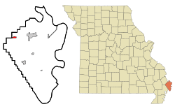
Location in Mississippi County and the state of Missouri
|
|

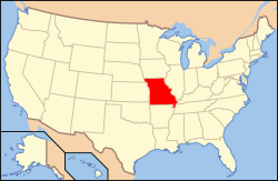
Location of Missouri in the United States
|
|
| Country | United States |
| State | Missouri |
| County | Mississippi |
| Area | |
| • Total | 0.82 sq mi (2.14 km2) |
| • Land | 0.82 sq mi (2.13 km2) |
| • Water | 0.00 sq mi (0.00 km2) |
| Elevation | 318 ft (97 m) |
| Population
(2020)
|
|
| • Total | 718 |
| • Density | 871.36/sq mi (336.52/km2) |
| Time zone | UTC-6 (Central (CST)) |
| • Summer (DST) | UTC-5 (CDT) |
| ZIP code |
63823
|
| Area code(s) | 573 |
| FIPS code | 29-04996 |
| GNIS feature ID | 2394153 |
Bertrand is a small city located in Mississippi County, Missouri, United States. It's a place where about 718 people lived in 2020. This number was a bit lower than the 821 people who lived there in 2010.
Contents
History of Bertrand
Bertrand was officially planned out in 1859. The city got its name from a person named Mr. Bertrand. He was involved in promoting railroads in the area. A post office opened in Bertrand in 1874 and has been helping people send mail ever since.
Exploring Bertrand's Geography
Bertrand is in the northwestern part of Mississippi County. It is about 6 miles (9.7 km) west of Charleston, which is the main city of the county. It's also about 8 miles (12.9 km) east-northeast of Sikeston.
U.S. Route 62 runs right through the middle of Bertrand. It is known as Cedar Street there. Interstate 57 is just south of the city. You can get to Bertrand from Exit 4, which is State Highway B. Interstate 57 goes southwest for about 4 miles (6.4 km) to connect with Interstate 55 near Sikeston. If you go northeast on I-57 for about 17 miles (27.4 km), you will cross the Mississippi River near Cairo, Illinois.
The city of Bertrand covers a total area of about 0.82 square miles (2.12 square kilometers). Most of this area is land. Only a tiny part, about 0.001 square miles (0.003 square kilometers), is water.
Population and People of Bertrand
| Historical population | |||
|---|---|---|---|
| Census | Pop. | %± | |
| 1880 | 126 | — | |
| 1890 | 221 | 75.4% | |
| 1900 | 266 | 20.4% | |
| 1910 | 346 | 30.1% | |
| 1920 | 355 | 2.6% | |
| 1930 | 322 | −9.3% | |
| 1940 | 377 | 17.1% | |
| 1950 | 390 | 3.4% | |
| 1960 | 465 | 19.2% | |
| 1970 | 604 | 29.9% | |
| 1980 | 688 | 13.9% | |
| 1990 | 692 | 0.6% | |
| 2000 | 740 | 6.9% | |
| 2010 | 821 | 10.9% | |
| 2020 | 718 | −12.5% | |
| source: | |||
What the 2010 Census Showed
In 2010, there were 821 people living in Bertrand. These people lived in 341 different homes. About 232 of these homes were families. The city had about 1052.6 people per square mile (406.4 people per square kilometer). There were also 355 housing units, which are places where people can live.
Many homes had children under 18 living there, about 33.4%. About 45.2% of the homes were married couples living together. Some homes had a female head of the house without a husband, and a few had a male head of the house without a wife. About 27.3% of all homes were made up of just one person. About 12.6% of homes had someone living alone who was 65 years old or older.
The average age of people in Bertrand in 2010 was 46.1 years. About 23% of the people were under 18 years old. About 22.9% were 65 years old or older. The city had more females than males, with 54.8% females and 45.2% males.
See also
 In Spanish: Bertrand (Misuri) para niños
 | Calvin Brent |
 | Walter T. Bailey |
 | Martha Cassell Thompson |
 | Alberta Jeannette Cassell |


