Mississippi County, Missouri facts for kids
Quick facts for kids
Mississippi County
|
|
|---|---|

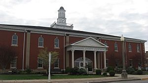
Mississippi County Courthouse in Charleston
|
|

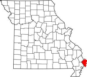
Location within the U.S. state of Missouri
|
|
 Missouri's location within the U.S. |
|
| Country | |
| State | |
| Founded | February 14, 1845 |
| Named for | Mississippi River |
| Seat | Charleston |
| Largest city | Charleston |
| Area | |
| • Total | 429 sq mi (1,110 km2) |
| • Land | 412 sq mi (1,070 km2) |
| • Water | 17 sq mi (40 km2) 4.0% |
| Population
(2020)
|
|
| • Total | 12,577 |
| • Density | 29.32/sq mi (11.319/km2) |
| Time zone | UTC−6 (Central) |
| • Summer (DST) | UTC−5 (CDT) |
| Congressional district | 8th |
Mississippi County is a special area called a county in the state of Missouri. It's located in the southeastern part of Missouri, known as the Bootheel. The famous Mississippi River forms its eastern border.
In 2020, about 12,577 people lived here. The biggest city and the main town for the county government is Charleston. Mississippi County was officially started on February 14, 1845. It was named after the mighty Mississippi River.
Contents
History of Mississippi County
Mississippi County is in a large flat area once called "Tywappity Bottom." This area was a huge floodplain. It was surrounded by hills to the north and rivers to the east and west.
Early Inhabitants and Explorers
Around 1540, a Spanish explorer named Hernando de Soto traveled through this region. He may have explored parts of southeastern Missouri. At that time, many different Native American tribes lived here. As more European settlers arrived, these tribes slowly moved west.
The land in southeastern Missouri was very flat and often swampy. The Mississippi River would flood it every year. This flooding made the soil incredibly rich and good for farming.
European American Settlement
By 1820, many European Americans had moved into southeastern Missouri. Most of these settlers came from southern states like Kentucky, Tennessee, and Virginia. They were mostly farmers looking for fertile and affordable land. They found what they needed near what is now Charleston, Missouri.
Founding of Charleston
European Americans first reached Charleston in 1830. In 1837, a woman named Thankful Randol sold some land to Joseph Moore. Mr. Moore then planned out the city of Charleston. The original town had 12 blocks. The official plan for Charleston was recorded on May 20, 1837. Charleston became an official city in Missouri on March 25, 1872.
Land Development and Farming
In the early 1900s, huge forests in the county attracted timber companies. After the trees were cut down, people worked with the state to build levees. These levees are walls that hold back water. They also created drainage systems to dry out the land.
Hundreds of miles of levees and dikes were built. This helped drain thousands of acres of land. This newly dry land was very fertile because of centuries of floods from the Mississippi River. Farmers grew crops like cotton, corn, and wheat. Later, soybeans and rice also became important crops.
Geography of Mississippi County

According to the U.S. Census Bureau, Mississippi County covers about 429 square miles. About 412 square miles of this is land. The remaining 17 square miles (4.0%) is water.
Neighboring Counties
Mississippi County shares borders with several other counties:
- Alexander County, Illinois (to the north)
- Ballard County, Kentucky (to the northeast, across the Mississippi River)
- Carlisle County, Kentucky (to the east, across the river)
- Hickman County, Kentucky (to the southeast, across the river)
- Fulton County, Kentucky (to the south, across the river)
- New Madrid County (to the southwest)
- Scott County (to the northwest)
Even though Mississippi County borders four counties in Kentucky across the river, there are no direct roads connecting them. This is because the Mississippi River is a big barrier. This means Kentucky and Missouri are the only two states that border each other across a major river without a direct highway connection. This is partly because these counties are mostly rural, meaning they have fewer people.
Main Roads in the County
 Interstate 57
 U.S. Route 60
 U.S. Route 62
 Route 77
 Route 80
 Route 105
Population and People
The number of people living in Mississippi County was highest in 1940. Over time, farming changed, and machines did more work. This meant fewer jobs were available, and the county's population slowly went down.
| Historical population | |||
|---|---|---|---|
| Census | Pop. | %± | |
| 1850 | 3,123 | — | |
| 1860 | 4,859 | 55.6% | |
| 1870 | 4,982 | 2.5% | |
| 1880 | 9,270 | 86.1% | |
| 1890 | 10,134 | 9.3% | |
| 1900 | 11,837 | 16.8% | |
| 1910 | 14,557 | 23.0% | |
| 1920 | 12,860 | −11.7% | |
| 1930 | 15,762 | 22.6% | |
| 1940 | 23,149 | 46.9% | |
| 1950 | 22,551 | −2.6% | |
| 1960 | 20,695 | −8.2% | |
| 1970 | 16,647 | −19.6% | |
| 1980 | 15,726 | −5.5% | |
| 1990 | 14,442 | −8.2% | |
| 2000 | 13,427 | −7.0% | |
| 2010 | 14,358 | 6.9% | |
| 2020 | 12,577 | −12.4% | |
| U.S. Decennial Census 1790-1960 1900-1990 1990-2000 2010-2015 |
|||
Population in 2000
In the year 2000, there were 13,427 people living in the county. These people lived in 5,383 households. About 77.93% of the people were White, and 20.53% were Black or African American. A small number of people were Native American, Asian, or from other backgrounds. About 0.96% of the population was Hispanic or Latino.
About 31.20% of households had children under 18 living with them. The average household had 2.44 people. The average family had 2.98 people.
The population was spread out by age:
- 26.30% were under 18 years old.
- 8.80% were 18 to 24 years old.
- 25.40% were 25 to 44 years old.
- 23.60% were 45 to 64 years old.
- 15.90% were 65 years or older.
The average age was 37 years.
Religious Groups
Mississippi County is part of an area known as the Bible Belt. This means that many people in the county follow evangelical Protestant religions. The most common religious groups in 2000 were:
- Southern Baptists (53.88%)
- Methodists (13.70%)
- Christian Churches and Churches of Christ (7.55%)
2020 Census Data
| Race | Num. | Perc. |
|---|---|---|
| White (NH) | 8,814 | 70% |
| Black or African American (NH) | 3,060 | 24.33% |
| Native American (NH) | 33 | 0.26% |
| Asian (NH) | 20 | 0.16% |
| Pacific Islander (NH) | 0 | 0% |
| Other/Mixed (NH) | 427 | 3.4% |
| Hispanic or Latino | 223 | 1.8% |
Education in Mississippi County
Many adults in Mississippi County have completed their education. About 61.1% of adults aged 25 and older have a high school diploma or higher. Also, 9.6% have earned a bachelor's degree or higher.
Public Schools
There are several public school districts in the county:
- Charleston R-I School District in Charleston
- Warren E. Hearnes Elementary School (Grades PK-05)
- Charleston Middle School (Grades 06-08)
- Charleston High School (Grades 09-12)
- East Prairie R-II School District in East Prairie
- East Prairie Elementary School (Grades PK-04)
- East Prairie Middle School (Grades 05-08)
- East Prairie High School (Grades 09-12)
- Scott County R-IV School District in Benton
- Kelly Elementary School (Grades K-05)
- Kelly Middle School (Grades 06-08)
- Thomas W. Kelly High School (Grades 09-12)
Private Schools
- St. Henry's School in Charleston (Grades 01-08) - This is a Roman Catholic school.
Public Libraries
- Mississippi County Library District
Communities in Mississippi County
- Anniston
- Bird's Point
- Bertrand
- Charleston (the county seat)
- Deventer
- Dorena
- East Prairie
- Miner
- Pinhook
- Wilson City
- Wolf Island
- Wyatt
See also
 In Spanish: Condado de Misisipi (Misuri) para niños
 | Aurelia Browder |
 | Nannie Helen Burroughs |
 | Michelle Alexander |

