Betteshanger Park facts for kids
Quick facts for kids Betteshanger Park |
|
|---|---|
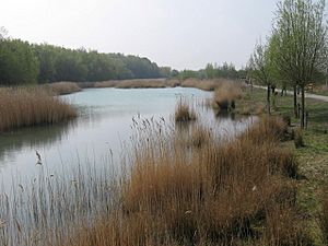
Fowlmead Lake in Betteshanger Park
|
|
| Area | 250 acres (1,000,000 m2) |
| Created | 2007 |
| Operated by | Hadlow Group |
| Status | Open 7 days a week |
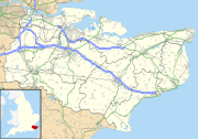
Betteshanger Park is a fantastic park located near Deal in Kent, England. It used to be known as Fowlmead Country Park and Betteshanger Country Park. This special park is built on what was once a huge pile of leftover material from a coal mine!
Contents
History of Betteshanger Park
From Coal Waste to Green Space
Betteshanger Park covers about 365 acres, which is a really big area! It's built on a "spoil tip." A spoil tip is a large mound of waste rock and dirt that was dug up from a coal mine. This particular spoil tip came from the old Betteshanger Colliery.
Betteshanger Colliery was one of the biggest coal mines in Kent. It started working between 1924 and 1930. The mine finally closed down in 1989. The spoil tip was located just northeast of where the mine used to be.
How the Park Got Its Name
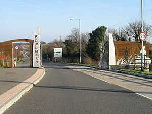
Before the spoil tip was there, the area was called Foulmead Marsh. The local community, with help from Dover District Council, chose a new name for the park. They picked Fowlmead, which means "bird meadow." This name was chosen because of the many birds found there.
In May 2015, a group called Hadlow Group took over the park. They decided to rename it Betteshanger Country Park. This was part of a bigger plan to improve the area. By 2017, the park's official name became Betteshanger Park.
Creating a New Park
Fowlmead Country Park and Nature Reserve was first developed with a lot of money. About £18.8 million was provided by English Partnerships. This was part of a national program to help areas where coal mines had closed.
The park officially opened in May 2007. A famous nature expert, Sir David Bellamy, helped open it. The visitor centre you see there today was also built with funding from these groups.
The ground of the entire park was made from shale. Shale is a type of rock from the coal mine. This shale was mixed with recycled green waste and plant food. This created rich topsoil, perfect for growing plants. Over 130,000 shrubs and trees were planted across the park.
Wildlife at the Park
Today, Betteshanger Park is home to lots of amazing wildlife. You can spot birds like the short-eared owl and marsh harrier. If you're lucky, you might even see a colourful kingfisher near the lake.
The park also has many different kinds of dragonflies. These creatures can be seen in the developing natural areas. These areas are found away from the main cycling paths.
Fun Activities at Betteshanger Park
Betteshanger Park offers many exciting things to do for everyone! You can enjoy walking on the paths or go cycling on the special tracks. It's also a great place for unique activities like fossil hunting.
If you like challenges, you can try a duathlon. This sport combines running and cycling. The park also has orienteering, where you use a map and compass to find points. You can even try geocaching, which is like a treasure hunt using GPS. Families can also have fun at the play area, which is close to the visitor centre.
Cycling at the Park
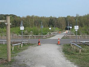
The park has a fantastic 3.5 kilometre tarmac cycle circuit. It's very smooth and perfect for road races or time trials. This circuit can be used as one long track. Or, it can be split into a 1.5 kilometre circuit or a 2 kilometre circuit.
The track is six metres wide, and it gets even wider at the finish line. British Cycling, which is the main group for cycling in the UK, says it's one of the best outdoor cycle circuits around! There's also a long mountain biking track that goes all around the park.
Many cycling and running competitions are held here. One amazing event was a Guinness World Record attempt. A team called the Red Wheelies tried to set a record for a twenty-four-hour Mobility Scooter Endurance Challenge. They completed 77 laps, which is 154 miles! This smashed the old record of 88 miles.
The Waiting Miner Statue Campaign
A Statue's Journey
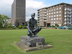
The "Waiting Miner" statue is a special artwork. It was first made for the Central Electricity Generating Board. It used to stand outside the Richborough power station. But when the power station closed, the statue needed a new home.
Each of Kent's mining towns had ideas for where the statue should go. These towns included Betteshanger, Chislet, Snowdown, and Tilmanstone. However, these ideas were not used. The statue was eventually moved to stand outside the National Coal Board’s office in Dover.
In 1987, the Coal Board Offices closed down. This left the "Waiting Miner" statue all alone on the seafront in Dover.
Remembering Mining History
In 2001, Dover District Council started a project. It was called the Coalfields Heritage Initiative Kent (CHIK). The goal was to remember and protect Kent's mining history. This project also created the Miner's Way Trail. This is a 30-mile cycle route that connects all the old coal mining villages in East Kent.
Moving the Miner to the Park
In September 2006, a new campaign began. It was called "Move The Miner." The group wanted to find a better place for the statue. They thought about Aylesham Village Square, another mining community. They also considered the entrance to Betteshanger Park.
In the end, the Country Park was chosen as the new site. It was a perfect spot because it was built on the old coal mine spoil heap. The next steps were to get permission and get everyone to agree.
The "Waiting Miner" statue was finally moved in July 2010. The campaign group then received £5000. This money helped pay for seating, information boards, and the base around the statue.
The Kent Miners Festival
After the statue moved, the park hosted the Kent Miners Festival. This event took place over a bank holiday weekend in August 2010. It was so popular that it became an annual event! The festival moves to different locations each year. In 2015, the festival returned to Betteshanger Park.
Location
Betteshanger Park is easy to find. It's located along the A258 road. This road runs between the towns of Deal and Sandwich.


