Bigfork, Minnesota facts for kids
Quick facts for kids
Bigfork
|
|
|---|---|

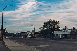
Main Street - Bigfork, Minnesota
|
|

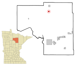
Location of the city of Bigfork
within Itasca County, Minnesota |
|
| Country | United States |
| State | Minnesota |
| County | Itasca |
| Area | |
| • Total | 1.89 sq mi (4.90 km2) |
| • Land | 1.86 sq mi (4.81 km2) |
| • Water | 0.03 sq mi (0.09 km2) |
| Elevation | 1,309 ft (399 m) |
| Population
(2020)
|
|
| • Total | 400 |
| • Density | 215.17/sq mi (83.09/km2) |
| Time zone | UTC-6 (Central (CST)) |
| • Summer (DST) | UTC-5 (CDT) |
| ZIP codes |
56628, 56639
|
| Area code(s) | 218 |
| FIPS code | 27-05698 |
| GNIS feature ID | 0655384 |
| Website | www.cityofbigfork.com |
Bigfork is a small city located in Itasca County, Minnesota, in the United States. In 2020, about 400 people lived there. A beautiful place called Scenic State Park is also nearby.
The main road through Bigfork is Minnesota State Highway 38. Other important roads, Highway 1 and Highway 6, are also close by.
History of Bigfork
Bigfork started as a small settlement when a man named Damase "Uncle Tom" Neveaux built a log cabin. This was in 1887, and he began cutting down trees for wood near the Big Fork River. Even though he arrived early, the land was not officially open for people to settle until 1900.
By 1902, Bigfork had its own post office. A few years later, in 1906, a train station was added for the Minneapolis and Rainy River Railway. This made it easier for people and goods to travel to and from Bigfork.
Bigfork officially became a village on January 17, 1907. This was less than a year after the train stop was finished. The Bigfork Village Hall, a historic building, was built in 1936. It was constructed with money from the WPA, a program that helped people find jobs during the Great Depression. This building is now listed on the National Register of Historic Places.
Geography of Bigfork
Bigfork covers a total area of about 1.80 square miles (4.66 square kilometers). Most of this area, about 1.77 square miles (4.58 square kilometers), is land. A small part, about 0.03 square miles (0.08 square kilometers), is water.
Population and People
| Historical population | |||
|---|---|---|---|
| Census | Pop. | %± | |
| 1910 | 167 | — | |
| 1920 | 160 | −4.2% | |
| 1930 | 295 | 84.4% | |
| 1940 | 382 | 29.5% | |
| 1950 | 463 | 21.2% | |
| 1960 | 464 | 0.2% | |
| 1970 | 399 | −14.0% | |
| 1980 | 457 | 14.5% | |
| 1990 | 384 | −16.0% | |
| 2000 | 469 | 22.1% | |
| 2010 | 446 | −4.9% | |
| 2020 | 400 | −10.3% | |
| U.S. Decennial Census | |||
In 2010, there were 446 people living in Bigfork. These people lived in 195 different homes. About 23.6% of these homes had children under 18 living there. Many people living in Bigfork were 65 years old or older. The average age of people in the city was 51.3 years.
See also
 In Spanish: Bigfork (Minnesota) para niños
 | Sharif Bey |
 | Hale Woodruff |
 | Richmond Barthé |
 | Purvis Young |

