Billings Mill Brook facts for kids
Quick facts for kids Billings Mill Brook |
|
|---|---|

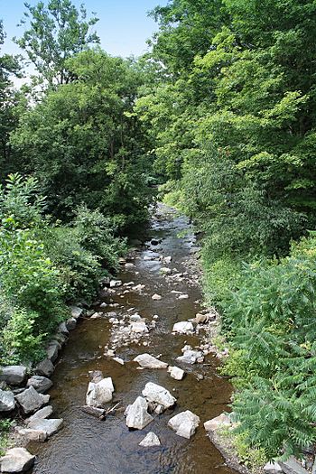
Billings Mill Brook looking downstream
|
|
| Other name(s) | Mill Brook, Billings Mill Creek |
| Physical characteristics | |
| Main source | Helman Swamp in Lemon Township, Wyoming County, Pennsylvania between 1,020 and 1,040 feet (311 and 317 m) |
| River mouth | Tunkhannock Creek in Tunkhannock Township, Wyoming County, Pennsylvania, near Tunkhannock 604 ft (184 m) 41°33′10″N 75°55′18″W / 41.5527°N 75.9216°W |
| Length | 3.5 mi (5.6 km) |
| Basin features | |
| Progression | Tunkhannock Creek → Susquehanna River → Chesapeake Bay |
| Basin size | 12.7 sq mi (33 km2) |
| Tributaries |
|
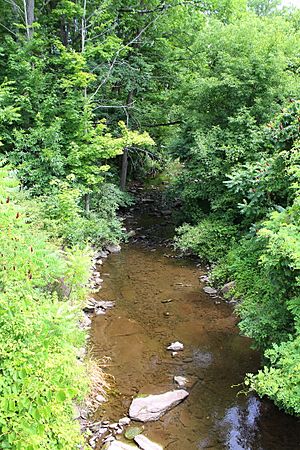
Billings Mill Brook is a small stream in Wyoming County, Pennsylvania. It's also known as Mill Brook or Billings Mill Creek. This stream is about 3.5 miles (5.6 km) long. It flows into Tunkhannock Creek.
The brook flows through Lemon Township and Tunkhannock Township. The land area that drains water into Billings Mill Brook is 12.7 square miles (33 km2). A lake called Lake Carey is also part of this area. The stream is a great place for fish, as it's known as a Coldwater Fishery and a Migratory Fishery.
Contents
Where Does Billings Mill Brook Flow?
Billings Mill Brook starts in a swamp called Helman Swamp in Lemon Township. It flows generally south, winding through a valley. After a while, it enters Tunkhannock Township.
The stream then continues its journey, turning in different directions. It eventually meets its only named smaller stream, Kern Glen Creek. After this, the valley around Billings Mill Brook gets wider. Finally, it reaches its end where it joins Tunkhannock Creek. This meeting point is about 2.78 miles (4.47 km) before Tunkhannock Creek flows into another river.
Kern Glen Creek: A Tributary
Billings Mill Brook has one main smaller stream that flows into it. This stream is called Kern Glen Creek. Kern Glen Creek joins Billings Mill Brook about 0.76 miles (1.22 km) before Billings Mill Brook ends. The area of land that drains into Kern Glen Creek is about 2.71 square miles (7.0 km2).
Land and Rocks Around the Stream
The land around Billings Mill Brook varies in height. Where the stream begins, its elevation is between 1,020 and 1,040 feet (310 and 320 m) above sea level. At its end, where it joins Tunkhannock Creek, the elevation is 604 feet (184 m) above sea level.
Near where the stream meets Tunkhannock Creek, there's a lot of sand and gravel. Along the middle and lower parts of the stream, the ground is mostly made of alluvium. This is a type of soil left behind by flowing water. Higher up, near the stream's beginning, the ground is covered by a type of till called Wisconsinan Till. This till was left by glaciers long ago.
You can also find wetlands, peat bogs, and small lakes in this area. The bedrock, which is the solid rock under the soil, is made of sandstone and shale. In its upper parts, Billings Mill Brook flows through a valley known as Whippoorwill Hollow.
The Billings Mill Brook Area
The entire area of land that collects water for Billings Mill Brook is called its watershed. This watershed covers about 12.7 square miles (33 km2). The stream and its watershed are located entirely within the Tunkhannock quadrangle, which is a specific map area. The end of the stream is close to the town of Tunkhannock.
As mentioned, Lake Carey is part of this watershed. It's one of the biggest lakes in the area that was formed by glacial deposits. These are materials left behind by ancient glaciers. The lake also has a man-made dam that is 10 feet (3.0 m) tall. Water flowing out of Lake Carey drops about 130 feet (40 m) over several waterfalls before reaching Billings Mill Brook.
History of Billings Mill Brook
Billings Mill Brook was officially named and added to the Geographic Names Information System in 1979. It has also been known as Mill Brook or Billings Mill Creek for a long time. The name "Mill Brook" even appeared in a book from 1883 about the geology of the Susquehanna River region.
In the past, there was a mill near the stream. This mill used the power of the flowing water to grind grain and make cider. That's likely where the "Mill" in its name comes from!
Over the years, several bridges have been built over Billings Mill Brook. For example, a bridge carrying State Route 1002 was built in 1990. Another bridge for State Route 1001 was built in 2006.
Organizations like Williams Companies and the Pennsylvania Department of Environmental Protection have worked together on projects to help the stream. One project, called the Billings Mill Brook Stream Habitat Enhancement Project, helped make the streambanks more stable. It also improved the quality of the habitat for animals living in and around the stream.
Wildlife in the Stream
The area around Billings Mill Brook is very important for fish. It's officially known as a Coldwater Fishery and a Migratory Fishery. This means it's a good place for fish that prefer cold water, and also for fish that travel (migrate) through the stream.
Wild trout naturally live and reproduce in the stream. They can be found in the lower 2.48 miles (3.99 km) of Billings Mill Brook. This shows that the stream provides a healthy environment for these fish to thrive.
 | May Edward Chinn |
 | Rebecca Cole |
 | Alexa Canady |
 | Dorothy Lavinia Brown |


