Birch Creek (Esopus Creek tributary) facts for kids
Quick facts for kids Birch Creek |
|
|---|---|
|
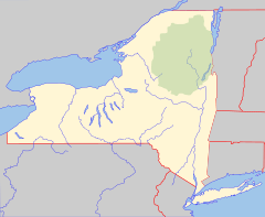
Location of the mouth of Birch Creek
|
|
| Country | United States |
| State | New York |
| Region | Catskill Mountains |
| Counties | Ulster, Greene |
| Physical characteristics | |
| Main source | 42°10′27″N 74°26′34″W / 42.174255°N 74.4426506°W |
| River mouth | Esopus Creek Big Indian 1,181 ft (360 m) 42°06′18″N 74°26′33″W / 42.1050899°N 74.4423734°W |
| Basin features | |
| Basin size | 12.6 square miles (33 km2) |
| Tributaries |
|
Birch Creek is a stream that flows into another stream called Esopus Creek. It's located in a place called Big Indian, in New York State.
A big part of the Belleayre Ski Resort is in the area where Birch Creek collects its water. This means that when snow melts at the ski resort, the water flows into Birch Creek. This often happens through a smaller stream called Cathedral Brook.
How Birch Creek Flows
Measuring Water Flow
Scientists keep track of how much water flows in Birch Creek. The United States Geological Survey (USGS) has a special tool called a stream gauge on Birch Creek. This gauge has been measuring the water flow since October 1998.
The gauge is located in Big Indian. It is about 0.1 miles (0.16 km) upstream from Lasher Road.
Water Levels and Events
The amount of water flowing in a stream is called its discharge. The gauge helps us see how much water is in Birch Creek at different times.
- Highest Flow: The most water ever recorded in Birch Creek was on August 28, 2011. At that time, 1,460 cubic feet (41 cubic meters) of water flowed per second! This happened when Hurricane Irene passed through the area, bringing a lot of rain.
- Lowest Flow: The least amount of water recorded was on September 26, 2008. Only 1.6 cubic feet (0.045 cubic meters) of water flowed per second then.
 | John T. Biggers |
 | Thomas Blackshear |
 | Mark Bradford |
 | Beverly Buchanan |


