Black Hills (Washington) facts for kids
Quick facts for kids Black Hills |
|
|---|---|

Black Hills behind the state capitol building in Olympia
|
|
| Highest point | |
| Peak | Capitol Peak |
| Elevation | 2,664 ft (812 m) |
| Geography | |
| Country | United States |
| State | Washington |
| Region | Western Washington |
| Range coordinates | 46°59′14″N 123°08′16″W / 46.9873190°N 123.1376480°W |
| Parent range | Willapa Hills |
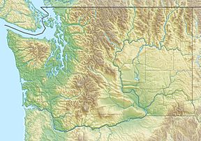
The Black Hills are a small group of hills in Washington. They are located in Thurston and Grays Harbor counties. These hills are often seen as part of the larger Willapa Hills range.
The tallest point in the Black Hills is Capitol Peak. It stands about 2,664 feet (812 meters) high.
Contents
What's in a Name?
Where Did "Black Hills" Come From?
The Black Hills got their name from the nearby Black River. For a while, people also called them the "Black Mountains."
Exploring the Black Hills
Capitol State Forest
A large part of the Black Hills is covered by the Capitol State Forest. This forest has almost the same borders as the hills themselves. It's a great place for outdoor activities.
Local Connections to the Hills
The Black Hills are important to the local community. Several places and groups are named after them:
- A.G. West Black Hills High School in Tumwater, Washington
- The Blackhills Football Club, a local soccer team
- A hospital in Olympia was once called Black Hills Community Hospital. It had this name from 1985 to 1991.
Black History Month on Kiddle
Renowned African-American Artists:
 | Kyle Baker |
 | Joseph Yoakum |
 | Laura Wheeler Waring |
 | Henry Ossawa Tanner |

All content from Kiddle encyclopedia articles (including the article images and facts) can be freely used under Attribution-ShareAlike license, unless stated otherwise. Cite this article:
Black Hills (Washington) Facts for Kids. Kiddle Encyclopedia.

