Blanca Bay facts for kids
Quick facts for kids Blanca Bay |
|
|---|---|
| Location | South America |
| Coordinates | 39°03′44″S 62°04′00″W / 39.06222°S 62.06667°W |
| Native name | Bahía Blanca (Spanish) |
| River sources | Sauce Chico River, Napostá Stream |
| Ocean/sea sources | Argentine Sea, South Atlantic Ocean |
| Basin countries | Argentina |
| Settlements | Punta Alta, Bahía Blanca, General Daniel Cerri, Ingeniero White |
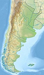
Blanca Bay (which means "White Bay" in Spanish) is a special part of the Argentine Sea. It's like a deep, narrow arm of the ocean that reaches into the land. You can find it in the southwest of the province of Buenos Aires, in the middle-east of Argentina. This bay sits where the flat Pampas region meets the wilder Patagonia area. The most important city nearby, Bahía Blanca, even got its name from this bay!
Why is it called White Bay?
The name Bahía Blanca means "White Bay" in Spanish. This name comes from the white salt that often covers the ground around the bay's shores. The bay is actually an estuary, which is a place where a river meets the sea.
A famous explorer named Ferdinand Magellan saw this bay way back in 1520. He was on his first trip around the world, trying to find a water path that would connect the Atlantic Ocean to the Pacific Ocean along the coast of South America. He was exploring for Charles I of Spain at the time.
See also
 In Spanish: Bahía Blanca (bahía) para niños


