Blountsville, Alabama facts for kids
Quick facts for kids
Blountsville, Alabama
|
|
|---|---|

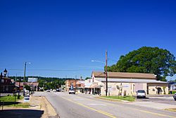
Main Street (U.S. Route 231)
|
|

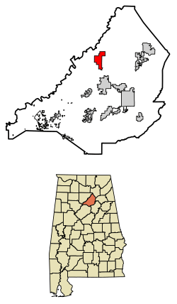
Location of Blountsville in Blount County, Alabama.
|
|
| Country | United States |
| State | Alabama |
| County | Blount |
| Area | |
| • Total | 5.49 sq mi (14.22 km2) |
| • Land | 5.42 sq mi (14.04 km2) |
| • Water | 0.07 sq mi (0.18 km2) |
| Elevation | 712 ft (217 m) |
| Population
(2020)
|
|
| • Total | 1,826 |
| • Density | 336.84/sq mi (130.06/km2) |
| Time zone | UTC-6 (Central (CST)) |
| • Summer (DST) | UTC-5 (CDT) |
| ZIP code |
35031
|
| Area codes | 205, 659 |
| FIPS code | 01-07456 |
| GNIS feature ID | 0114510 |
Blountsville is a small town in Blount County, Alabama, in the United States. In 2020, about 1,826 people lived there.
Blount County was created in 1818. It was named after Governor Willie G. Blount of Tennessee. He helped settlers in Alabama during a time of conflict. The county is located in the northeastern part of Alabama. This area is known for its minerals.
Contents
History of Blountsville
The area where Blountsville is now was once a Native American village. An old map from 1819 shows it as "Wassausey." This name meant "Bear Meat Cabin." The town was started by Caleb Fryley and Johnny Jones in 1816. They also called it Bear Meat Cabin.
Many settlers moving west stopped here after the Creek War. The town's post office opened as Blountsville in 1825. The town officially became a town in 1827. Blountsville was the county seat, or main government town, until 1889. Then, the government moved to Oneonta.
In the early days, Blountsville had many schools. These included The Academy and Blount College. The Blount County Courthouse and jail were built in 1833. They stayed there until the county seat moved.
Blountsville was an important meeting point in early Alabama. During the American Civil War, it became a supply center for the Confederate cavalry. There were short battles in the town. In May 1863, Confederate forces led by General Nathan Bedford Forrest fought Union forces. Union General Lovell H. Rousseau and his cavalry also stayed in the town in July 1864.
Blount College was located in the old courthouse building. It was founded in 1890. The Blountsville United Methodist Church was built in 1818. It is the oldest building in Blountsville and is still used today. Another old building, the Barclift House, was built in 1834. It was once a tavern and is now being restored by a family.
Geography of Blountsville
Blountsville is in northern Blount County. It sits in the Blountsville Valley. Major roads like County Highway 26 and U.S. Highway 231 meet here.
U.S. Highway 231 goes south to Cleveland and Oneonta. Oneonta is about 14 miles away. The highway also goes north to Huntsville, which is about 50 miles away. Alabama Highway 79 also passes through the town. It connects to Guntersville to the northeast and Birmingham to the southwest.
The town covers about 5.49 square miles (14.2 square kilometers). Most of this area is land. Only a small part, about 0.07 square miles (0.18 square kilometers), is water.
Population Information
| Historical population | |||
|---|---|---|---|
| Census | Pop. | %± | |
| 1880 | 222 | — | |
| 1890 | 288 | 29.7% | |
| 1910 | 287 | — | |
| 1920 | 427 | 48.8% | |
| 1930 | 468 | 9.6% | |
| 1940 | 576 | 23.1% | |
| 1950 | 695 | 20.7% | |
| 1960 | 672 | −3.3% | |
| 1970 | 1,254 | 86.6% | |
| 1980 | 1,509 | 20.3% | |
| 1990 | 1,527 | 1.2% | |
| 2000 | 1,768 | 15.8% | |
| 2010 | 1,684 | −4.8% | |
| 2020 | 1,826 | 8.4% | |
| U.S. Decennial Census 2013 Estimate |
|||
2020 Census Details
In 2020, Blountsville had 1,826 people living there. There were 702 households and 486 families.
| Race | Num. | Perc. |
|---|---|---|
| White (non-Hispanic) | 1,335 | 73.11% |
| Black or African American (non-Hispanic) | 11 | 0.6% |
| Native American | 11 | 0.6% |
| Asian | 23 | 1.26% |
| Other/Mixed | 48 | 2.63% |
| Hispanic or Latino | 398 | 21.8% |
2010 Census Details
In 2010, the town had 1,684 people. There were 654 households and 439 families. About 87.3% of the people were White. About 15.3% of the population were Hispanic or Latino.
The average household had about 2.57 people. The average family had about 3.16 people. About 25.8% of the population was under 18 years old. About 14.7% were 65 years or older.
Education in Blountsville
Blountsville has two main schools. They are J.B. Pennington High School (PHS) and Blountsville Elementary School (BES). Both schools are in the center of town. They are part of the Blount County School District.
Fun Places to Visit
Blountsville has some interesting historical sites and a water park.
The Freeman House
The Freeman House was built around 1825. A storm damaged the original two-story brick house. It was then rebuilt into a one-story home using the same bricks. The house has porches facing the old Meat Cabin Road and U.S. Highway 231. The Blountsville Historical Society has restored the house. It now serves as a museum and a place for visitors. Other old buildings have been moved to the park. They are filled with furniture from that time. You can visit the park for tours.
The Thomas Nation House
The Thomas Nation House was built around 1835. Sadly, a storm in 1998 destroyed most of it. Only one and a half walls are left. You can still see these ruins from U.S. Highway 231.
Spring Valley Beach Water Park
Blountsville is also home to Spring Valley Beach Water Park. It is one of the few water parks in the lower Sand Mountain area. The park has one of the largest swimming pools in the Southern United States. It also has seven water slides. One of its slides, the 360 Rush, is said to be unique in the world.
See also
 In Spanish: Blountsville (Alabama) para niños
 | Calvin Brent |
 | Walter T. Bailey |
 | Martha Cassell Thompson |
 | Alberta Jeannette Cassell |

