Bluffton, Minnesota facts for kids
Quick facts for kids
Bluffton, Minnesota
|
|
|---|---|

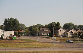
Downtown Bluffton
|
|

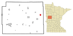
Location of Bluffton, Minnesota
|
|
| Country | United States |
| State | Minnesota |
| County | Otter Tail |
| Founded | March 1880 |
| Incorporated | February 26, 1903 |
| Area | |
| • Total | 2.756 sq mi (7.138 km2) |
| • Land | 2.735 sq mi (7.083 km2) |
| • Water | 0.021 sq mi (0.055 km2) |
| Elevation | 1,362 ft (415 m) |
| Population
(2020)
|
|
| • Total | 210 |
| • Estimate
(2022)
|
213 |
| • Density | 76.78/sq mi (29.65/km2) |
| Time zone | UTC−6 (Central (CST)) |
| • Summer (DST) | UTC−5 (CDT) |
| ZIP Code |
56518
|
| Area code(s) | 218 |
| FIPS code | 27-06778 |
| GNIS feature ID | 2394210 |
| Sales tax | 7.375% |
Bluffton is a small city in Otter Tail County, Minnesota, in the United States. It is located right next to the Leaf River. In 2020, about 210 people lived there.
Contents
Bluffton's Story: A Look Back
Bluffton was first planned out in March 1880. This process, called "platting," is when someone maps out how a town will be divided into streets and building lots. The city got its name from the "bluffs," which are steep hills, found along the nearby Leaf River.
Bluffton officially became an incorporated city on February 26, 1903. This means it became a legal town with its own local government.
Where is Bluffton? (Geography)
The city of Bluffton covers a total area of about 2.76 square miles (7.14 square kilometers). Most of this area, about 2.74 square miles (7.08 square kilometers), is land. A small part, about 0.02 square miles (0.05 square kilometers), is water.
U.S. Route 10 is a major road that goes through the community. It helps people travel in and out of Bluffton.
Who Lives in Bluffton? (Population)
| Historical population | |||
|---|---|---|---|
| Census | Pop. | %± | |
| 1880 | 69 | — | |
| 1910 | 148 | — | |
| 1920 | 220 | 48.6% | |
| 1930 | 204 | −7.3% | |
| 1940 | 234 | 14.7% | |
| 1950 | 239 | 2.1% | |
| 1960 | 211 | −11.7% | |
| 1970 | 195 | −7.6% | |
| 1980 | 206 | 5.6% | |
| 1990 | 187 | −9.2% | |
| 2000 | 210 | 12.3% | |
| 2010 | 207 | −1.4% | |
| 2020 | 210 | 1.4% | |
| 2022 (est.) | 213 | 2.9% | |
| U.S. Decennial Census 2020 Census |
|||
A Snapshot of Bluffton's People
According to the 2010 census, there were 207 people living in Bluffton. These people lived in 79 households, and 54 of these were families. The city had about 75 people per square mile.
Most of the people in Bluffton were White (96.1%). A small number of people were Native American, Asian, or from other backgrounds. About 1.4% of the population identified as Hispanic or Latino.
Many households (32.9%) had children under 18 living with them. Most households (58.2%) were married couples living together. About 27.8% of all households were made up of individuals living alone. About 15.2% of people living alone were 65 years old or older.
The average age in Bluffton was 33.9 years. About 25.6% of residents were under 18. About 15.9% were 65 years or older. The population was almost evenly split between males (48.3%) and females (51.7%).
Getting Around Bluffton
The Empire Builder train, run by Amtrak, travels through Bluffton. This train goes between cities like Seattle and Portland on one side, and Chicago on the other. It uses the train tracks owned by BNSF.
However, the Empire Builder train does not stop in Bluffton. The closest train station is in Staples, which is about 23 miles (37 kilometers) southeast of Bluffton.
See also
 In Spanish: Bluffton (Minnesota) para niños
 | James B. Knighten |
 | Azellia White |
 | Willa Brown |

