
Otter Tail County, Minnesota facts for kids
Quick facts for kids
Otter Tail County
|
|
|---|---|

Otter Tail County Courthouse in Fergus Falls.
|
|

Location within the U.S. state of Minnesota
|
|
 Minnesota's location within the U.S. |
|
| Country | |
| State | |
| Founded | March 18, 1858 (created) September 12, 1868 (organized) |
| Named for | Otter Tail Lake and Otter Tail River |
| Seat | Fergus Falls |
| Largest city | Fergus Falls |
| Area | |
| • Total | 2,225 sq mi (5,760 km2) |
| • Land | 1,972 sq mi (5,110 km2) |
| • Water | 252 sq mi (650 km2) 11% |
| Population
(2020)
|
|
| • Total | 60,081 |
| • Estimate
(2023)
|
60,626 |
| • Density | 30.5/sq mi (11.8/km2) |
| Time zone | UTC−6 (Central) |
| • Summer (DST) | UTC−5 (CDT) |
| Congressional district | 7th |
Otter Tail County is a special place in Minnesota, a state in the United States. It's known for having more lakes than any other county in the whole country! Imagine, over 1,000 lakes are found here. In 2020, about 60,081 people lived in Otter Tail County. The main city, where the county government is located, is called Fergus Falls.
Contents
Exploring Otter Tail County's Past
Early Native American Life
Long ago, Native American tribes lived in the Otter Tail County area. They used the land for hunting and fishing. They also had permanent homes here. Two main tribes, the Dakota (also known as Sioux) and the Ojibwa (or Chippewa), sometimes had conflicts over land.
Scientists have found very old Native American remains near Pelican Rapids, Minnesota. These remains, nicknamed "Minnesota Girl," are about 13,000 years old! This shows that people have lived in this area for a very long time. You can still find old burial mounds and artifacts from these early communities.
European Fur Traders and Settlers
The first Europeans to visit the county were French and British fur traders. They tried to set up trading posts near the Leaf Lakes and Otter Tail Lake. Later, in the late 1800s, most towns grew up along the new railroad lines.

The main jobs back then were working with wood (lumber) and farming. The many pine and hardwood forests helped Fergus Falls become an important center for the lumber business.
How Otter Tail County Was Formed
The United States government first created the Wisconsin Territory in 1836. Then, in 1849, the Minnesota Territory was formed. The leaders of the Minnesota Territory created nine counties that same year.
Otter Tail County was officially created on March 18, 1858. It was made from parts of other counties called Cass and Pembina. The county got its name from Otter Tail Lake and the Otter Tail River.
At first, the county didn't have a main city or a full government. But on September 12, 1868, the state government finished organizing the county. They chose a place called Otter Tail City to be the county seat.
Moving the County Seat
Otter Tail City started as a stop for fur traders traveling between Saint Paul and the Red River valley. It was an important place, so the government put a land office there. That's why it was chosen as the first county seat.
However, people had already started settling in the area that would become Fergus Falls in 1857. This area grew quickly. In 1872, people voted to move the county seat to Fergus Falls.
The Northern Pacific Railroad had planned to build a train line through Otter Tail City. But problems came up, and the line was built through Fergus Falls instead. This helped Fergus Falls grow even more and led to the county seat moving there.
Early Telephone Service
Imagine a time without cell phones! In 1882, the Fergus Falls Telephone Exchange Company started. It was in a room at the First National Bank. The first telephone system was very basic.
At first, county leaders didn't think telephones were needed in the courthouse. But eventually, a phone was put in the auditor's office. A clerk had to find the right person when a call came in! Later, a bigger company bought the telephone business in 1883.
Geography and Natural Features
Otter Tail County is a beautiful area with rolling hills. Many parts are covered with thick forests. It's famous for its many lakes and ponds. The land also has rivers, streams, and valleys. A lot of the land is used for farming.
The Otter Tail River flows through the middle and western parts of the county. It eventually joins another river to form the Red River. The Pelican River also flows into the Otter Tail River.
Two of the highest points in the county are Inspiration Peak, which is about 1,727 feet (526 meters) high, and Pekan Peak, which is about 1,800 feet (549 meters) high.
Otter Tail County has a total area of about 2,225 square miles (5,760 square kilometers). About 252 square miles (650 square kilometers) of this area is water, which is about 11% of the county! This shows just how many lakes are here.


Getting Around Otter Tail County
Major Roads
Many important roads help people travel through Otter Tail County. These include:
 I-94
I-94 US 10
US 10 US 52
US 52 US 59
US 59 MN 29
MN 29 MN 34
MN 34 MN 78
MN 78 MN 106
 MN 108
 MN 210
Airports
There are also several small airports in the county for smaller planes:
- Aerovilla Airport (near Perham)
- Battle Lake Municipal Airport (near Battle Lake)
- Fergus Falls Municipal Airport (FFM)
- Henning Municipal Airport (05Y)
- Pelican Rapids Municipal Airport (47Y)
- Perham Municipal Airport (16D)
- Wadena Municipal Airport (ADC)
Neighboring Counties
Otter Tail County shares its borders with these other counties:
- Becker County (north)
- Wadena County (northeast)
- Todd County (southeast)
- Douglas County (south)
- Grant County (southwest)
- Wilkin County (west)
- Clay County (northwest)
Protected Natural Areas
Otter Tail County has many protected areas where nature is preserved. These include:
- Aastad State Wildlife Management Area
- Amor State Wildlife Management Area
- Bluff Creek State Wildlife Management Area
- Davies State Wildlife Management Area
- Dead Lake State Wildlife Management Area
- Doran State Wildlife Management Area
- Eagle Lake State Wildlife Management Area
- Eastern Township State Wildlife Management Area
- Elmo State Wildlife Management Area
- Folden Woods State Wildlife Management Area
- Glendalough State Park
- Hi-View State Wildlife Management Area
- Inman State Wildlife Management Area
- Inspiration Peak State Wayside Park
- Jensen Memorial State Wildlife Management Area
- Maplewood State Park
- Orwell State Wildlife Management Area
- Otter Tail Prairie Scientific and Natural Area
- Prairie Ridge State Wildlife Management Area
- Valdine State Wildlife Management Area
People of Otter Tail County
The population of Otter Tail County has changed over the years. Here's a quick look at how many people have lived here:
| Historical population | |||
|---|---|---|---|
| Census | Pop. | %± | |
| 1860 | 240 | — | |
| 1870 | 1,968 | 720.0% | |
| 1880 | 18,675 | 848.9% | |
| 1890 | 34,232 | 83.3% | |
| 1900 | 45,375 | 32.6% | |
| 1910 | 46,036 | 1.5% | |
| 1920 | 50,818 | 10.4% | |
| 1930 | 51,006 | 0.4% | |
| 1940 | 53,192 | 4.3% | |
| 1950 | 51,320 | −3.5% | |
| 1960 | 48,960 | −4.6% | |
| 1970 | 46,097 | −5.8% | |
| 1980 | 51,937 | 12.7% | |
| 1990 | 50,714 | −2.4% | |
| 2000 | 57,159 | 12.7% | |
| 2010 | 57,303 | 0.3% | |
| 2020 | 60,081 | 4.8% | |
| 2023 (est.) | 60,626 | 5.8% | |
| U.S. Decennial Census 1790-1960 1900-1990 1990-2000 2010-2020 |
|||
In 1870, about 2,000 people lived in the county. Many spoke Norwegian, Swedish, German, and English. By 1875, there was also a large Polish community.
Who Lives Here Now?
According to the 2020 census, Otter Tail County is home to a diverse group of people:
| Race | Number | Percentage |
|---|---|---|
| White | 54,362 | 90.5% |
| Black or African American | 843 | 1.4% |
| Native American | 284 | 0.5% |
| Asian | 334 | 0.6% |
| Pacific Islander | 17 | 0.03% |
| Other/Mixed | 2,025 | 3.4% |
| Hispanic or Latino | 2,216 | 3.7% |
Communities in Otter Tail County


Cities to Visit
Here are some of the cities you can find in Otter Tail County:
- Battle Lake
- Bluffton
- Clitherall
- Dalton
- Deer Creek
- Dent
- Elizabeth
- Erhard
- Fergus Falls (the county seat)
- Henning
- New York Mills
- Ottertail
- Parkers Prairie
- Pelican Rapids
- Perham
- Richville
- Rothsay (part)
- Underwood
- Urbank
- Vergas
- Vining
- Wadena (part)
Smaller Communities
There are also smaller, unincorporated communities in the county:
Townships in the County
Otter Tail County is divided into many smaller areas called townships:
- Aastad Township
- Amor Township
- Aurdal Township
- Blowers Township
- Bluffton Township
- Buse Township
- Butler Township
- Candor Township
- Carlisle Township
- Clitherall Township
- Compton Township
- Corliss Township
- Dane Prairie Township
- Dead Lake Township
- Deer Creek Township
- Dora Township
- Dunn Township
- Eagle Lake Township
- Eastern Township
- Edna Township
- Effington Township
- Elizabeth Township
- Elmo Township
- Erhards Grove Township
- Everts Township
- Fergus Falls Township
- Folden Township
- Friberg Township
- Girard Township
- Gorman Township
- Henning Township
- Hobart Township
- Homestead Township
- Inman Township
- Leaf Lake Township
- Leaf Mountain Township
- Lida Township
- Maine Township
- Maplewood Township
- Newton Township
- Nidaros Township
- Norwegian Grove Township
- Oak Valley Township
- Orwell Township
- Oscar Township
- Otter Tail Township
- Otto Township
- Paddock Township
- Parkers Prairie Township
- Pelican Township
- Perham Township
- Pine Lake Township
- Rush Lake Township
- Scambler Township
- St. Olaf Township
- Star Lake Township
- Sverdrup Township
- Tordenskjold Township
- Trondhjem Township
- Tumuli Township
- Western Township
- Woodside Township
Education in Otter Tail County
Students in Otter Tail County attend schools in various districts. Here are some of the school districts that serve the area:
- Ashby Public School District
- Barnesville Public School District
- Battle Lake Public School District
- Bertha-Hewitt Public School District
- Brandon-Evansville Public Schools
- Breckenridge Public School District
- Campbell-Tintah Public School District
- Detroit Lakes Public School District
- Fergus Falls Public School District
- Frazee-Vergas Public School District
- Henning Public School District
- Lake Park Audubon School District
- Menahga Public School District
- New York Mills Public School District
- Parkers Prairie Public School District
- Pelican Rapids Public School District
- Perham-Dent Public School District
- Rothsay Public School District
- Sebeka Public School District
- Underwood Public School District
- Wadena-Deer Creek School District
- West Central Area School District
Images for kids
-
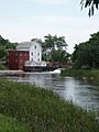
The Otter Tail River at Phelps Mill. June 2004

See also
 In Spanish: Condado de Otter Tail para niños
