Otter Tail River facts for kids
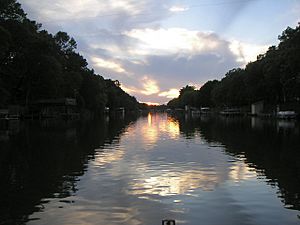
The Otter Tail River is a long river in the middle-western part of Minnesota, a state in the United States. Its name in the Ojibwe language, spoken by Native American people, is Nigigwaanowe-ziibi. The river is about 192 miles (309 kilometers) long.
It starts in Clearwater County, Minnesota, which is about 40 miles (64 km) southwest of a city called Bemidji, Minnesota. As it flows, the Otter Tail River goes through many beautiful lakes and towns in Minnesota. These include Elbow Lake, Many Point Lake, Chippewa Lake, Height of Land Lake, and the town of Frazee, Minnesota. It also passes through the Pine lakes, Rush Lake, Otter Tail Lake, the town of Ottertail, Minnesota, West Lost Lake, and the city of Fergus Falls, Minnesota. Finally, it reaches Orwell Lake.
Where the River Ends
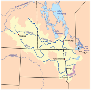
The Otter Tail River eventually meets another river called the Bois de Sioux River. When these two rivers join, they form the famous Red River. This meeting point is between the cities of Breckenridge, Minnesota and Wahpeton, North Dakota.
From this point on, the Red River creates the border between Minnesota and North Dakota. It continues to flow north all the way to the Canada–United States border. All the water from the Red River's watershed (the area of land where all the water drains into the river) eventually flows into Hudson Bay in Canada.
Dams on the River
Between the years 1909 and 1925, a company called the Otter Tail Power Company built five dams along the Otter Tail River. Dams are structures built across a river to hold back water, often to create power or control floods.
The dams built were:
- Dayton Hollow, built in 1909
- Hoot Lake, built in 1914
- Pisgah, built in 1918
- Central / Wright, which was first built in 1871 and then rebuilt in 1922
- Taplin Gorge, built in 1925
These dams helped control the river's flow and were important for generating electricity in the area.
 | Stephanie Wilson |
 | Charles Bolden |
 | Ronald McNair |
 | Frederick D. Gregory |


