Bokchito, Oklahoma facts for kids
Quick facts for kids
Bokchito, Oklahoma
|
|
|---|---|

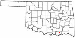
Location of Bokchito, Oklahoma
|
|
| Country | United States |
| State | Oklahoma |
| County | Bryan |
| Area | |
| • Total | 0.68 sq mi (1.77 km2) |
| • Land | 0.68 sq mi (1.77 km2) |
| • Water | 0.00 sq mi (0.00 km2) |
| Elevation | 633 ft (193 m) |
| Population
(2020)
|
|
| • Total | 574 |
| • Density | 839.18/sq mi (324.19/km2) |
| Time zone | UTC-6 (Central (CST)) |
| • Summer (DST) | UTC-5 (CDT) |
| ZIP code |
74726
|
| Area code(s) | 580 |
| FIPS code | 40-07350 |
| GNIS feature ID | 2411703 |
Bokchito is a small town located in Bryan County, Oklahoma, United States. Its name comes from the Choctaw language, where "bok" means river and "chito" means big or large. So, "Bokchito" literally translates to "big creek." According to the 2020 census, about 574 people live there.
Contents
History of Bokchito
Bokchito has an interesting history, especially because of its connection to the Choctaw Nation. A post office was first opened in Bokchito, which was then part of the Indian Territory, on August 11, 1894. The town was named after a local waterway, Bok Chito, meaning "Big Creek" in the Choctaw language.
The federal government officially planned and recognized Bokchito as a town within the Choctaw Nation on April 27, 1901. At that time, it was estimated that about 200 people lived in the town. When it was founded, Bokchito was located in an area called Blue County, which was part of the Moshulatubbee District of the Choctaw Nation.
Did you know that famous basketball player Dennis Rodman lived in Bokchito when he was in college?
Geography and Location
Bokchito is located in a convenient spot in Oklahoma. It is about 13 miles (21 km) east of the city of Durant and 37 miles (60 km) west of Hugo.
The town is situated right where two important roads meet: U.S. Route 70 and Oklahoma State Highway 22. This makes it easy to get to and from Bokchito.
The United States Census Bureau reports that the town covers a total area of 0.68 square miles (1.77 km2), and all of this area is land.
Population Information
| Historical population | |||
|---|---|---|---|
| Census | Pop. | %± | |
| 1910 | 535 | — | |
| 1920 | 627 | 17.2% | |
| 1930 | 466 | −25.7% | |
| 1940 | 581 | 24.7% | |
| 1950 | 643 | 10.7% | |
| 1960 | 620 | −3.6% | |
| 1970 | 607 | −2.1% | |
| 1980 | 628 | 3.5% | |
| 1990 | 576 | −8.3% | |
| 2000 | 564 | −2.1% | |
| 2010 | 632 | 12.1% | |
| 2020 | 574 | −9.2% | |
| U.S. Decennial Census | |||
The population of Bokchito has changed over the years. In 2000, there were 564 people living in the town. By 2010, the population had grown to 632 people. However, in the most recent census in 2020, the population was recorded as 574.
In 2000, about 23.4% of the people in Bokchito were under 18 years old. About 18.3% were 65 years old or older. The average age of people in the town was 39 years.
Local Economy
The economy around Bokchito is mainly based on farming and raising animals. Farmers in the area focus on growing crops like cotton, corn, peanuts, oats, hay, and cucumbers. They also raise beef and dairy cattle.
Education in Bokchito
The towns of Bokchito and Blue have joined their school systems together. They formed what is now known as the Rock Creek School District. The elementary school for the district is located in Blue, while the high school is in Bokchito.
See also
 In Spanish: Bokchito (Oklahoma) para niños
 | James Van Der Zee |
 | Alma Thomas |
 | Ellis Wilson |
 | Margaret Taylor-Burroughs |

