Bolivar, West Virginia facts for kids
Quick facts for kids
Bolivar, West Virginia
|
|||
|---|---|---|---|
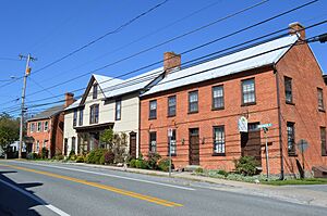
Houses on Washington Street
|
|||
|
|||
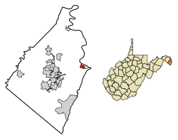
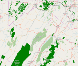
Location of Bolivar in Jefferson County, West Virginia.
|
|||
| Country | United States | ||
| State | West Virginia | ||
| County | Jefferson | ||
| Area | |||
| • Total | 0.43 sq mi (1.12 km2) | ||
| • Land | 0.43 sq mi (1.12 km2) | ||
| • Water | 0.00 sq mi (0.00 km2) | ||
| Elevation | 509 ft (155 m) | ||
| Population
(2010)
|
|||
| • Total | 1,045 | ||
| • Density | 2,360.28/sq mi (910.98/km2) | ||
| Time zone | UTC-5 (EST) | ||
| • Summer (DST) | UTC-4 (EDT) | ||
| Area code(s) | 304 | ||
| FIPS code | 54-08932 | ||
| GNIS feature ID | 2390738 | ||
| Website | http://www.bolivarwv.org/ | ||
Bolivar is a small town in Jefferson County, West Virginia, United States. In 2020, about 1,072 people lived there. The town is named after Simón Bolívar, a famous leader who helped several South American countries gain independence.
Bolivar is located in the eastern part of West Virginia, known as the Eastern Panhandle. It is also close to the larger Washington metropolitan area.
The famous Appalachian Trail goes through nearby Harpers Ferry. Many people think Harpers Ferry is the middle point of the trail. Bolivar and Harpers Ferry have even teamed up to be known as a united Appalachian Trail Community.
Contents
Where is Bolivar Located?
Bolivar is right next to the historic town of Harpers Ferry. It sits a little bit uphill from Harpers Ferry.
The town covers a total area of about 0.44 square miles (1.12 square kilometers). All of this area is land.
How Many People Live in Bolivar?
| Historical population | |||
|---|---|---|---|
| Census | Pop. | %± | |
| 1850 | 1,054 | — | |
| 1860 | 1,130 | 7.2% | |
| 1880 | 822 | — | |
| 1890 | 804 | −2.2% | |
| 1900 | 781 | −2.9% | |
| 1910 | 687 | −12.0% | |
| 1920 | 585 | −14.8% | |
| 1930 | 616 | 5.3% | |
| 1940 | 628 | 1.9% | |
| 1950 | 637 | 1.4% | |
| 1960 | 754 | 18.4% | |
| 1970 | 943 | 25.1% | |
| 1980 | 672 | −28.7% | |
| 1990 | 1,013 | 50.7% | |
| 2000 | 1,045 | 3.2% | |
| 2010 | 1,045 | 0.0% | |
| 2020 | 1,072 | 2.6% | |
| U.S. Decennial Census | |||
Population in 2010
In 2010, there were 1,045 people living in Bolivar. These people lived in 498 households. The town had about 2,375 people per square mile.
Most of the people in Bolivar were White (93.4%). About 4.5% were African American. A small number of people were Native American or Asian. About 1.3% of the population was Hispanic or Latino.
The average age in Bolivar was about 43.7 years old. About 17.5% of residents were under 18. About 16.1% were 65 years or older.
How to Get Around Bolivar
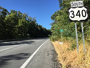
The main road that goes through Bolivar is U.S. Route 340. Even though it's called a "north-south" road, it generally runs east from Bolivar.
This road briefly goes through Harpers Ferry. Then it crosses into Virginia and Maryland, eventually reaching Frederick. If you go west on U.S. Route 340, you will pass through Charles Town.
Bolivar and Harpers Ferry also have an alternate route for U.S. Route 340. This route follows Washington Street through Bolivar.
See also
 In Spanish: Bolívar (Virginia Occidental) para niños
 | James Van Der Zee |
 | Alma Thomas |
 | Ellis Wilson |
 | Margaret Taylor-Burroughs |


