Boston Hollow facts for kids
Boston Hollow is a really deep valley, also called a ravine, located in Ashford, Connecticut. It's a special place for many reasons!
Geologists, who study rocks and the Earth, say Boston Hollow is an ancient fault. A fault is like a giant crack in the Earth's crust where rocks have moved. This fault is in the eastern highlands of Connecticut. Even though there are many faults in this area, Boston Hollow is one of the deepest, clearest, and best-preserved ones.
Getting to Boston Hollow
You can reach Boston Hollow from the southwest, near Westford. You'll take an unpaved road called Boston Hollow Road. This road is actually part of the old Center Turnpike, which was built in 1827. It used to be a major route connecting Boston to Hartford!
The road goes almost perfectly straight through the bottom of the hollow. For about two-thirds of the way, it follows a small, unnamed brook. Then, the brook disappears, and the road reaches a higher point. If you keep going northeast, you'll see another dip in the ground, but it usually doesn't have water. This second dip leads to a swamp at the end of the hollow.
Exploring the Hollow's Shape
Boston Hollow is known for its deep, straight crack in the Earth, which runs towards the northeast. The lowest part of the hollow is about 630 feet (190 meters) above sea level at its southern end. At the swamp in the north, it's about 600 feet (180 meters) above sea level. The highest point along the road is around 700 feet (210 meters) high.
The road passes through the bottom of the hollow for almost one mile (1.6 kilometers). This means the change in height along the bottom is very gentle. The width of the hollow, from one wall to the other, changes from 100 to 500 feet (30 to 150 meters).
On the west side of the hollow, there are swampy areas. The water doesn't flow very well here because the ground is almost flat. On both sides of this low area, the hollow's walls rise quickly. The west side is the steepest, reaching about 850 feet (260 meters) high. It's so steep that climbing it feels like a real hike! In the middle-northern part of the western wall, there are sheer rock faces that are more than 20 feet (6 meters) tall. These rocks even overhang, forming caves where fallen rocks lie underneath. The top of the west ridge has several peaks and high points.
On the east side, the hollow wall rises directly from the road. It's steep, but not as rocky as the west side. After a short, steep climb, the hill becomes less steep. This hill is called Turkey Hill. Turkey Hill is actually taller than the west ridge, reaching over 950 feet (290 meters) above sea level. There are also several pond-like swamps on the flat top of Turkey Hill.
Yale-Myers Forest
The land that includes Boston Hollow is part of the Yale-Myers Forest. This huge forest covers 7,800 acres (32 square kilometers) and is owned by Yale University. It's used for teaching, scientific research, and even for cutting timber. While most of the hollow is on Yale-Myers Forest land, some nearby land belongs to Hull Forest Products.
The Yale-Myers Forest is private land, but it's not marked with "No Trespassing" signs. There's one marked trail that goes through Boston Hollow called the Nipmuck Trail. It enters the hollow from the southeast, after crossing the rocky ridges and flat areas of Turkey Hill, which were shaped by glaciers long ago. The trail crosses Boston Hollow Road in the middle-northern part of the hollow and then quickly climbs the west ridge.
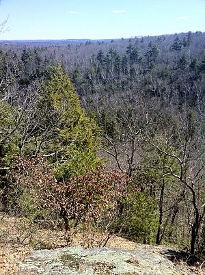
On the west side of the trail, as it goes up the west ridge, there's a small valley that often fills with water in winter or during wet times. Ice has been seen here as late as March, showing how cold this area can get! The trail climbs a series of ridges to a summit. This summit is bare rock and has no trees facing the hollow. To the west, there's a short, tree-covered flat area before the land slopes down to a large swamp. The trail continues southwest from the summit, then curves and goes down northwest of the hollow onto Barlow's Mill Road.
Plants and Animals
The plants and animals in Boston Hollow are mostly what you'd expect to see in southern New England. However, you can also find some species that usually live in colder, northern areas.
The bottom of the hollow is covered with dense hemlock trees. These evergreen trees block a lot of the sunlight, making the hollow's floor quite dark. Higher up, on the ridges of the hollow, you'll find hardwood trees. The most common one is the red oak. The forest around the summit of the west ridge mainly has short red oaks. On the side of Turkey Hill facing the west ridge, the trees are similar, but there are also many paper birch trees. These paper birches look beautiful in the fall when their leaves change color, especially when viewed from the summit of the west ridge.
One special plant found in Boston Hollow is the mountain maple. This is a shrub-like tree that usually grows in northern New England. For animals, you might see white-tailed deer and coyotes, which are common in New England. It's also likely that moose and American black bear live in the thick forests around the hollow.


