Brûlé Lake (Stewart Township) facts for kids
Quick facts for kids Brûlé Lake |
|
|---|---|
| Location | Nipissing District, Ontario |
| Coordinates | 46°36′31″N 79°25′53″W / 46.60861°N 79.43139°W |
| Type | Lake |
| Part of | Saint Lawrence River drainage basin |
| Primary outflows | Unnamed creek |
| Basin countries | Canada |
| Max. length | 2.0 kilometres (1.2 mi) |
| Max. width | 1.0 kilometre (0.62 mi) |
| Surface elevation | 329 metres (1,079 ft) |
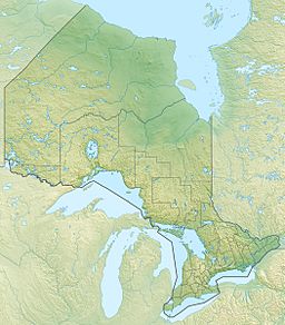
Brûlé Lake is a freshwater lake located in Stewart Township, Nipissing District in Northeastern Ontario, Canada. It is part of a very large water system called the Saint Lawrence River drainage basin. This means all the water from Brûlé Lake eventually flows into the Saint Lawrence River.
Discover Brûlé Lake
Brûlé Lake is found in the beautiful natural area of Nipissing District. It is a freshwater lake, which means its water is not salty like the ocean. The lake is about 2 kilometers (1.2 miles) long and 1 kilometer (0.6 miles) wide. It sits at an elevation of 329 meters (1,079 feet) above sea level.
Where Does the Water Go?
Many small, unnamed streams flow into Brûlé Lake from different directions. These streams bring water into the lake from the east, southeast, south, west, and north.
The main way water leaves Brûlé Lake is through an unnamed creek at its northern end. This creek flows towards another lake called Jocko Lake. From there, the water continues its journey through the Jocko River. The Jocko River then joins the mighty Ottawa River, which eventually flows into the Saint Lawrence River.
Nearby Connections
The Ontario Northland Railway runs along the northeast shore of Brûlé Lake. This railway is an important transportation route in the region. About 2 kilometers (1.2 miles) north of the lake, the railway passes through a small community called Jocko.
 | Victor J. Glover |
 | Yvonne Cagle |
 | Jeanette Epps |
 | Bernard A. Harris Jr. |


