Brady, Washington facts for kids
Quick facts for kids
Brady, Washington
|
|
|---|---|

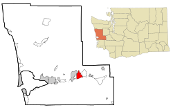
Location of Brady, Washington
|
|
| Country | United States |
| State | Washington |
| County | Grays Harbor |
| Area | |
| • Total | 6.14 sq mi (15.89 km2) |
| • Land | 6.11 sq mi (15.83 km2) |
| • Water | 0.02 sq mi (0.06 km2) |
| Elevation | 46 ft (14 m) |
| Population
(2020)
|
|
| • Total | 692 |
| • Density | 112.79/sq mi (43.55/km2) |
| Time zone | UTC-8 (Pacific (PST)) |
| • Summer (DST) | UTC-7 (PDT) |
| ZIP code |
98563
|
| Area code(s) | 360 |
| FIPS code | 53-07590 |
| GNIS feature ID | 1512024 |
Brady is a small community in Grays Harbor County, Washington, in the United States. It is a "census-designated place" (CDP). This means it is an area that the government counts for the census, but it is not an officially incorporated city or town. In 2020, about 692 people lived there.
Contents
History of Brady
How Brady Got Its Name
Brady was named after an early settler in the area, John Brady. He had a farm about a mile north of where the Brady Food Mart is today.
Old School District and Fire Department
The larger Brady area used to be defined by the boundaries of the old Brady school district. This district no longer exists. Its borders were the Satsop River to the east, the Grays Harbor County line to the north, the Chehalis River to the south, and the Montesano School District boundary to the west. Today, these same boundaries are used by Grays Harbor Fire District No. 2, which is served by the Brady Volunteer Fire Department.
The school in Brady was called Olympic View School. It was a very important place for the community. It closed in 1968 and joined with the Montesano School District. The school building was then sold to a charity called the Harvester Foundation.
Early Settlers and Roads
The first people to settle in this area were the Smith, Twidwell, and Foster families. They arrived in the late 1800s in the Chehalis River valley, south of Brady. Andrew Jackson Smith started his large farm in 1851. The Smith, Foster, and Twidwill families were all related.
Back then, the Chehalis River was the only way to travel in and out of the area. So, these early farms were built along the river. Later, roads were built. In the 1930s, a two-lane highway, called Highway 410, was paved through Brady. This road connected the Pacific coast to U.S. Highway 101 at Olympia. Today, it is known as the Monte-Elma Road. In the mid-1960s, a bigger, four-lane freeway was built through the Brady area. This freeway connects Interstate 5 at Olympia to Aberdeen and is part of U.S. Route 12.
Geography of Brady
Brady is located at 46°59′46″N 123°31′18″W / 46.99611°N 123.52167°W.
The United States Census Bureau says that Brady covers a total area of about 7.1 square miles (18.5 square kilometers). Most of this area, about 7.1 square miles (18.4 square kilometers), is land. A very small part, about 0.14%, is water.
People in Brady
| Historical population | |||
|---|---|---|---|
| Census | Pop. | %± | |
| 2000 | 645 | — | |
| 2010 | 676 | 4.8% | |
| U.S. Decennial Census | |||
In 2000, there were 645 people living in Brady. There were 239 households, which are groups of people living together in one home. Most of these households (185) were families. The population density was about 90.6 people per square mile (35.0 people per square kilometer).
Most people in Brady were White (about 96%). There were also some Native American people and people of two or more races. A small number of people were Hispanic or Latino.
About 35% of households had children under 18 living with them. Most households (68%) were married couples living together. About 17% of all households were made up of individuals living alone.
The average age of people in Brady was 39 years old. About 24% of the population was under 18 years old. About 13% of the population was 65 years or older.
In 2000, the average income for a household in Brady was about $67,386 per year. The average income for a family was about $72,750 per year.
Today, Brady has a grocery store with a gas station, a Grange Hall, and a fire station. It does not have a church or a post office.
Notable Residents
- Allan Mustard is a person from Brady. He used to be the United States Ambassador to Turkmenistan. He is also the Chair of the OpenStreetMap Foundation, which is a group that supports a free online map of the world.
See also
 In Spanish: Brady (Washington) para niños

