Breese, Illinois facts for kids
Quick facts for kids
Breese
|
|
|---|---|

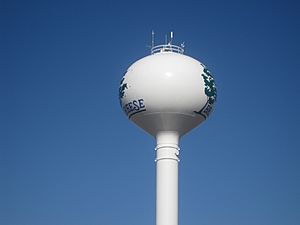
Breese water tower along U.S. Route 50
|
|
| Motto(s):
"Proud of our past, planning for our future"
|
|

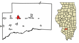
Location of Breese in Clinton County, Illinois.
|
|

Location of Illinois in the United States
|
|
| Country | United States |
| State | Illinois |
| County | Clinton |
| Named for | Sidney Breese |
| Area | |
| • Total | 2.70 sq mi (6.99 km2) |
| • Land | 2.67 sq mi (6.92 km2) |
| • Water | 0.03 sq mi (0.07 km2) |
| Elevation | 453 ft (138 m) |
| Population
(2020)
|
|
| • Total | 4,641 |
| • Density | 1,736.90/sq mi (670.50/km2) |
| Time zone | UTC-6 (CST) |
| • Summer (DST) | UTC-5 (CDT) |
| ZIP code |
62230
|
| Area code(s) | 618 |
| FIPS code | 17-07913 |
| GNIS feature ID | 2393409 |
| Public Transit | South Central Transit |
| Wikimedia Commons | Breese, Illinois |
Breese is a city located in Clinton County, Illinois, in the United States. It's the biggest city in Clinton County. In 2020, about 4,641 people lived there. Most of the people in Breese have German family roots. Breese is also part of the larger Metro-East area near St. Louis, Missouri.
Contents
History of Breese
The city of Breese is named after Sidney Breese. He was a important person who served as a United States Senator. He lived around the same time as President Abraham Lincoln. Breese was officially started in 1855.
People first settled in the area around Breese in 1816. But it wasn't until 1835 that German families came to live and farm there. They liked the flat, fertile land. About 20 years later, a railroad called the Mississippi and Ohio Railroad was finished. This made transportation much easier for the early settlers.
A company from Chicago bought 80 acres of land near the new railroad. They planned out 24 acres for the town, with some land on the north side and some on the south side of the tracks. This led to the creation of Breese Township on February 3, 1855.
Later in 1855, about 40 Catholic immigrants wanted to build a church. Two years later, the company that owned the land gave them half of one of its 80 acres (32 ha) for their project. By December 1869, the St. Dominic's Catholic Church was completed.
Breese was first recognized as a town on April 11, 1871. It then became a village on September 23, 1876. A village hall was built, and it was finished in 1885. Seven years later, a group of volunteers started a fire department. As more people moved to Breese, it officially became a city on January 19, 1905. Henry Hummert was the first mayor of the new city.
Mayor Hummert wanted to make Breese better. He approved building an electric light plant, which was finished in 1906. In 1911, the streets of Breese were improved with road oil. The city's water system also got upgrades the next year.
However, not everything was easy. In 1914, a sickness called scarlet fever spread through the community. All the schools had to close. Only four years later, in 1918, a flu epidemic also spread through the area.
1906 Mine Accident
On December 24, 1906, a sad accident happened at a coal mine. Six miners lost their lives and one was hurt. This happened when a mine cage fell down the shaft. The mine was owned by The Breese and Trenton Coal Company.
The miners who died were Henry Middeke, Herman Scheleper, Walter Schaffner, August Foppe, Frank Zehrer, and Hermann Holtmann. The only person who was hurt was the mine manager, William Fritz. An investigation found that the accident happened because an old air shaft was not filled correctly. This caused dirt to slide and the cage to collapse. The Breese and Trenton Coal Company was found responsible for the accident.
Geography
Breese covers a total area of about 2.69 square miles (6.97 km2). Most of this area, about 2.67 square miles (6.92 km2), is land. A small part, about 0.03 square miles (0.08 km2), is water.
The city is located right on U.S. Route 50. It is about 40 miles (64 km) east of St. Louis, Missouri.
Population Information
| Historical population | |||
|---|---|---|---|
| Census | Pop. | %± | |
| 1870 | 489 | — | |
| 1880 | 574 | 17.4% | |
| 1890 | 808 | 40.8% | |
| 1900 | 1,571 | 94.4% | |
| 1910 | 2,128 | 35.5% | |
| 1920 | 2,399 | 12.7% | |
| 1930 | 1,957 | −18.4% | |
| 1940 | 2,206 | 12.7% | |
| 1950 | 2,181 | −1.1% | |
| 1960 | 2,461 | 12.8% | |
| 1970 | 2,885 | 17.2% | |
| 1980 | 3,516 | 21.9% | |
| 1990 | 3,567 | 1.5% | |
| 2000 | 4,048 | 13.5% | |
| 2010 | 4,442 | 9.7% | |
| 2020 | 4,641 | 4.5% | |
| U.S. Decennial Census | |||
In 2020, there were 4,641 people living in Breese. There were 1,861 households and 1,116 families. The city had about 1,722 people per square mile.
Most of the people in Breese, about 93.30%, were White. A small number were African American, Native American, or Asian. About 4.37% of the population were Hispanic or Latino.
About 22.7% of households had children under 18 living with them. More than half, 50.24%, were married couples. About 18.27% of households had someone living alone who was 65 or older.
The average age of people in Breese was 39.9 years. About 21.0% of the population was under 18.
The average income for a household in Breese was $70,411. For families, the average income was $90,208. About 4.9% of all people in Breese lived below the poverty line.
Schools in Breese
Breese has both public and private schools for students.
Public Schools
- District 12 Grade School (Breese, Illinois)
- Central Community High School - This high school was formed in 1971. It combined students from the Breese and Aviston high schools.
Private Schools
- Mater Dei High School (Breese, Illinois)
- All Saints Academy Grade School (Breese, Illinois)
Famous People from Breese
Some well-known people were born in Breese:
- Jake Odorizzi, a former baseball pitcher for the Tampa Bay Rays.
- Josh Thole, a former baseball catcher for the New York Mets and Toronto Blue Jays.
- Tom Timmermann, a former baseball pitcher for the Detroit Tigers and Cleveland Indians.
See also
 In Spanish: Breese para niños
 | Ernest Everett Just |
 | Mary Jackson |
 | Emmett Chappelle |
 | Marie Maynard Daly |

