Brewster, Ohio facts for kids
Quick facts for kids
Brewster, Ohio
|
|
|---|---|
|
Village
|
|

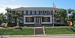
Brewster Railroad YMCA, built 1916
|
|

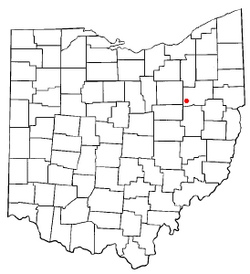
Location of Brewster, Ohio
|
|

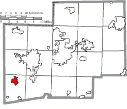
Location of Brewster in Stark County
|
|
| Country | United States |
| State | Ohio |
| County | Stark |
| Township | Sugar Creek |
| Area | |
| • Total | 2.27 sq mi (5.89 km2) |
| • Land | 2.27 sq mi (5.87 km2) |
| • Water | 0.01 sq mi (0.02 km2) |
| Elevation | 981 ft (299 m) |
| Population
(2020)
|
|
| • Total | 2,113 |
| • Estimate
(2023)
|
2,103 |
| • Density | 932.48/sq mi (360.09/km2) |
| Time zone | UTC-5 (Eastern (EST)) |
| • Summer (DST) | UTC-4 (EDT) |
| ZIP code |
44613
|
| Area code(s) | 330 |
| FIPS code | 39-08504 |
| GNIS feature ID | 2397449 |
Brewster is a small village located in southwestern Stark County, Ohio, in the United States. In 2020, about 2,113 people lived there. It is part of the larger Canton–Massillon metropolitan area.
Contents
History of Brewster
Brewster has had a post office since 1910. This means mail has been delivered and sent from here for over a century.
Railroad History in Brewster
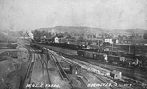
Brewster is very important to the Wheeling and Lake Erie Railway. Both the old company and the current regional railroad have their main offices and workshops here.
The Wheeling and Lake Erie (WLE) started building steam locomotives in its Brewster shops in 1910. These shops were known as some of the best places in the country for making steam engines. Over the years, the WLE built many of its own steam engines. This was a big achievement, as many larger railroads never even tried to build their own.
Today, the Wheeling and Lake Erie Brewster Shops still work on locomotives. They repair, upgrade, and build new parts for both locomotives and freight cars.
Geography of Brewster
Brewster is located right next to Sugar Creek. This creek adds to the natural beauty of the area.
Land and Water Area
The United States Census Bureau reports that Brewster covers a total area of about 2.24 square miles (5.8 square kilometers). Most of this area, about 2.23 square miles (5.8 square kilometers), is land. Only a very small part, about 0.01 square miles (0.02 square kilometers), is water.
Population and People
| Historical population | |||
|---|---|---|---|
| Census | Pop. | %± | |
| 1920 | 928 | — | |
| 1930 | 1,464 | 57.8% | |
| 1940 | 1,534 | 4.8% | |
| 1950 | 1,618 | 5.5% | |
| 1960 | 2,025 | 25.2% | |
| 1970 | 2,020 | −0.2% | |
| 1980 | 2,321 | 14.9% | |
| 1990 | 2,307 | −0.6% | |
| 2000 | 2,324 | 0.7% | |
| 2010 | 2,112 | −9.1% | |
| 2020 | 2,113 | 0.0% | |
| 2023 (est.) | 2,103 | −0.4% | |
| U.S. Decennial Census | |||
Population in 2010
In 2010, the census showed that 2,112 people lived in Brewster. There were 816 households, which are groups of people living together. About 581 of these were families.
The village had about 947 people per square mile. There were 862 housing units, like houses or apartments. Most residents were White (98.5%).
About 31.4% of households had children under 18 living with them. Many households (54.2%) were married couples. About 24.0% of households were individuals living alone. The average household had 2.48 people.
The average age in Brewster was 42.9 years. About 21.4% of residents were under 18. About 20.1% were 65 years or older. The population was almost evenly split between males (49.0%) and females (51.0%).
Population in 2000
In 2000, the census counted 2,324 people in Brewster. There were 855 households, with 630 being families. The population density was about 1,146 people per square mile.
About 35.7% of households had children under 18. Many (58.8%) were married couples. About 22.2% of households were individuals living alone. The average household had 2.62 people.
The population was spread out by age. About 25.9% were under 18. About 17.9% were 65 or older. The average age was 38 years. For every 100 females, there were about 94 males.
Economy of Brewster
Brewster has a strong economy with a few key industries.
Major Businesses
- Railroad Industry: As mentioned, the Wheeling and Lake Erie Railway has its headquarters and shops here. This provides many jobs related to trains and transportation.
- Shearer's Foods: Brewster is home to the headquarters of Shearer's Foods. This company makes popular potato chips and other snacks.
- Brewster Dairy: The village also hosts Brewster Dairy. This is the largest plant in the United States that makes Swiss cheese.
These businesses are important parts of Brewster's economy, providing jobs and products.
See also
 In Spanish: Brewster (Ohio) para niños


