Bridgeport, Michigan facts for kids
Quick facts for kids
Bridgeport, Michigan
|
|
|---|---|

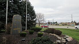
Welcome marker along Dixie Highway
|
|

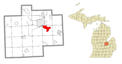
Location within Saginaw County
|
|
| Country | United States |
| State | Michigan |
| County | Saginaw |
| Township | Bridgeport |
| Established | 1836 |
| Area | |
| • Total | 8.45 sq mi (21.89 km2) |
| • Land | 8.40 sq mi (21.76 km2) |
| • Water | 0.05 sq mi (0.13 km2) |
| Elevation | 610 ft (190 m) |
| Population
(2020)
|
|
| • Total | 6,571 |
| • Density | 782.26/sq mi (302.03/km2) |
| Time zone | UTC-5 (Eastern (EST)) |
| • Summer (DST) | UTC-4 (EDT) |
| ZIP code(s) |
48601 (Saginaw)
48722 |
| Area code(s) | 989 |
| FIPS code | 26-10440 |
| GNIS feature ID | 2393346 |
Bridgeport is a community in Saginaw County, Michigan. It is an unincorporated community. This means it is not a separate town with its own local government. It is part of Bridgeport Township.
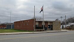
Bridgeport is also a census-designated place (CDP). This is a special area defined by the government for counting people. In 2020, about 6,571 people lived here. Even though it's not a city, Bridgeport has its own post office.
Contents
History of Bridgeport
Bridgeport was first known as Cass Bend. This name came from a sharp curve in the Cass River. A post office opened here on October 12, 1836. It was in the Michigan Territory at that time.
The name Bridgeport came from the many bridges that crossed the river. The post office changed its name to Cass Bridge in 1864. It closed in 1904. Another post office, Bridgeport Centre, opened in 1851. In 1880, it was renamed Bridgeport and is still open today.
Near Bridgeport, there are two important archaeological sites. They are called the Bugai Site and the Schmidt Site. These places help us learn about people who lived there long ago. The State Street Bridge is also historic. It was built in 1906 over the Cass River. These three spots are listed on the National Register of Historic Places. This means they are very important to history.
Geography of Bridgeport
Bridgeport covers about 8.45 square miles (21.89 square kilometers). Most of this area is land. A small part is water, like the river.
The community is located between two cities. To the northwest is Saginaw. To the east is Frankenmuth. The Cass River flows right through the middle of Bridgeport.
Major Roads in Bridgeport
 I-75 /
  US 23 is a major highway. It runs north and south through the western part of Bridgeport. You can get on or off this highway at Dixie Highway exits 144A and 144B.
People of Bridgeport
| Historical population | |||
|---|---|---|---|
| Census | Pop. | %± | |
| 1990 | 8,569 | — | |
| 2000 | 7,849 | −8.4% | |
| 2010 | 6,950 | −11.5% | |
| 2020 | 6,571 | −5.5% | |
| U.S. Decennial Census | |||
In 2000, about 7,849 people lived in Bridgeport. There were about 3,022 households. Many different people live in Bridgeport. The population has changed over the years. In 2020, the population was 6,571.
About 26.2% of the people were under 18 years old. About 13.2% were 65 years or older. The average age was 38 years.
Schools in Bridgeport
Bridgeport has its own school district. It is called the Bridgeport-Spaulding Community School District. The main high school in the area is Bridgeport High School. It is located right in the community.
Famous People from Bridgeport
- Monty Brown: A retired professional wrestler. He also played American football.
- Ferdinand Brucker: A lawyer and politician.
- David R. Gilmour: A diplomat. He is currently the Ambassador to Equatorial Guinea.
- David Haas: An author and composer. He writes contemporary Catholic liturgical music.
See also
 In Spanish: Bridgeport (Míchigan) para niños
 | Audre Lorde |
 | John Berry Meachum |
 | Ferdinand Lee Barnett |


