
British Columbia Highway 101 facts for kids
Quick facts for kids
|
||||
|---|---|---|---|---|
| Sunshine Coast Highway | ||||
|
Highway 101 highlighted in red.
|
||||
| Route information | ||||
| Length | 156 km (97 mi) | |||
| Existed | 1962–present | |||
| Major junctions | ||||
| South end | ||||
| North end | Lund | |||
| Location | ||||
| Districts: | Sechelt | |||
| Major cities: | Powell River | |||
| Towns: | Gibsons | |||
| Highway system | ||||
British Columbia provincial highways
|
||||

British Columbia Highway 101, also known as the Sunshine Coast Highway, is a very important road in British Columbia, Canada. It runs north and south along the beautiful Sunshine Coast.
This highway first opened in 1962. It's special because it's split into two parts on land. A ferry ride connects these two sections. Even though it's on the mainland, Highway 101 isn't directly connected to other major roads in British Columbia. You can only get to it by taking a ferry. Ferries arrive from Horseshoe Bay to the south end in Gibsons. Another ferry comes from Comox to Powell River. Part of Highway 101 is even a feeder route for Canada's National Highway System.
Contents
Exploring Highway 101

Highway 101 is about 156 kilometers (97 miles) long, including the ferry trip. It starts in the south at the BC Ferries terminal in Langdale. This terminal connects the Sunshine Coast to Vancouver by ferry across Howe Sound.
The southern part of the highway on land is about 80 kilometers (50 miles) long. Along this section, you'll find towns like Gibsons, Roberts Creek, Sechelt, Halfmoon Bay, and Pender Harbour.
To get from the southern part to the northern part, you take a ferry. This ferry crosses the Jervis Inlet. The ride is about 9.5 nautical miles (17.6 kilometers) long. It goes between Earls Cove in the south and Saltery Bay in the north.
The northern land section of Highway 101 is about 59 kilometers (37 miles) long. Here, you'll pass through places like Stillwater and Lang Bay. You'll also go through the city of Powell River. The highway ends in the community of Lund in the north.
Connecting the Sunshine Coast
People have often wondered about building a direct road or bridge to connect the Sunshine Coast to the rest of British Columbia. This would also mean bridging the ferry gap within Highway 101 itself.
Why a Fixed Link?
A "fixed link" means a permanent connection, like a bridge or a tunnel. It would make travel faster and more reliable for people living there. It could also help tourism grow and make the area more accessible.
Ideas for Connection
Many ideas have been suggested over the years. Here are some of the main ones:
- Connecting to Squamish: One idea is to extend Highway 101 for about 58 kilometers (36 miles). This new road would follow the west side of Howe Sound. It would connect to Highway 99 near Squamish. This would create a way to drive from Vancouver to Gibsons without needing a ferry.
- Bridges Across Howe Sound: Another idea is a shorter, more direct route. This would involve building two large suspension bridges across Howe Sound. They would be about 1.5 kilometers (0.9 miles) long each, with Anvil Island in between. This route would connect to Highway 99 north of Lions Bay. It would also offer a ferry-free way from Vancouver to Gibsons.
- New Highway to Powell River: A much longer idea is a new 200-kilometer (124-mile) highway. This road would link Powell River to Squamish. It would cross the Coast Mountains and need two long tunnels. This route could open up new areas for tourism and recreation. It would also help businesses in Powell River by lowering shipping costs.
- Bridging the Ferry Gap: An idea specifically for Highway 101 is a 19-kilometer (12-mile) road link. This would remove the need for the ferry between Saltery Bay and Earls Cove. It would involve two suspension bridges and cross Nelson Island.
What's Next?
Studies have looked at how possible these ideas are. They found that all four options could be built. However, the costs would be very high. Some bridge ideas seemed to offer more benefits for their cost than the long road links. For now, all these ideas are still being considered.
Images for kids
-
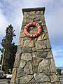
Milestone marker in Lund showing the end of the highway.

