Bubbs Creek facts for kids
Quick facts for kids Bubbs Creek |
|
|---|---|

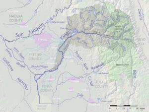
Map of the Kings River drainage basin. Bubbs Creek joins the South Fork at right.
|
|
| Country | United States |
| State | California |
| Physical characteristics | |
| Main source | Near Junction Pass Sierra Nevada 13,012 ft (3,966 m) 36°41′47″N 118°21′02″W / 36.69639°N 118.35056°W |
| River mouth | South Fork Kings River above Kanawyers 5,125 ft (1,562 m) 36°47′22″N 118°33′03″W / 36.78944°N 118.55083°W |
| Length | 16.4 mi (26.4 km) |
| Basin features | |
| Basin size | 69.5 sq mi (180 km2) |
| Tributaries |
|
Bubbs Creek is a beautiful stream that flows for about 16.4 miles (26.4 km) in the Sierra Nevada mountains of California. It's a branch of the South Fork Kings River. This creek is entirely located within the amazing Kings Canyon National Park. It's a popular spot for hikers and nature lovers.
Contents
Discovering Bubbs Creek
Bubbs Creek is a natural wonder hidden in the high mountains. It's known for its clear waters and stunning views. The creek helps create the beautiful landscapes of Kings Canyon. It flows through a deep valley carved by ancient glaciers.
Where Does Bubbs Creek Start?
Bubbs Creek begins high up in the mountains. Its source is near a place called Junction Pass. This spot is in the northeastern part of Tulare County, California. The creek starts at a very high elevation, about 13,012 feet (3,966 meters) above sea level.
Journey Through the Canyon
From its start, Bubbs Creek flows north. It passes through several small lakes. Then, it enters Fresno County, California. Here, the creek turns west. It flows through a deep canyon that was shaped by glaciers long ago. Finally, Bubbs Creek joins the South Fork Kings River. This meeting point is at the eastern end of the famous Kings Canyon.
Exploring the Trails
Bubbs Creek is a favorite for hikers. Two well-known trails follow parts of the creek.
- The Pacific Crest Trail follows Bubbs Creek for a section. This trail is famous for its long-distance route.
- The Bubbs Creek Trail is another path. It follows the creek further downstream into Kings Canyon. These trails offer amazing views of the mountains and the creek.
How Bubbs Creek Got Its Name
Bubbs Creek was named after a person named John Bubbs. He was a prospector, someone who searched for valuable minerals. In 1864, John Bubbs traveled into this area. He came from the Owens Valley by crossing Kearsarge Pass. The creek was then named in his honor.
 | Jackie Robinson |
 | Jack Johnson |
 | Althea Gibson |
 | Arthur Ashe |
 | Muhammad Ali |

