Buena Vista (Miami) facts for kids
Quick facts for kids
Buena Vista
|
|
|---|---|
|
Neighborhood of Miami
|
|

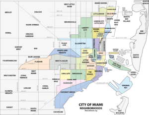
Buena Vista neighborhood within the City of Miami
|
|
| Country | United States |
| State | Florida |
| County | Miami-Dade County |
| City | City of Miami |
| Settled | 1892 |
| Annexed into the City of Miami | 1924 |
| Subdistricts of Buena Vista |
Neighborhoods list
Buena Vista East Historic District
|
| Population
(2010)
|
|
| • Total | 9,058 |
| • Density | 9,168/sq mi (3,540/km2) |
| Time zone | UTC-05 (EST) |
| ZIP Code |
33127, 33137
|
| Area code(s) | 305, 786 |
Buena Vista is a neighborhood in Miami, Florida, United States. It's located south of Little Haiti and north of the Miami Design District.
Buena Vista is mostly a place where people live. It has many historic single-family homes, most of which were built in the 1920s. The Buena Vista East Historic District, which has some of the oldest houses in the neighborhood, is also found here.
Contents
History of Buena Vista
In the 1890s, Buena Vista was a small village. It grew at the same time as the city of Miami. During the "Land Boom" of the 1920s, when many people moved to Florida, the area was developed into new neighborhoods called Biltmore and Shadowlawn.
At first, many people from Georgia and North Carolina settled here. Soon, the neighborhood became popular with business owners from nearby areas. The houses show how their owners' social status grew. You can see different styles like Mediterranean Revival, Mission, Craftsman, and Art Deco.
Early Settlements and Growth
Buena Vista, along with Lemon City and Little River, were some of the first settlements in Miami-Dade County. The area known as Buena Vista was once a small village next to Miami, but not officially part of it.
The earliest records of the village come from government surveys. These old maps still help define land areas today. The land that became Buena Vista was originally owned by William Henry Gleason and E.L. White. Gleason was an important figure in early Miami-Dade County politics. He was even elected lieutenant governor of Florida.

The Railroad's Impact
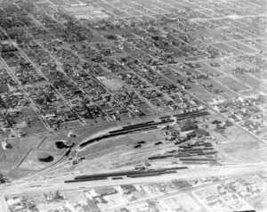
When the railroad arrived in 1896, it changed everything for Lemon City, a pioneer town that was important because of its docks. The train brought supplies to Dade County and drew people away from the bayfront to Miami and its surrounding areas.
The Lemon City train station, built in 1896, brought more business inland. This helped the village of Buena Vista grow. By 1910, Buena Vista had a hotel called the Courley House, its own train station on the Florida East Coast Railway line, a small post office, fruit groves, a fruit-packing house, a grocery store, and the Holy Cross Episcopal Church.
Prominent Landowners and Annexation
Other important people bought land in Buena Vista. One was the wealthy Charles Deering. He bought a large piece of land along the bay, east of the railroad. This area is now known as the Upper Eastside and the Baypoint neighborhood. Deering loved nature and created a special area for birds and animals there. He didn't want public roads in his area, so it stayed natural for many years.
As Miami's population grew in the 1910s and early 1920s, new areas spread north. The city limits of Miami moved to NE 38th Street, which included a part of Buena Vista. On August 4, 1924, Buena Vista officially became a town. The next year, it joined the City of Miami, along with Coconut Grove and Silver Bluff.
Geography
Buena Vista is located at 25°48′47″N 80°11′31″W / 25.813°N 80.192°W. It is about 13 feet (4.0 m) above sea level, making it one of the higher spots in Miami.
Boundaries
- To the north: NW 54th Street
- To the south: I-195
- To the west: I-95
- To the east: Biscayne Boulevard
Buena Vista East Historic District
The Buena Vista East Historic District is on the eastern side of Buena Vista. It is located between NE 2nd Avenue and Miami Avenue, from NE 42nd Street to NE 48th Street. This area is known for its historic homes.
Population and People
As of 2000, Buena Vista had a population of 11,290 people. The area covers about 1.265 square miles (3.28 km2).
In 2000, there were 5,396 males and 5,894 females. The average age for males was 31.5 years, and for females, it was 36.9 years. The average household had 3.2 people. About 13.5% of the population spoke English not well or not at all.
Many residents were born in Florida (41.5%). About 16.8% were born in other U.S. states. A smaller group (4.3%) were native residents but born outside the U.S. Finally, 37.4% of the residents were born in other countries.
Education
Miami-Dade County Public Schools manages the public schools in the area.
Elementary Schools
- Shadowlawn Elementary School
Middle Schools
- Jose De Diego Middle School
- Georgia Jones Ayers Middle School
High Schools
- Miami Edison Senior High School
- Design and Architecture Senior High School
- Archbishop Curley-Notre Dame High School (a private/Catholic school)
 | James Van Der Zee |
 | Alma Thomas |
 | Ellis Wilson |
 | Margaret Taylor-Burroughs |

