Burnt Ranch, California facts for kids
Quick facts for kids
Burnt Ranch
|
|
|---|---|

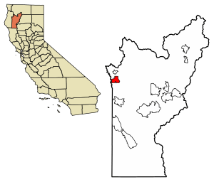
Location of Burnt Ranch in Trinity County, California.
|
|
| Country | |
| State | |
| County | Trinity |
| Area | |
| • Total | 13.38 sq mi (34.66 km2) |
| • Land | 13.38 sq mi (34.66 km2) |
| • Water | 0.00 sq mi (0.00 km2) 0.01% |
| Elevation | 1,502 ft (458 m) |
| Population
(2020)
|
|
| • Total | 250 |
| • Density | 18.7/sq mi (7.21/km2) |
| Time zone | UTC-8 (Pacific (PST)) |
| • Summer (DST) | UTC-7 (PDT) |
| ZIP Code |
95527
|
| Area code(s) | 530 |
| GNIS feature ID | 2582954 |
Burnt Ranch is a small community in Trinity County, California. It is known as a census-designated place (CDP). This means it is an area identified by the government for statistics.
Burnt Ranch has its own school and a post office. Its special mail code, called a ZIP Code, is 95527. The phone area code for the region is 530. The community sits at an elevation of about 1,502 feet (458 meters) above sea level. In 2020, about 250 people lived there. This was a slight decrease from 281 people in 2010.
Contents
History of Burnt Ranch
Early Inhabitants
Long ago, before European settlers arrived, the area around Burnt Ranch was home to Native American people. They spoke a language called Chimariko. This language was used along the Trinity River. Their main village was located where Burnt Ranch is today. These people also spoke a dialect of the Hupa language, known as Tsnungwe.
How Burnt Ranch Got Its Name
The name "Burnt Ranch" comes from an event in 1849. Canadian miners set fire to a Native American settlement, called a rancheria, in this area. This is how the place got its unique name.
Events in the 1800s
In 1858, a group of 16 men from Burnt Ranch faced an attack. They were ambushed by the Whilkut people in the Bald Hills. One man was killed, and another was injured. The group had to retreat for safety.
In the spring of 1863, Burnt Ranch was destroyed by a Native American raiding party. A trading post nearby was also attacked. The people living at Burnt Ranch were moved to a safer place just in time. Soon after, the community was set on fire.
Later, from May to November 1864, Burnt Ranch served as a temporary camp. It was used by the 1st Battalion California Volunteer Mountaineers. They used the camp while moving Native Americans to Fort Humboldt.
Geography and Climate
Location and Area
Burnt Ranch is located in a beautiful part of California. According to the United States Census Bureau, the community covers about 13.4 square miles (34.7 square kilometers). Almost all of this area is land. Only a tiny part is water.
The town is about 15.7 miles (25.3 kilometers) southeast of Willow Creek. You can reach it by traveling on State Route 299.
Local Climate
Burnt Ranch experiences hot and dry summers. This type of weather is common in areas with a warm-summer Mediterranean climate. On climate maps, this is often shown as "Csb."
Population Information
| Historical population | |||
|---|---|---|---|
| Census | Pop. | %± | |
| 2020 | 250 | — | |
| U.S. Decennial Census | |||
In 2010, the population of Burnt Ranch was 281 people. All of these people lived in homes. No one lived in group homes or institutions.
There were 129 households in the community. About 17% of these households had children under 18. Many households were made up of married couples. Some people lived alone. The average household size was about 2.18 people.
The population included people of different ages. About 13.5% were under 18 years old. About 21% were 65 years or older. The average age in Burnt Ranch was about 52.1 years.
Most homes in Burnt Ranch were owned by the people living in them. About 82% of the homes were owner-occupied. The rest were rented.
See also
 In Spanish: Burnt Ranch para niños
 | Frances Mary Albrier |
 | Whitney Young |
 | Muhammad Ali |


