Buttle Lake facts for kids
Quick facts for kids Buttle Lake |
|
|---|---|

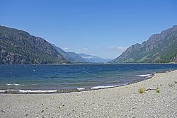
Buttle Lake from below the Lupin Falls trail
|
|
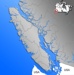
| Location | Vancouver Island, British Columbia |
| Coordinates | 49°40′59″N 125°32′59″W / 49.68306°N 125.54972°W |
| Lake type | Reservoir |
| Primary inflows | Ralph River, Thelwood Creek, Wolf River |
| Primary outflows | Campbell River |
| Basin countries | Canada |
| First flooded | 1958 |
| Max. length | 23 km (14 mi) |
| Max. width | 1.5 km (0.93 mi) |
| Surface area | 28 km2 (11 sq mi) |
| Max. depth | 120 m (390 ft) |
| Surface elevation | 221 m (725 ft) |
Buttle Lake is a beautiful lake located on Vancouver Island in British Columbia, Canada. It's part of the Strathcona Regional District. This long lake stretches about 23 kilometers (14 miles) and is about 1.5 kilometers (1 mile) wide.
Buttle Lake is quite deep, reaching up to 120 meters (394 feet). It sits at an elevation of 221 meters (725 feet) above sea level. You can find the lake between the towns of Campbell River and Gold River. It is completely inside Strathcona Provincial Park. The lake is also the starting point for the Campbell River.
Discovering Buttle Lake's Past
Buttle Lake is named after a person named John Buttle. He was a geologist and botanist from Kew Gardens in London, England. John Buttle came to this area with the Royal Engineers in 1865.
They were mapping the land around the lake. Buttle had explored Vancouver Island in 1864 as a naturalist. He was part of the Vancouver Island Exploring Expedition. He found and mapped this lake the very next year.
How the Lake Level Changed
Between 1955 and 1958, a large structure called the Strathcona Dam was built. This dam was built on Upper Campbell Lake. The dam caused the water level to rise by 30 meters (98 feet).
This rise in water connected Upper Campbell Lake and Buttle Lake. It made Buttle Lake's water level go up by 5 meters (16 feet). Before the water rose, about 600 hectares (1,483 acres) of forest were cut down. These forests were in the low-lying areas along the shore.
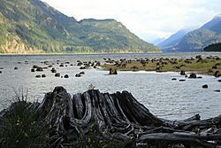
However, many areas were not fully cleared. So, when the water level is low, you can still see mudflats. These mudflats have tree stumps from the old forests that used to grow there.
Fun Activities at Buttle Lake
Buttle Lake is easy to reach through Strathcona Provincial Park. This park is located almost in the middle of Vancouver Island. The main way to get to the park is by using Highway 28.
Highway 28 connects to Gold River on the west coast of Vancouver Island. This highway goes through the northern part of the park. It also provides direct access to Buttle Lake.
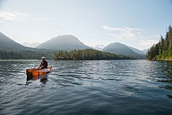
There are many campgrounds located along the shores of Buttle Lake. Visitors enjoy lots of outdoor activities here. Popular things to do include hiking, swimming, boating, and fishing. Many people also enjoy bicycling in and around the lake area.
 | Claudette Colvin |
 | Myrlie Evers-Williams |
 | Alberta Odell Jones |


