Buzzard Point facts for kids
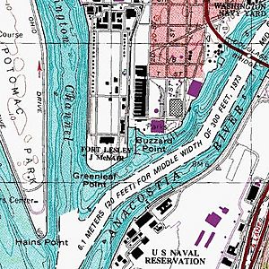
Buzzard Point is a part of Washington, D.C. located in the southwest area. It's on a peninsula where two big rivers, the Potomac and the Anacostia River, come together.
Contents
History of Buzzard Point
Early Names and Military Use
The very first name for this tip of land, back in 1673, was Turkey Buzzard Point. This name was often shortened to Buzzard Point. Later, in the 1790s, when Washington, D.C., was being planned, it was called Young's Point after the landowner, Notley Young. Soon after, it became Greenleaf's Point (or Greenleaf Point), named after James Greenleaf, who bought a lot of land in the new city.
George Washington wanted some of this land for military use, like building defenses. In 1791, he and Pierre Charles L'Enfant picked the spot for a fort. They bought about 28 acres of land for this purpose. L'Enfant even marked it as "Military District No. 5" on his city plan. This area was perfect for military defenses because it was where the two rivers met.
A small fort with one cannon was set up there, possibly as early as 1791. By 1794, it was definitely there. Over a few years, this military site, known as "The U.S. Arsenal at Greenleaf Point," grew to more than 89 acres. By 1803, it was officially called an "Arsenal," and Congress provided money to build more structures.
Buzzard Point During the Civil War
During the American Civil War, new weapons were tested at the Washington Arsenal, which was the Army's name for the site. Soldiers tested new types of guns like Breechloaders, the Spencer carbine, and the Gatling gun on this peninsula. Because of its military importance, the tip of the peninsula was called Arsenal Point in 1908. The Washington Arsenal was later renamed Fort Lesley J. McNair in 1948.
Life in the Old Buzzard Point Community
For a long time, Buzzard Point was mostly ignored by the rest of Washington, D.C. People hoped for busy river traffic and wharves, but that never really happened. Instead, the area stayed mostly rural, like the countryside. An old resident once described it as a "wild stretch of land" with a few houses and brick kilns.
A small stream called James Creek flowed next to the Arsenal. It was often used for dumping trash and caused diseases. In 1866, it was turned into a canal, but it wasn't very useful.
In 1875, a survey found only 36 homes and a few businesses in Buzzard Point. The population was small, peaking at 323 people in 1894, and then it slowly decreased. Most residents were working-class, and they lived together, both Black and white. Many people were farmers until about 1920, when "driver" became a more common job.
From 1880 to 1920, Buzzard Point was a quiet community with neat vegetable gardens and small farms. There were also workers' houses and small businesses. People rarely visited from outside the area. One person said, "A stranger is a very strange thing on Buzzard Point."
Changes and Industrial Growth
By the 1910s, the area started to change. Fields were left empty, and the trash-filled James Creek Canal was slowly filled in. Unpleasant industrial businesses began to appear along South Capitol Street, like trash removal. As the population dropped, city planners tried to find new uses for this neglected area. It's important to know that there wasn't a bridge connecting Buzzard Point across the Anacostia River until 1950.
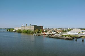
In 1920, the city decided to zone Buzzard Point for industrial use. This meant they wanted big factories and utility buildings there. This plan destroyed what was left of the old rural area. It brought in railroad lines, the Potomac Electric Power Company (PEPCO) power plant in 1933, and an oil/gas storage facility. Over time, many of these large facilities closed down as new buildings started to appear closer to the Navy Yard. Some boat yards and marinas stayed open along the Anacostia River.
Buzzard Point Today
Today, the name "Buzzard Point" refers to most of the urban area south of M Street SW and west of South Capitol Street SW, not including Fort McNair. The very tip of the peninsula, where Fort McNair is, is still officially called "Greenleaf Point" on maps. James Creek, which was once a stream, is now the James Creek Marina, located between these two points.
Buzzard Point has long been known as an industrial part of the city. However, it's now close to Nationals Park, where the Washington Nationals baseball team plays. It's also not far from the Waterfront and Navy Yard – Ballpark Metro stations, making it easier to get to.
The waterfront area of Buzzard Point stretches along the Anacostia River. Along this stretch, you'll find the James Creek Marina, the former headquarters of the United States Coast Guard, Buzzard Point Marina, and Buzzard Point Park.
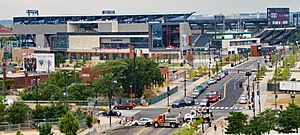
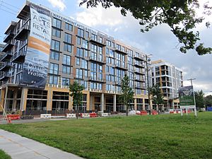
In 2007, Pepco announced that it planned to close its power plant at Buzzard Point by 2012. A big change came in 2013 when a deal was made to build a new soccer stadium for the D.C. United team at Buzzard Point. This stadium, called Audi Field, officially opened on July 14, 2018. This new stadium has brought a lot of excitement and new development to the area.
 | William L. Dawson |
 | W. E. B. Du Bois |
 | Harry Belafonte |


