Anacostia River facts for kids
Quick facts for kids Anacostia River |
|
|---|---|
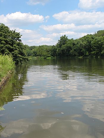
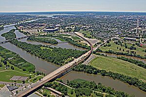
Anacostia River adjacent to the United States National Arboretum in Washington, D.C.
|
|
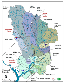
Map of the Anacostia River watershed
|
|
| Country | United States |
| State | Maryland and Washington, D.C. |
| Physical characteristics | |
| Main source | Bladensburg, Maryland 38°56′33″N 76°56′38″W / 38.94250°N 76.94389°W |
| River mouth | Potomac River Washington, D.C. −3 ft (−0.91 m) 38°51′13″N 77°01′13″W / 38.85361°N 77.02028°W |
| Length | 8.4 mi (13.5 km) |
| Basin features | |
| Basin size | 176 sq mi (460 km2) |
| Tributaries |
|
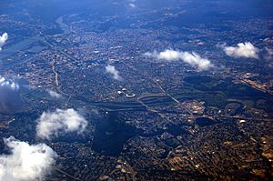
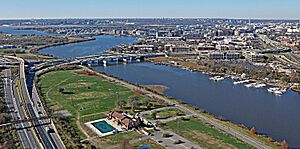
The Anacostia River is a river located in the eastern United States. It starts in Prince George's County, Maryland. The river then flows into Washington, D.C.. Finally, it joins the Washington Channel and flows into the Potomac River. The Anacostia River is about 14 kilometers (8.7 miles) long.
The name "Anacostia" comes from the Nacotchtank people. They were Native Americans who lived along the river's banks long ago. For a long time, the Anacostia River was very polluted. People also didn't invest much in developing the areas along its banks. This made it known as "D.C.'s forgotten river."
However, many groups are now working to make the river cleaner. Local businesses, private groups, and the governments of D.C., Maryland, and the U.S. are all helping. They want to reduce pollution and protect the river's important natural areas.
Contents
River's Path
The Anacostia River begins where two smaller rivers meet. These are the Northwest Branch and the Northeast Branch. This meeting point is just north of Cottage City, Maryland.
Many smaller streams flow into these two main branches. Some of these streams include Sligo Creek, Paint Branch, and Indian Creek. Other streams like Watts Branch also flow directly into the Anacostia River.
River's Watershed
A watershed is an area of land where all the water drains into a single river or lake. The Anacostia River's watershed covers about 456 square kilometers (176 square miles). This area includes parts of Montgomery County and Prince George's County in Maryland. It also covers most of the eastern half of Washington, D.C.
River's History
Captain John Smith explored the Anacostia River in 1608. He was looking for the main part of the Potomac River. The Native American Anacostan people welcomed him. On older maps, the Anacostia River was called the "Eastern Branch of the Potomac River." It got its current name later.
In the 1800s, the Washington City Canal was built. It connected the Anacostia River to other waterways. This canal was used until the mid-1850s. Later, parts of the canal were filled in.
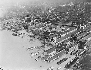
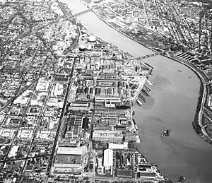
During the American Civil War, many forts were built south of the river. These forts, like Fort Stanton, protected the Washington Navy Yard. The Navy Yard is located right next to the river.
River Pollution
The Anacostia River has faced serious pollution problems. One major issue has been raw sewage flowing into the river. This happens during heavy rainstorms. The city's old combined sewer system can't handle all the water. This causes untreated sewage to overflow into the river.
This sewage makes the water unhealthy. It contains harmful bacteria and other germs. It also reduces oxygen in the water, which can kill fish. Studies have shown that people who use the river for fun, like kayaking, can get polluted water in their mouths. This can affect their health.
Stopping Sewage Overflows
Groups like the Anacostia Watershed Society (AWS) have worked to stop this pollution. They took legal action against the D.C. water authority (DCWASA) in 1999. As a result, DCWASA agreed to spend money to fix the problem.
In 2011, DCWASA started building a huge system of tunnels. These tunnels store sewage and stormwater during heavy rains. This helps prevent it from overflowing into the river. The first part of this tunnel system opened in 2018. The rest of the Anacostia storage system was finished in September 2023. These tunnels are expected to reduce sewage overflows into the Anacostia by 98 percent. The entire project includes over 29 kilometers (18 miles) of tunnels.
Other Pollution Sources
The Washington Navy Yard has also been a source of pollution. It is believed to have released harmful chemicals called PCBs into the river.
Cleaning Up Litter
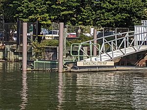
In 2009, a special floating trap called a Bandalong Litter Trap was placed in Watts Branch. This trap helps collect trash floating in the water. In its first year, it removed over 226 kilograms (500 pounds) of litter each month.
Mussel Project
Since 2018, thousands of mussels have been placed in the Anacostia River. Mussels are filter feeders, meaning they clean water by filtering out tiny particles. This project aims to improve water quality. It helps remove pollution like PCBs and tiny plastic pieces.
The Anacostia Watershed Society believes these mussels have already cleaned millions of gallons of water. The project started with 9,000 mussels in 2018. Because it was successful, the D.C. Department of Energy and Environment (DOEE) provided funding for 35,000 more mussels in 2019. Part of this money came from a small tax on plastic bags in D.C.
The river's health has improved, even after heavy rains in 2018. In 2019, the Anacostia received its second-best grade ever on a river report card. However, it still failed the evaluation with a score of 51 percent. Swimming in the Anacostia River became illegal in 1971. But as of 2019, city officials were thinking about changing this rule. They hoped to build public swimming areas by 2025.
Fun Activities on the River
The Bladensburg Waterfront Park is a great place to visit along the river. It offers boat and bike rentals. There's also a boat ramp and dock. Many rowing teams from universities and high schools use the boathouse there.
The Anacostia Riverwalk Trail is a paved path for walking and biking. It connects Bladensburg Waterfront Park to the Tidal Basin. The trail is about 45 kilometers (28 miles) long. It also connects to places like the United States National Arboretum and Nationals Park.
River Crossings
Many bridges cross the Anacostia River. Some of these include the 11th Street Bridges, the Frederick Douglass Memorial Bridge, and the John Philip Sousa Bridge.
See also
 In Spanish: Río Anacostia para niños
 | Aaron Henry |
 | T. R. M. Howard |
 | Jesse Jackson |


