Washington Channel facts for kids
Quick facts for kids Washington Channel |
|
|---|---|

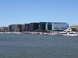
View of the Washington Channel from the Southwest Waterfront
|
|
| Country | United States |
| Physical characteristics | |
| Main source | Tidal Basin 0 feet (0 m) |
| River mouth | Anacostia River at Hains Point 0 feet (0 m) |
| Length | 2 miles (3.2 km) |
| Basin features | |
| River system | Potomac River |
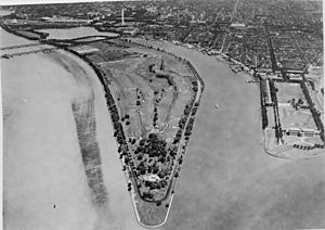
The Washington Channel is a waterway in Washington, D.C.. It runs alongside the famous Potomac River. This channel is found between the Southwest Waterfront on its east side and East Potomac Park on its west side.
The channel is about two miles (3.2 km) long. Water flows into its north end from the Tidal Basin. The channel then empties into the Anacostia River at Hains Point on its south end. The water in the channel can be from 8.8 feet (2.7 m) to 23 feet (7.0 m) deep.
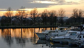
The east side of the Washington Channel is a lively area. It has many restaurants, inns, and places for boats. These include the Washington Marina, Gangplank Marina, and Capital Yacht Club. Gangplank Marina is special because people can live on their boats there.
Near the north end of the channel, you will find the Maine Avenue Fish Market. This market is just south of the 14th Street Bridge. Closer to the south end are important landmarks. These include the Women's Titanic Memorial, Fort Lesley J. McNair, and the National Defense University. The James Creek Marina is also located here. As of 2010, the USS Sequoia, a former presidential yacht, was docked in the channel.
Who Manages the Washington Channel?
In 2010, Eleanor Holmes Norton, who represents Washington, D.C. in the House of Representatives, suggested a new law. This law would have changed who was in charge of part of the Washington Channel. Currently, the Army Corps of Engineers manages it. The new law would have given some of this responsibility to the District of Columbia.
The House of Representatives approved this idea in July 2010. However, the Senate did not pass the law that year.
This plan was part of a bigger project to improve the Southwest Waterfront. The goal was to add more docks and boating activities close to the U.S. Capitol building. Important groups like the Coast Guard and the Navy agreed that this change would not make boating unsafe.
Delegate Norton brought the idea back to the House of Representatives in 2011. This time, her bill became part of a larger law. President Barack Obama signed this law on July 9, 2012. This meant that the District of Columbia gained more control over parts of the channel.
Channel Crossings
Many bridges and tunnels cross over or under the Washington Channel. They help people and trains get across the water.
- The Tidal Basin Outlet Bridge carries Ohio Drive.
- The Washington Channel Bridge carries 14th Street and U.S. Route 1.
- A CSX Transportation rail bridge allows trains to cross.
- The Francis Case Memorial Bridge carries Interstate 395.
- The Washington Metro Yellow Line subway travels through a tunnel under the channel.
See also
 In Spanish: Canal de Washington para niños
 | Mary Eliza Mahoney |
 | Susie King Taylor |
 | Ida Gray |
 | Eliza Ann Grier |


