East Potomac Park facts for kids
Quick facts for kids |
|
|
East Potomac Park
|
|
|
U.S. Historic district
Contributing property |
|
 |
|
| Location | 14th Street, Washington Channel, Potomac River, SW Washington, D.C. |
|---|---|
| Area | 394.9 acres (159.8 ha) |
| Built | 1917 |
| Part of | East and West Potomac Parks Historic District (ID73000217) |
| Designated CP | November 30, 1973 |
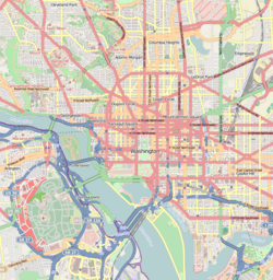
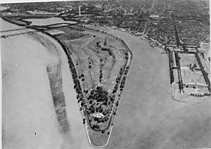
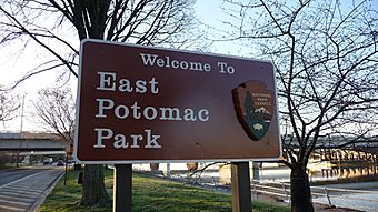
East Potomac Park is a special park in Washington, D.C., built on a man-made island in the Potomac River. This island sits between the Washington Channel and the Potomac River. You can find the park southeast of the Jefferson Memorial and the 14th Street Bridge.
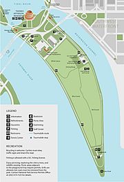
The park is a fun place with lots to do! It has the East Potomac Park Golf Course, a mini-golf course, a public swimming pool, tennis courts, and many sports fields. You can play baseball, softball, soccer, rugby, or football here. It's also a popular spot for fishing. Many people enjoy walking, cycling, inline skating, and running on the park's roads and paths. A road called Ohio Drive SW goes around the park's edge. The very southern tip of the park is known as Hains Point.
You can mostly get to East Potomac Park by car using Ohio Drive SW. Public buses don't go directly to the park, and there isn't a Washington Metro subway stop very close. The nearest Metro station is Smithsonian station, which is about six blocks away.
Contents
Exploring East Potomac Park
The park's island is located between the Washington Channel and the Potomac River. Its southern end, Hains Point, is where the Potomac and Anacostia rivers meet. From Hains Point, you can see Fort Lesley McNair and the National War College across the Washington Channel. You can also see Bolling Air Force Base across the Anacostia River. The famous Jefferson Memorial is at the northern end of the park. If you look southwest across the Potomac, you might spot Ronald Reagan Washington National Airport in Virginia.
East Potomac Park is managed by the National Park Service (NPS) as part of the National Mall and Memorial Parks. The park covers about 330 acres (1.3 km²). It includes the East Potomac Golf Club, the East Potomac Swimming Pool, and many of Washington's famous cherry trees. These beautiful trees stretch all the way to Hains Point.
A concrete path for walking and biking runs around the entire edge of East Potomac Park. However, sometimes the Potomac and Anacostia Rivers overflow during high tide. When this happens, the path can get covered with water.
Ohio Drive is a flat road that loops around the park, including Hains Point. Traffic on this road goes only one way, clockwise. This means you drive northwest on the Potomac River side and southeast on the Washington Channel side. Different kinds of cherry trees line both sides of the road. Another road, Buckeye Drive, cuts through the middle of the park, connecting the north and south parts of Ohio Drive. Ohio Drive continues beyond the park, following the Potomac River up to the Lincoln Memorial.
As of 2010, East Potomac Park had 320 parking spaces. You can reach these from both Ohio Drive and Buckeye Drive. On weekends and some holidays, cars are not allowed on parts of Ohio Drive between Buckeye Drive and Hains Point. This stretch of road, which is about 3.2 miles (5.2 km) long, is a favorite for people who love bicycling and inline skating. The park's land is very flat, rising only about 10 feet (3 meters) above the water.
How the Park Was Built
Long ago, the Potomac River in Washington, D.C., had many muddy areas, sandbars, and marshy flats. In 1834, the United States Army Corps of Topographical Engineers found large tidal flats (muddy areas exposed at low tide) near where the 14th Street Bridge is today. By 1881, these muddy areas stretched quite far. The city's sewer system also drained into a large tidal flat, causing a bad smell when the sewage was exposed to the air.
The southern part of the city, including Pennsylvania Avenue, often flooded in the late 1800s. After a big flood in 1881, the United States Army Corps of Engineers decided to dredge (dig up) a deep channel in the Potomac River. They used the dirt and mud they removed to fill in the riverbanks and raise the land near the White House and Pennsylvania Avenue by almost 6 feet (1.8 meters). Much of this dredged material was used to build up the existing tidal flats and sandbars in the Potomac River.
This land reclamation happened in three main parts. One part became West Potomac Park, another became the area around the Tidal Basin, and the third part became East Potomac Park. In 1897, Congress officially named these areas "Potomac Park." To stop the new island from washing away, trees like poplars and willows were planted along its edges.
In 1900, a group called the McMillan Commission was formed to plan how Washington, D.C., and its parks should look. Their plan, called the McMillan Plan, suggested turning the undeveloped land of East Potomac Park into a formal park with many places for recreation.
Park History
The island of East Potomac Park continued to be filled in even after it was mostly complete. In 1908, a large dip in the middle of the island was filled in. By 1910, a part of the park was used as a plant nursery to grow trees, shrubs, and flowers for government buildings.
Congress allowed East Potomac Park to open to the public in August 1912. Soon after, roads were built along the Potomac River and Washington Channel sides of the park. These roads were finished by mid-1915. In 1914, the park's management was given to the District of Columbia, which meant the Army Corps of Engineers oversaw it.
In the spring of 1915, the park was landscaped for the first time. Workers planted many shrubs, flowering plants, and 203 Japanese cherry trees. Another 133 Japanese cherry trees were planted in 1916.
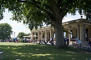
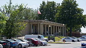
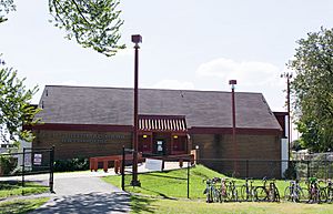
One of the first buildings in East Potomac Park was the National Park Service (NPS) lodge. This building was originally in Franklin Square and was moved to the north end of East Potomac Park between 1913 and 1915. The NPS has used it for various purposes, and since 1965, it has been the headquarters for the National Mall and Memorial Parks unit.
Paths for horseback riding were built in 1913 and expanded in 1915 and 1916. The first three baseball fields were created in 1915, and many walking paths were added. In 1916 and 1917, a large area in the center of the park was prepared for athletic fields. However, this land was later used by the Boy Scouts of America for "victory gardens" during wartime.
Hains Point is named after Peter Conover Hains (1840–1921), a Major General in the United States Army. He designed the Tidal Basin in Washington, D.C., which helped solve drainage problems and bad smells in the city's marshy areas.
Golf Course and Other Buildings
Much of the park remained undeveloped until 1913. In 1914, local sports fans asked for a golf course, and the Army Corps of Engineers approved it. Construction on the golf course began in 1917. The first nine holes opened on July 7, 1920. More holes were added, and the full 18-hole course opened in late September 1924.
Two fieldhouses, which are buildings with lockers and showers, were also built around this time. World War I caused delays, but both fieldhouses were completed by December 1921. In the 1920s, a teahouse, a campground for tourists, and horse stables were also built in the park. A four-mile-long walking path was added around the park's edge in 1935.
For many years, not everyone could use all the park's facilities. Before 1949, some areas like the golf course, tennis courts, and swimming pool were separated, meaning not all families could play there. This changed over time, making the park open to everyone.
The Park's Pool
The idea for a pool in East Potomac Park first came up in 1927. In April 1935, the government approved and funded a pool, and construction began in 1936. A separate bathhouse was built for pool users. A major flood in July 1936 damaged some of the construction, but the pool finally opened on June 4, 1937.
Later, one of the original fieldhouses was closed to the public and became the U.S. Park Police District 1 Station. The pool and bathhouse were updated between 1976 and 1977. The old concrete pool was replaced with a new one made of aluminum and fiberglass, and the bathhouse was also rebuilt.
The pool closed at the end of 2016 for upgrades. However, the project was stopped in 2020 and the pool was taken apart. This happened because of a mistake in a report about how deep the groundwater was.
Modern Buildings and Changes
In 1956, the National Park Service started a plan called Mission 66 to improve all its facilities. As part of this plan, three new buildings were proposed for East Potomac Park. The headquarters for the NPS's National Capital Region (NCR) was built in 1963. The headquarters for the United States Park Police (USPP) was built next to it in 1964. Both buildings were designed by architect William M. Haussmann. In 1969, a cafeteria and training center were added to the NCR headquarters.
In 2014, the old 1913 lodge and the two fieldhouses were suggested for inclusion on the National Register of Historic Places. The fieldhouses were praised as great examples of the Mission 66 style of architecture.
In 2015, the National Park Service planned a big update for the Mission 66 buildings. These changes were needed because the headquarters buildings were in an area that could flood. Also, the USPP District 1 headquarters needed better security after the 9/11 events. The plan included upgrading the heating and cooling systems, making the buildings accessible for people with disabilities, and redesigning the inside for more efficient use of space. A new USPP District 1 station was planned to be built, which would allow the old fieldhouse to be used by the public again. This project was managed by the architectural firm of Beyer Blinder Belle.
Other Interesting Facts
From 1971 to 1982, the United States lightship Chesapeake was docked off East Potomac Park in the Washington Channel. This ship attracted 25,000 visitors each year before it was moved to Baltimore.
The bridge that carries the 14th Street Bridge over the Washington Channel and East Potomac Park was rebuilt in 1980.
In 1988, Congress chose Hains Point as the location for a National Peace Garden. However, the plan for this memorial eventually expired without any construction.
Hains Point was once home to The Awakening, a large sculpture by J. Seward Johnson Jr.. It was installed in 1980 but was moved to National Harbor, Maryland in 2008.
In 2003, the United States Navy built a large steel shed in a part of the park. This construction was related to national security, and the Navy stated it was for "utility assessment and upgrade."
By 2015, East Potomac Park needed some repairs. The 5-mile (8 km) long riprap seawall (a wall to protect the shore) was falling apart, and sidewalks were cracked. The miniature golf course was also worn out. A part of the seawall and sidewalk at the southern tip of the park was in such bad condition that the National Park Service closed it to walkers in 2014.
See also
 In Spanish: Parque East Potomac para niños
- Cuban Friendship Urn
- East Potomac Park Golf Course
- West Potomac Park
 | Janet Taylor Pickett |
 | Synthia Saint James |
 | Howardena Pindell |
 | Faith Ringgold |


