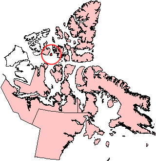
Byam Martin Island facts for kids

Byam Martin Island, Nunavut
|
|
| Geography | |
|---|---|
| Location | Northern Canada |
| Coordinates | 75°12′N 104°17′W / 75.200°N 104.283°W |
| Archipelago | Queen Elizabeth Islands Canadian Arctic Archipelago |
| Area | 1,150 km2 (440 sq mi) |
| Length | 46 km (28.6 mi) |
| Width | 37 km (23 mi) |
| Highest elevation | 153 m (502 ft) |
| Administration | |
|
Canada
|
|
| Territory | Nunavut |
| Region | Qikiqtaaluk Region |
| Demographics | |
| Population | Uninhabited |
Byam Martin Island is a cool island in the Canadian Arctic Archipelago, which is a group of islands way up north in Canada. It's found in a part of Canada called Nunavut. This island sits on the north side of a large body of water called Viscount Melville Sound.
Byam Martin Island is separated from other nearby islands by channels, which are like narrow waterways. To its west, about 27 km (17 mi) away, is Melville Island. The water between them is called the Byam Martin Channel. To the northeast, about 35 km (22 mi) away, is Bathurst Island, separated by the Austin Channel.
About the Island
Byam Martin Island is part of the Queen Elizabeth Islands, a large group of islands in the Canadian Arctic. It is not home to any people and is considered uninhabited.
Size and Shape
The island is shaped a bit like a long oval. It is 46 km (29 mi) long and 37 km (23 mi) wide. The total area of the island is 1,150 km2 (440 sq mi). This makes it a medium-sized island in the Arctic.
How It Got Its Name
The island was named after a person named Sir Thomas Byam Martin. He was a British naval officer. The island was named by Sir William Edward Parry in August 1819. Parry was on an important trip to try and find the Northwest Passage, which is a sea route through the Arctic Ocean.
See also

- Isla Byam Martin para niños (in Spanish)


