
Bắc Giang province facts for kids
Quick facts for kids
Bắc Giang province
Tỉnh Bắc Giang
|
|
|---|---|
|
From top, left to right: Skyline of Bắc Giang City, Ngọc Liễn Cathedral, Vĩnh Nghiêm Temple, Đinh Hương Tomb, and Vân Xuyên Temple.
|
|
| Nickname(s):
The homeland of Blue River and Black Mountain
|
|

Location of Bắc Giang within Vietnam
|
|
| Country | |
| Region | Northeast |
| Capital | Bắc Giang |
| Subdivision | 1 city, 9 rural districts |
| Government | |
| • Type | Province |
| • Body | Bắc Giang People's Council |
| Area | |
| • Province | 3,895.59 km2 (1,504.10 sq mi) |
| Population
(2021)
|
|
| • Province | 1,902,238 |
| • Density | 488.3055/km2 (1,264.7054/sq mi) |
| • Urban | 272,649 |
| Ethnic groups | |
| • Vietnamese | 85.74% |
| • Nùng | 5.31% |
| • Tày | 3.27% |
| • Others | 5.68% |
| Time zone | UTC+7 (ICT) |
| Area codes | 204 |
| ISO 3166 code | VN-54 |
| Vehicle registration | 13, 98 |


.jpg)


Bắc Giang is a province in Vietnam. It is located in the Northeast part of the country. The province is about 50 kilometers (31 miles) east of Hanoi, the capital city.
Bắc Giang covers an area of 3,895.59 square kilometers (1,504.10 sq mi). In 2019, about 1.8 million people lived there. The province is part of the Red River Delta. It shares borders with Quảng Ninh to the east and Lạng Sơn to the north. To the west are Thái Nguyên and part of Hanoi. To the south are Bắc Ninh and Hải Dương.
Contents
History of Bắc Giang
Bắc Giang has a very long history. It dates back to the time of the Hùng kings. This was during the Hong Bang period, when Vietnam was called Văn Lang. Bắc Giang was then known as Võ Ninh.
Over many centuries, the area changed its name and borders. During the Lê dynasty, it was called Bắc Hà. Later, under the Nguyễn dynasty, it became Thiên Phúc and then Đa Phúc.
The modern province of Bắc Giang was officially created on October 10, 1895. It was formed from parts of Bắc Ninh Province. Its first capital was Phủ Lạng Thương, which is now Bắc Giang city. In 1950, during the time of the Democratic Republic of Vietnam, Bắc Giang was part of the Confederation of Northern Vietnam. It had seven districts.
Later, in 1962, Bắc Giang joined with Bắc Ninh to form Hà Bắc province. But on January 1, 1997, it became a separate province again. The name Bắc Giang means "north of the river" in Vietnamese.
Geography and Nature
Bắc Giang has three main types of land: lowlands (delta), midlands, and mountains. The mountainous areas make up about 72% of the province. These include districts like Sơn Động and Lục Ngạn.
About 123,000 hectares (300,000 acres) of land are used for farming. Another 110,000 hectares (270,000 acres) are covered by forests. The farmland is great for growing rice, vegetables, and fruits. The forests provide wood and bamboo.
The province is 50 kilometers (31 miles) from Hanoi. It has good roads and railway lines. These connect Bắc Giang to other major cities like Hanoi and Lạng Sơn.
The land is mostly hilly, with mountains in the north. The highest point is Mount Yên Tử, at 1,068 meters (3,504 ft). In the northeast, near Quảng Ninh, is the Khe Rỗ forest. It covers 71.53 square kilometers (27.59 sq mi) and has many different plants and animals.

Bắc Giang has 347 kilometers (216 miles) of rivers and streams. The three most important rivers are the Lục Nam, the Thương, and the Cầu. There are also many lakes, like Cấm Sơn Lake and Khuôn Thần Lake. Cấm Sơn Lake is very long, about 30 kilometers (19 miles). Khuôn Thần Lake has five small islands surrounded by pine forests.
- Climate
Bắc Giang has a tropical climate. It has two main seasons:
- A hot, rainy season from May to September.
- A cold, dry season from November to March.
The average temperature is around 22–23°C (72–73°F). The highest temperature recorded was 41°C (106°F), and the lowest was 13°C (55°F). The province gets a lot of rain, about 1,953 millimeters (76.9 in) per year. Because it's not directly on the coast, big hurricanes are rare.
- Minerals
Bắc Giang has many different minerals. In 2005, 63 mines were active, digging up 15 types of minerals. Important ones include:
- Coal: Found in Yên Thế, Lục Ngạn, and Sơn Động districts. There are about 114 million tonnes of coal.
- Iron ore: About 0.5 million tonnes in Yên Thế district.
- Bronze ore: About 100,000 tonnes in Lục Ngạn and Sơn Động districts.
- Kaolin: Three million tonnes in Yên Dũng.
- Clay: Large amounts in Việt Yên, Lạng Giang, and other districts. This clay is used to make bricks.
- Birds
Many different kinds of birds live in Bắc Giang. Surveys have found 146 species of birds in the province.
People of Bắc Giang
In 2016, the population of Bắc Giang province was about 1,657,600 people. This means there were about 430 people per square kilometer (1,100 per sq mi).
Most people in Bắc Giang are ethnic Vietnamese, making up about 88.1% of the population. Other ethnic groups include the Nùng people (4.5%), Tày (2.6%), Sán Chay people and Sán Dìu people (both 1.6%), Hoa (1.2%), and Dao people (0.5%).
How Bắc Giang is Governed
Bắc Giang province is divided into 10 main areas. These include:
- 1 provincial city: Bắc Giang (which is the capital).
- 9 rural districts: Hiệp Hòa, Lạng Giang, Lục Nam, Lục Ngạn, Sơn Động, Tân Yên, Việt Yên, Yên Dũng, and Yên Thế.
These areas are further divided into smaller towns, communes, and wards.
Table of local government divisions
| Name | Division type | Population (2016) | Area (km2) | Towns (huyện lỵ or thị trấn) (bold) and communes (xã) |
|---|---|---|---|---|
| Bắc Giang | City (thành phố) | 185,000 | 66.77 | Wards (phường): Trần Phú, Ngô Quyền, Lê Lợi, Hoàng Văn Thụ, Mỹ Độ, Trần Nguyên Hãn, Thọ Xương. Communes (xã): Dĩnh Kế, Xương Giang, Đa Mai, Song Mai. |
| Hiệp Hòa District | District (huyện) | 237,900 | 201 | Thắng, Bắc Lý, Châu Minh, Đại Thành, Danh Thắng, Đoan Bái, Đông Lỗ, Đồng Tân, Đức Thắng, Hòa Sơn, Hoàng An, Hoàng Lương, Hoàng Thanh, Hoàng Vân, Hợp Thịnh, Hùng Sơn, Hương Lâm, Lương Phong, Mai Đình, Mai Trung, Ngọc Sơn, Quang Minh, Thái Sơn, Thanh Vân, Thường Thắng, Xuân Cẩm. |
| Lạng Giang District | District (huyện) | 191,048 | 246 | Kép, Dĩnh Trì, Thái Đào, Đại Lâm, Tân Dĩnh, Xương Lâm, Tân Hưng, Hương Sơn, Xuân Hương, Mỹ Thái, Phi Mô, Tân Thanh, Mỹ Hà, Tiên Lục, Đào Mỹ, An Hà, Tân Thịnh, Hương Lạc, Nghĩa Hưng, Nghĩa Hòa, Quang Thịnh, Dương Đức, Yên Mỹ. |
| Lục Nam District | District (huyện) | 202,886 | 597 | Đồi Ngô (capital), Lục Sơn, Bình Sơn, Trường Sơn, Vô Tranh, Trường Giang, Nghĩa Phương, Huyền Sơn, Bắc Lũng, Cẩm Lý, Vũ Xá, Đan Hội, Yên Sơn, Lan Mẫu, Phương Sơn, Thanh Lâm, Chu Điện, Bảo Đài, Bảo Sơn, Tam Dị, Đông Phú, Đông Hưng, Tiên Nha, Khám Lạng. |
| Lục Ngạn District | District (huyện) | 204,416 | 1012 | Chũ, Cấm Sơn, Tân Sơn, Phong Vân, Sa Lý, Phong Minh, Sơn Hải, Hộ Đáp, Trung tâm huấn luyện Cấm Sơn, Kim Sơn, Biên Sơn, Kiên Lao, Thanh Hai, Kiên Thành, Giáp Sơn, Tân Hoà, Biển Động, Tân Hoa, Tân Quang, Hồng Giang, Trù Hựu, Quý Sơn, Phượng Sơn, Mỹ An, Tân Mộc, Đèo Gia, Phỉ Điền, Đồng Cốc, Phú Nhuận, Nghĩa Hò, Tân Quang, Tân Lập, Nam Dương. |
| Sơn Động District | District (huyện) | 68,724 | 845.77 | An Châu (the capital), Thanh Sơn, Hữu Sản, An Lạc, Vân Sơn, Lệ Viễn, Vĩnh Khương, An Lập, Dương Hưu, Long Sơn, An Châu, An Bá, Yên Định, Tuấn Đạo, Bồng Am, Thanh Luận, Cẩm Đàn, Giáo Liêm, Chiên Sơn, Quế Sơn, Phúc Thắng, Thạch Sơn, Tuấn Mậu. |
| Tân Yên District | District (huyện) | 161,835 | 203.7 | Cao Thượng (capital), Nhã Nam, Quế Nham, Việt Lập, Liên Chung, Cao Xá, Ngọc Lý, Ngọc Thiện, Ngọc Châu, Ngọc Vân, Hợp Đức, Phúc Hòa, Tân Trung, An Dương, Lan Giới, Nhã Nam, Đại Hóa, Quang Tiến, Phúc Sơn, Lam Cốt, Việt Ngọc, Song Vân, Liên Sơn. |
| Việt Yên District | District (huyện) | 181,034 | 171.4 | Bích Động (capital), Nếnh, Quang Châu, Ninh Sơn, Tiên Sơn, Trung Sơn, Nghĩa Trung, Hồng Thái, Tăng Tiến, Quảng Minh, Vân Hà, Vân Trung, Việt Tiến, Thượng Lan, Minh Đức, Tự Lạn, Hương Mai. |
| Yên Dũng District | District (huyện) | 135,075 | 185.9 | Neo (capital), Tân Dân, Đồng Phúc, Đồng Việt, Tư Mại, Đức Giang, Tiến Dũng, Cảnh Thụy, Lãng Sơn, Trí Yên, Lão Hộ, Tân An, Xuân Phú, Tân Tiến, Tân Liễu, Tiền Phong, Yên Lư, Hương Gián, Quỳnh Sơn, Tân Mỹ, Song Khê, Nội Hoàng, Đồng Sơn, Nham Sơn, Thắng Cương. |
| Yên Thế District | District (huyện) | 102,574 | 301 | Cầu Gồ (capital), Bố Hạ , Đồng Vương, Canh Nậu, Đồng Kỳ, Bố Hạ, Hương Vĩ, Đông Sơn, Xuân Lương, Tam Tiến, Tiến Thắng, Tân Hiệp, Tam Hiệp, An Thượng, Phồn Xương, Đồng Lạc, Hồng Kỳ, Đồng Hưu, Tân Sỏi, Đồng Tiến, Đồng Tâm. |
Economy and Farming
Bắc Giang's economy relies a lot on farming. A large part of its land is used for agriculture. The province is famous for growing fruits, especially pineapples and lychees. About a quarter of Bắc Giang's land is used for forestry.
Bắc Giang is close to Hanoi, which is good for trade. Before 1997, Bắc Giang was quite poor. Most people worked in farming and lived below the poverty line. But since then, the province has started many industrial projects. This has brought in a lot of money and created jobs.
New farming methods have helped the economy grow. More goods are sold, and services have improved. The number of people living in poverty has gone down. Textiles and clothes are a big export for the province.
The roads and towns have also improved. New industrial parks and high-tech areas are being built. Key industries like fertilizer, engineering, building materials, and food processing are growing. The goal is for the economy to grow even more by 2020.
- Thac Huong Irrigation System
The Thac Huong Irrigation Scheme is in the Yên Thế district. It was built a long time ago, starting in 1922. This system helps bring water from the Cầu River to farms. It irrigates a large area of land in Bắc Giang and a nearby province. It also provides drinking water and helps transport goods by boat.
The system has a concrete dam across the Cầu River. Over the years, floods and conflicts have damaged parts of it. It was repaired in 2000 with help from the Asian Development Bank. Today, it sometimes faces water shortages because of new projects upstream and increased use by industries.
Lychee Fruit

Lychee is a very important fruit crop in Bắc Giang Province. About 20,275 hectares (50,100 acres) of land in the province are used to grow lychees. This is a big part of Vietnam's total lychee farming area.
This type of lychee first came from Hải Dương province. Now, it is grown for sale in districts like Lục Ngạn, Lục Nam, and Yên Thế in Bắc Giang. Researchers have found many different types of lychee grown in the area.
Places to Visit
Bắc Giang has many interesting places for visitors to see. These include ancient forests, temples, and historical sites.
- Khe Rỗ Primitive Forest
The Khe Rỗ Primitive Forest is a natural forest in An Lạc commune. It is a protected area, covering 7,153 hectares (17,680 acres). This forest is home to many different plants and animals. Scientists have found 236 types of trees, 255 valuable medical plants, 37 mammals, 73 bird species, and 18 reptile species here. Some of these animals are very rare.
Many streams flow through the forest. The local people in An Lạc commune offer ecotourism programs. Visitors can stay in local homes and try traditional foods. Guides can take you on tours through the forest, past waterfalls and lakes, and up Khau Tron Peak. This helps the local people and protects their culture.
- Đức La Pagoda
The Đức La Pagoda is a very old temple built in the 12th century. It is located in Trí Yên commune. This pagoda was an important center for a Buddhist school called "Trúc Lâm Trinity." The pagoda is surrounded by beautiful rice fields and green bamboo groves.
The pagoda has several main areas. It features old Buddhist statues and beautiful decorations from different time periods. It also has special wooden blocks used for printing Buddhist sutras (religious texts).
- Tho Ha Communal House
The Tho Ha Communal House is in Tho Ha village. It was built a long time ago, during the rule of King Lê Hy Tong. This house is known for its unique design. It is built on raised ground and has a special curved roof. The roof is decorated with creatures like lion cubs.
The communal house has 7 rooms and is supported by 48 strong ironwood pillars. The roof frame has beautiful carvings of ladies, phoenixes, and dragons. The floor is made of polished blue stones. The entrance is made of wood, carved and painted in gold, giving it an ancient feel. A stone inscription tells us that the villagers helped build this house.
- ATK2
ATK stands for "An Toàn Khu," which means "safe zone." This area was used by Việt Cộng fighters during the war from 1965 to 1972. It had a network of tunnels and defenses. Today, it is a historical site that teaches about the past.
- Other Sights
Other interesting places in Bắc Giang include:
- The Museum dedicated to Hoàng Hoa Thám and Đồn Phồn Xương in Yên Thế District.
- The Dinh Hương Tomb in Đức Thắng commune. This is the burial place of La Quý Hầu, a noble and army officer from the Lê dynasty.
- The historical area of Suối Mỡ and Đền Suối Mỡ in Lục Nam District.
- The ancient fort of Xương Giang.
- The Cây Dã tree in Tiên Lục commune, Lạng Giang District. This tree is believed to be over 1,000 years old. It is so big that eight people holding hands are needed to measure its circumference!
Gallery
-
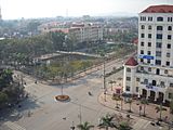
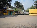
Bắc Giang
-
Bắc Giang
-
Bắc Giang
-
Bắc Giang
-
Bắc Giang
-
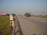
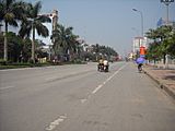
Highway in Bắc Giang Province
-
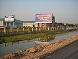
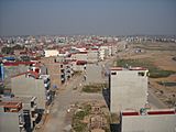
Việt Yên
-
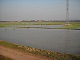
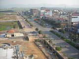
Việt Yên


See also
 In Spanish: Provincia de Bắc Giang para niños
