Cable Creek facts for kids
Quick facts for kids Cable Creek |
|
|---|---|
|
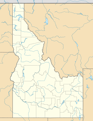
Location of the mouth of Cable Creek in Idaho
|
|
| Country | United States |
| State | Washington, Idaho |
| County | Kootenai, Spokane. |
| Physical characteristics | |
| Main source | Cable Peak Kootenai County, Idaho 4,557 ft (1,389 m) 47°37′29″N 117°00′44″W / 47.62472°N 117.01222°W |
| River mouth | Spokane River at Liberty Lake, Washington 2,024 ft (617 m) 47°41′26″N 117°03′56″W / 47.69056°N 117.06556°W |
| Length | 5 mi (8.0 km) |
Cable Creek is a small, natural waterway that flows for about 5 miles (8 kilometers). It runs through the beautiful Spokane Valley, crossing the border between the states of Washington and Idaho. This creek is an important part of the local water system in this area.
About Cable Creek
Cable Creek is a relatively short stream. It helps to drain water from the land around it. The creek flows through two different counties: Kootenai County in Idaho and Spokane County in Washington. Its journey takes it from high ground down to a larger river.
Where Cable Creek Starts
The journey of Cable Creek begins high up on a mountain called Cable Peak. This peak is located in Kootenai County, Idaho. The water starts flowing from an elevation of about 4,557 feet (1,389 meters) above sea level. This high starting point gives the creek its initial push as it flows downhill.
Where Cable Creek Ends
After its 5-mile journey, Cable Creek flows into the Spokane River. This meeting point is near Liberty Lake in Washington state. The elevation where Cable Creek joins the Spokane River is much lower, around 2,024 feet (617 meters). This difference in elevation shows how the creek flows downhill from its source to its mouth. The Spokane River then continues its own journey, eventually joining the Columbia River.
 | Calvin Brent |
 | Walter T. Bailey |
 | Martha Cassell Thompson |
 | Alberta Jeannette Cassell |


